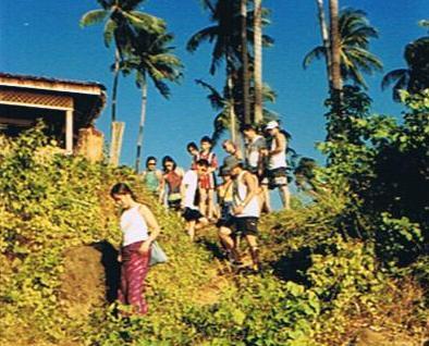
Higatangan Island (Naval, Biliran)

Shifting Sandbar

Come Monday, I decided to do some island hopping with a 1-day excursion to the 5 sq. km. Higatangan Island in neighboring island province of Biliran.  I was accompanied by Jandy and a guide and translator, Mr. Narciso “Noknok” T. Villamor, a product specialist from Pharmacia & Upjohn referred to me by my sister-in-law Paula.  After a very early and heavy breakfast, we left Tacloban City on Noknok’s car by 8:30 AM, bringing with us a picnic basket packed for us by Paula.  Along the way, we passed by the Leyte towns of Palo, Sta. Fe, Alangalang, Jaro, Tunga, Carigara, Capoocan and Leyte before stopping for a photo session at Biliran Bridge over the narrow Biliran Strait which connects the island to Leyte.  After crossing the bridge, we continued on to Biliran town and then to Naval.  The road going there was surprisingly smooth all the way.

Biliran Bridge

After a 2-hr. (123-km.) trip, we finally arrived at Naval, the provincial capital and largest town, by 10:30 PM.  We first parked our car at the parking area of the town’s church where Noknok, a former seminarian himself, had some priest friends.  We then hailed a tricycle, loaded our bags and picnic basket and proceeded to the port.  There was only one scheduled, 25-30-pax boat going to Higatangan Island which was to leave by 12 noon.  The boat would return to Naval at 7 AM, the next day.  Fare was PhP15 per person for the 1-hr. trip.  The boat was still loading people and large sacks when we arrived at 11 AM.  We took our seats near the prow and while waiting we befriended Ms. Bebie Balatero, a lot agent working in Naval and a resident of the island.  She willingly agreed to guide us around the place.  From the port we could espy, from a distance, Dalutan Island and Capinahan Island, all within the jurisdiction of Almeria town. Dalutan, we were told, has a small stretch of white sand beach naturally pocked by sea-sculpted boulders on both sides.

Higatangan Island

We departed the port at 11:45 AM and arrived at the island a little before 1 PM, landing at the cresent-shaped white sand beach of Brgy. Libertad, one of the islands 2 barangays (the other is Mabini).  A short distance away was a beautiful white sandbar which extends 200 m. to sea.  It periodically shifts; found near Higatangan’s tip one day and near the other the next day, thanks to the action of wind and changes in sea currents.  The beach has a number of picnic huts and the island’s only resort, Limpiado Higatangan Beach Resort.  The late owner of the inn, Fidel Mahinay Limpiado, Sr. (who was born on April 24, 1892 and passed away on May 25, 1981) was the founder of the Higatangan Evangelical Church of Christ, the first Protestant church  and mother of all UCCP churches in Northern Leyte.

Limpiado Higatangan Island Beach Resort

Jandy was excited about swimming and snorkeling at the beach, even under the hot noontime sun, and was soon down to his trunks.  Noknok and I soon followed suit.  We also got one picnic hut for ourselves and our things.  All of us took our first dip in and around the sandbar.  Later, I decided to comb the beach for shells and was able to pick a presentable spider conch.  Fearing a nasty sunburn (what little sunblock lotion I had was reserved for my son), I rested at the picnic hut and couldn’t help but notice a man talking continuously, without letup, to a boy who was reading a magazine and seemed oblivious to what the man was saying.  Later on, the boy left but the man kept on talking, if only, to himself. Noknok noticed him too.  Anyway, I thought to myself, he wasn’t hurting anybody and so, I ignored him and left him to his own devices.

After 30 mins. of delightful swimming and beachcombing, we remembered that we haven’t eaten lunch and we all settled down to partake of what Paula packed for us.  In the picnic basket was spaghetti, a lechon manok, sliced roasted lechon, rice plus my favorite tipay (scallops baked with garlic).   In addition, we had ripe mangoes for dessert and bottled water and canned soft drinks to wash it all down.  We invited Bebie plus the manager of the inn to join us and pretty soon, although shyly at first, were also partaking our fare.

Higatangan Island is memorable to the late Pres. Ferdinand E. Marcos.  On November 1943, Fidel Limpiado and his family provided refuge  and saved the life of Marcos, a guerilla leader.  Together with his eldest son Ranulfo, they ferried Marcos from Higatangan to Manorabe, Sorsogon in a sailboat, eluding Japanese Navy patrols.  They were, however,  caught in a typhoon and were stranded in Camandag, Sto. Nino in Samar.  The rest is history.  On May 10, 1978, a grateful Marcos, now president of the Republic, together with First Lady Imelda Marcos and daughter Irene, visited Fidel and granted his requests.  The island was declared as a tourist spot.  Higatangan High School was opened immediately and a 9-km. circumferential road, post office, medical clinic and 4 windmill-powered water systems were also built.  Today, a hill is named after the late president and it offers a panoramic view of Samar, Leyte, Cebu and Masbate.

It was getting late in the afternoon, and since there was no regular return trip to Naval, Bebie  offered to look for a boat willing to take us back to Naval.  And off she went, looking for a certain Linda.  In the meantime, we all returned to the inn for an invigorating shower, packed our things and waited at the picnic hut for our boat.  The same boat that ferried us to the island, now empty, soon arrived and docked near the sandbar.  They offered to bring us back to Naval for the cutthroat price of PhP700.  Before its arrival, we were able to meet Linda who agreed to accompany and tour us in her boat around to the western side of the island before going back to Naval. We settled on Linda’s price of PhP450.

While waiting for the boat, we couldn’t help but notice that same strange Shakespearian character again talking to himself at the adjoining hut.  We three were soon aboard the boat, together with Bebie, Linda and Linda’s daughter, when our boatman soon arrived.  Lo and behold!!!  It was our same, strange Shakespearean character!  Noknok and I swallowed hard and started to pray ….  So off we went.  Our apprehension soon turned to admiration as we noticed how our boatman, incidentally and, somewhat unfairly, named Gunggung, handled our seemingly fragile craft.  I was seated next to him and soon was the focus of all his senseless chatter.  Later on, he was singing a ditty.  Both chatter and song were in Cebuano. I took it all goodnaturedly.  Later on, I learned that he had a wife and two children but was separated from his wife.  Poor fellow.

We soon rounded the island’s end and approached the island’s western side.  It was a totally different story round here.  Instead of endless white sand beaches, we were introduced to a surrealistic world of short stretches of beach punctuated by magnificent and grotesque rock formations topped by dense undergrowth, all products of the constant battering forces of wind and waves against these rock walls.  Looking down at the sea, we were surprised to see how clear the waters were at this area.  We could see, in great detail, numerous large corals as well as bright blue starfish.  It has a good potential as a dive site.  After about 30 mins., we finished circumnavigating the island and soon headed back for Naval.  Our trip was uneventful for the next half hour.  It started to rain and Jandy took to wearing a raincoat supplied by Linda.

Pretty soon, the waves became choppy and Jandy was screaming with every high wave that lifted the banca.  I took it calmly (I’ve seen worst during an excursion in Calapan City, Mindoro Oriental), trusting in Gunggung (and in God) as he capably rode the banca through the waves.  Noknok later told me that, this being his first time in such a situation, this prodded him to pray to God, and all the saints for that matter, for deliverance.  The choppiness ceased as we neared Naval.  Pretty soon, Naval harbor came into view and we breathed a sigh of relief.  We, including Linda, were so engrossed with relief that we failed to notice that Gunggung didn’t cut the engines to slow down the boat. We hit the shore with a crash, almost knocking us off our feet and into the now shallow shoreline.  There’s nothing like ending our trip with a bang! Gunggung inspected the boat and reported no damage to the boat’s superstructure except for a crumpled propeller.  I gladly paid Linda her fee plus an extra PhP50 for all her trouble, thanked her and Bebie and then parted ways.  We took a tricycle back to the church, loaded our stuff and left Naval by 6 P.M..  We were back in Tacloban by 8 PM.

Sohoton Natural Bridge National Park – Natural Bridge (Basey, Western Samar)

Sohoton Natural Bridge

After about an hour and a half of exploration, we exited the cave and proceeded back to our boat for the trip to Sohoton Bridge.  After a short distance, shallow water grounded our boat to a stop and we were told to alight and walk the remaining distance.  There are 2 winding, moss and fern covered trails going to the bridge, one a longer but more scenic 700-m. hike and the other being half the distance.  We took the scenic route.  Pretty soon we came upon the huge, 15-m. high natural parabolic stone arch entrance (from which the park got its name) stretching across the valley and connecting two mountain ridges.  Underneath is the Sohoton River.

The Sohoton River

Based on my research on caves, I theorized that millions of years ago, the bridge was formerly part of a tunneled cave with the Sohoton River flowing underground through it.  The active river eventually enlarged the cave too much for roof stability, collapsing some parts to form cylindrical shafts leading above ground.  Further collapses reduced the cave roof to stretches of tunnel or arches, forming a gorge.  The process of unroofing ceased when the level of the river fell. The narrow Sohoton natural bridge is the one remaining arch of this cave.   That this bridge was once part of a cave is seen from the huge stalactites still hanging below the bridge.

We went no further than the natural bridge, returned back along the trail, clambered down to the riverbank and retraced our steps back to the boat which was moored near the river’s rapids.   Feeling hungry, we invited Sidong and the boatmen to join us for lunch and we feasted on the contents of our picnic basket – tipay (scallops baked with garlic), lechon manok, (roasted chicken), lechon de leche (roasted pig), rice; and then pushed it all down our systems with bottled water and canned soft drinks.  The river was inviting, so we were soon down to our trunks and tried to test our strength against the rapids.  After a one-hour refreshing swim, we got dressed, packed our stuff and made the 90-min. return trip along the river back to the town.  Upon arrival at Basey, we paid our guide and boatman and were soon on our way back to Tacloban, arriving in time for the Palm Sunday mass.

Sohoton Natural Bridge National Park – Sohoton Caves (Basey, Samar)

The “Guardian Angel”

On April 16, Palm Sunday, Jandy and I made plans to visit the 840-hectare Sohoton Natural Bridge National Parkin Basey, Samar, established as such by American Gov. Frank Murphy on July 19, 1935 by virtue of Proclamation No. 831.  Joining us as guide was Mr. Victor Macasera, a medical representative from Astra Zeneca.  We woke up early and I packed my camera, videocam and other essentials for this day trip. Victor soon arrived and joined us for a hearty breakfast.  We left Tacloban in Victor’s car by 9 AM, bringing with us a picnic basket with packed lunch prepared for us by my sister-in-law Paula.   The 26-km. trip from Tacloban City to Basey took us a mere 20 mins., passing through the 2.16-km. longSan Juanico Bridge, Southeast Asia’s longest bridge, which connects Leyte Island with Samar Island.  There was still a break in the bridge’s railing, where, on February 11, 6 drunk Army men, coming from a fiesta in V&G Subdivision, crashed their vehicle through the railing, into the San Juanico Strait, and all drowned.

San Juanico Bridge

Upon our arrival at Basey’s port, Victor parked his car at the pier and arranged for a small pumpboat, Petromax lamp, permit and guide, all for PhP600.  He chose a small boat for two reasons.  First, we were just a small party and second, its shallow draft will enable us to negotiate the shallow portion of the Basey River.  The guide assigned to us was Mr. Francisco “Sidong” Corales, a 45-year old park ranger and certified spelunker.  The trip up the winding Basey (or Cadacan) River was engrossing.  From the wharf, it is an 11-km. (1.5 hr.) boat ride up along the 50 to sometimes 200 m. wide, golden brown Basey River.

Basey River

The initial portion was along evergreen banks lined with coconut trees, swamp plants and nipa palm (Nypa fruticans).   We had an intimate glimpse of small villages with river dwellers going about heartwarming daily activities like washing clothes and bathing children.  We also passed a colorful assortment of small native outriggers loaded with produce and passengers.  As we went further down the river, it started to narrow dramatically and the scenery began to change to eerie jungle, with massive and very rugged limestone outcrops gradually towering on both sides of the river.  We also passed bizarre, weather-sculpted limestone rock formations.  Huge trees, with interlaced roots and thick branches, hug the river’s edge and large, ancient-looking boulders also jutted out the water.

Bizarre rock formations along river

Occasionally, there were shallow portions along the river and Sidong and the boatmen had to alight to push the boat.  Pretty soon, we reached a junction where the Basey River branches out into the Bugasan and Sohoton Rivers and just before that was the unprepossessing entrance to the Panhulugan I Cave, the largest (546 sq. m.) and most spectacular endogenic cave in the park.   Directly across is towering Panhulugan Cliff, a high and steep rock formation, and cutting into the face of this cliff is  the 3.5-m. high and 50-m. long scar of Panhulugan Cave II. During the Philippine-American War, Filipino insurgents dropped rocks and logs down on U.S. troops coming up the narrow curve of the river.

Panhulugan Cave I entrance

We moored our boat at the entrance of Panhulugan Cave I, climbed a series of steps, crossed a bridge and stopped at a resting area with concrete tables and benches.  Here, Sidong showed us a map of the park and briefed us on what to expect inside the cave.  Upon entering and squeezing our way through narrow and sometimes low openings, we were ushered into a mystical and magical world of beautiful, glittering and exotically shaped and patterned stone unseen except with our Petromax lamps.  There were some walls of sparkling, pure white crystal and chambers replete with stalactites and stalagmites.  Geologically active, water constantly drips from stalactites and there are also large accumulations of materials beneath the chimney holes.

With their wild and vivid imagination, locals have christened many of the beautiful and breathtaking formations after religious icons, animals, plants, parts of the human anatomy and domestic as well as foreign tourist destinations.  Only nature can create and preserve such wonders.  One formation resembled a “three-legged elephant” complete with trunk (above).  Others were appropriately named the “Chair of Alexander the Great,” the “Ice Cream Cone,” the “Guardian Angel,” “Anaconda,” “Statue of Liberty” and beside it, the “Holy Family.” A fenced off portion has a flow area similar to the famed “Banaue Rice Terraces”.  A miniature horizontal ribbon-like formation is aptly named the “Great Wall of China” and beside it the “Chocolate Hills” of Bohol.

The Breast Room

Sidong also tried his hand in music, tapping on some seemingly hollow formations like organ pipes to create musical notes. He also ushered us into the Love Room where the ceiling was covered with the so-called European, American and Filipino versions of the female breast as well as the male sex organ.  One chamber has 15-m. high ceiling which exudes the solemn atmosphere of a high-domed cathedral.  Its eerie silence sent a tingling feeling down my spine.  Before exiting, Sidong showed us what appeared to be ancient animal bone fragments embedded in one of the cave walls.

Tongonan Hot Spring National Park (Ormoc City, Leyte)

From Lake Danao, we again boarded our AUV and proceeded to Tongonan Hot Spring National Park.  Located at an elevation of 2,000 ft. amid densely forested hills, this 272-hectare park is at the west end of the Leyte Mountain Trail, 18 kms. (a 45-min. drive) northeast of Ormoc City.  It also has a cool climate, lush tropical vegetation and underbrush, a warm medicinal pool, a cavernous hillside geyser that spouts boiling water and steam hourly and formations exuding sulfuric vapors.  It is also home to wild pig, monkeys, deer and birds.  Its 112.5 MW Tongonan Geothermal Power Plant is the first geothermal power plant to operate in the Philippines. It supplies the region’s less than 100 MW consumption as well as that of the Luzon and Visayas grid.  A little farther off is the 5-hectare Lake Kasudsuran, located in a virgin forest at Brgy. Ga-as and Mt. Hanagdan, 1,000 ft. above sea level.

Tongonan Hot Spring National Park

After the Tongonan tour, we returned to Ormoc City for lunch, switched to Roy’s car and next paid a visit to the house of our host, Mr. Sabin Larrazabal.  We were greeted by his widowed daughter-in-law, Daya and his son Dr. Mario “Butch” Larrazabal who served us coffee and snacks.  Mr. Larrazabal arrived after a few minutes.  Already in his 70s, his still very active lifestyle belies his actual age.  Roy introduced us, but due to Mr. Larrazabal’s hectic schedule, could only talk to us for a short while.  After saying farewell, we proceeded back to the resort to check out our luggage.

Back at the city proper

Before we were brought to the bus terminal, Roy showed us around the city.  We also visited the Philippine-Japan Peace Memorial on Carlota Hills (a marker overlooking Ormoc Bay put up by the relatives of Japanese war veterans from the Nagoya and Gifu Prefectures) and the nearby cross-shaped common burial vault of the unknown victims of the Ormoc tragedy.

Near the port, we visited the marker showing plaques of the city’s achievements, the remnants of the old Spanish-era Fuente de la Reina bridge and the 7,000-person capacity Ormoc City Superdome (where the PBA provincial games are played). Ending our city tour, Roy dropped us off at the city’s bus terminal where we took a PhP100 per person Hi-Ace van for the 2-hr. trip back to Tacloban City.

Lake Danao Natural Park (Ormoc City, Leyte)

From Kananga, we again boarded the AUV for the 2,193-hectare Lake Danao Natural Park.  Declared as such on June 2, 1972, this outstanding trekking area is part of the 40-km. Leyte Mountain Trail which starts from the 365-hectare Mahagnao National Park (established in 1937), between Burauen and La Paz, to Lake Danao and Tongonan National Park.  The trek offers a rain forest tour, beautiful Lakes Mahagnao, Malagsum, Kasudsuran and Danao, the spectacular Guinaniban Falls and breathtaking views of the mountains, forest, plains and the islands of Samar and Leyte from the crest of the central Amandiwing Mountain Range with its near-virginal tropical rainforest.

Lake Danao

Located 25 kms. from Tacloban City and 15 kms. (a 30-min. drive) northeast of Ormoc City, the violin-shaped, 148-hectare Lake Danao, formerly called Lake Imelda, is situated at an elevation of 1,600 ft. above sea level and is hemmed in by the cloud-capped Amandiwing mountain range.  Considered to be one of the most beautiful and cleanest lakes in the country, it is 3 kms. long, 200 m. deep and has a cool and invigorating climate.  We parked our vehicle near the Ranger Station and went up the nearby wooden viewing tower for a beautiful view of the lake.

We were greeted by Mr. Antonio Elias, station utility man, who offered to row me and Jandy in his small banca to the middle of the lake.  Upon our return, we paid a visit to the lone ranger (any similarity to a fictional character is purely coincidental) assigned to the station, Mr. Quinciano C. Abiertas, Jr., who gave us additional information about the lake.

Me and Jandy at the viewing tower

The lake is home to giant and native tilapia, shrimp (awang), mudfish (bul-a), shellfish (kaykay and taab) and is also said to be the habitat for giant eels  (igat or kasili).  The 2,045-hectare surrounding cloud-capped mountains has a dense secondary rain forest and a mossy forest on top.  It is planted with narraagoholauannato and gmelina trees plus wild ferns, pitcher plants and wild orchids.  It is also home to much wildlife including monkeys, wild pigs (baboy damo), monitor lizards (bayawak), deer and iguanas (ibid).  Birds include wild chicken, hornbill, kingfisher, hanging parakeet, parrots, serpent eagle, kite eagle and wild ducks.  The park is ideal for swimming (near the river’s mouth), picnicking, hiking and horseback riding.  Hunting is prohibited but can hardly be enforced due to Mr. Abiertas’ lack of personnel. Kaingin (slash and burn) farming is also a problem.  The lake can be reached by jeepneys from Ormoc City’s jetty.

The Pineapples of Kananga (Leyte)

The following day, Jandy and I woke up at 7 A.M..  Mr. Roy Perez, a medical representative of Astra Zeneca and an Ormoc resident,  picked us up at 9 A.M. and we traveled on board an open-sided AUV.  First item on our itinerary was a tour of Mr. Sabin Larrazabal’s 60-hectare pineapple plantation in Brgy. Toril in nearby Kananga town. 

Rows of pineapples

Kananga, as well as Ormoc City, is famous for its pineapples, its leading fruit product.  Not just any pineapple, but the distinct queen or formosa variety, acclaimed as the sweetest pineapple in the land and grown only here and the Bicol province of Camarines Norte. Ranging from 0.45 to 1.3 kilograms in weight, it has deep eyes and a yellow to deep yellow flesh color.  The plantation grows one crop in 15 months and our arrival was timely as some of the pineapples were being harvested.

Roy, Jandy and I trying some pineapples
Our driver chose about five pieces for us to sample. After returning to the caretaker’s house, one fruit was pared and divided for me and Roy.  It was indeed sweet and succulent and so crispy that even the core could be eaten.  According to Roy, canning these pineapples is not feasible as less juice can be derived from one fruit unlike the other variety.  It is best eaten in its natural state, without preservatives.  Fruits here are sold around Leyte and Samar as well as shipped to nearby Cebu.

Finally …. The Summit of Mt. Makulot

Marge, Jandy and I at the summit

The others woke up by 8 AM and we all had breakfast at Mang Ed’s place.  We soon prepared to climb the mountain’s peak.  Jandy and I were joined by Rainy and Marge.  Lulu, still under the weather, decided to remain and Vi stayed with her.  We left by 9 AM, bringing along our cameras and mineral water bottles and entered the trail blazed along the tall and sharp cogon grass. It was getting hot as we arrived after 30 mins. at the edge of the light forest.  We had a last look at the campsite on the mountain’s shoulder, its tents but pinpricks to our eyes.  The forest cover was a welcome relief from the sweltering heat of the sun but the trail was extremely muddy as this forest is frequently cloud shrouded.  We literally had to crawl our way up, clinging to tree trunks and hanging vines for support.  Rest stops were frequent and we soon exhausted our water.  After what seemed another eternity, we soon reached the clearing at the peak, tired but exhilarated. 

View at the summit

Eureka! We made it!.  Jandy and I finally conquered our first mountain, the highest in Batangas for that matter.  I sent text messages on my mobile phone to Grace and Cheska and got a congratulatory call in return.  After the all-important photo session for posterity’s sake, we made our way back down the mountain, crawling in reverse this time, arriving at the campsite in time for lunch at Mang Ed’s store.   After lunch, we decided to leave early and make our way down the mountain. After dismantling our tents and packing our stuff in our backpacks, we thanked Mang Ed and hired Eduardo, Jr., Mang Ed’s son, to carry some of the ladies’ backpacks.  I, for once, decided to carry my own pack. The descent was faster, with fewer rest stops, but harder on the joints and toes.   We arrived at the Mountaineer’s Stop-over Store after an hour’s hike, drained a huge bottle of Sprite and changed into dry clothes.  We were soon on our way back to Manila, taking the more scenic Lemery/Tagaytay City route.  We had stopovers for a photo session at the Disneyland-like Fantasy World residential resort in Lemery and a short visit to my almost finished residence project at Southridge.  We were back in Manila by nightfall.  I had a dead toenail when I took off my shoes at home.

Return to Mt. Makulot (Cuenca, Batangas)

The summit of Mt. Makulot

Four months have passed since my climb to Mt. Makulot and here I am making plans to climb again, this time to camp at the shoulder and make for the peak.  Aside from Jandy, also traveling with us are Ms.  Glorain “Rainy Canillas” and Ms. Marge Yu, former SPED (Special Education) teachers of Jandy; and Warner Bros. executive Ms. Lourdes “Lulu” Seguinza and Ms. Rosevie Sevilla, both friends of Rainy and me.  All, except Rainy (who made it up the campsite a few years back), were first timers up the mountain.         

A World War II Japanese tunnel

Laden with backpacks, tents, sleeping bags and provisions for an overnight camping stay, we left Manila at 6 AM, Friday, February 25, 2000 (Edsa Revolution anniversary and a non-working holiday), passing through the South Luzon Expressway (SLEX) up to the Calamba Exit, then entering Batangas to Sto. Tomas, Tanauan, Malvar and Lipa City before turning right to Cuenca, arriving there at 9 AM.  At the barangay hall of Brgy.  7, we all registered and paid the required PhP5 fee .  Here, I secured the services of 3 porters to carry the bulk of our equipment.  We parked our car at the Mountaineer’s Stopover Store and began our climb from here.

Another tunnel

My first climb to the campsite was a breeze compared to the climb we were doing now.  During my first visit the skies were overcast, the weather was cool and the ground along the trail, slightly wet due to rain the day before, was nevertheless compact, making it easier to climb.  Today, the sun was shining intensely bright and the weather was humid. There wasn’t a gust of wind.  We were in boisterous spirits when we initially started out over the gentle, moderate grade gravel trail, chatting and laughing as we went along.  As the porters were carrying our equipment, we only carried our bottles of water.  Pretty soon, the chatting died down as our tongues were beginning to hang out due to thirst and heat stroke.  Even as our load was beginning to lightened (we were drinking our water at an alarming rate), we frequently had to stop to recover our breath and replenish our system with water.

The mountain spring

After about 30 minutes, the trail became steeper as we entered the light forest.  As the ground was very dry, we frequently slipped and literally had to crawl our way up.  There were many refreshment stations along the way selling fresh buko juice (good for rehydration), a welcome relief.  Things changed as the forest gave way to an even narrower, dusty and more slippery path through tall, sharp cogon grass, virtually unprotected from the intense heat of the sun.  And worse, there were no more refreshment stations along the way. The pace was beginning to tell on us especially Lulu who was a little bit under the weather.   She practically lost her voice and had to be assisted.  Our once compact group was now splintered as the others were beginning to lag behind and we had to wait for them.  Other hikers, all seemingly fit and able, occasionally passed as by.  We all arrived at the campsite after about 2 hrs.; hungry, thirsty, drenched with perspiration and bedraggled.  Again, it seemed like an eternity getting there.

Being a long 3-day holiday, there were many campers and tents were sprouting like mushrooms all around us. By the end of the day, there would be 250 names registered in the barangay hall logbook.  Mang Ed, together with his wife, was there to welcome us.  Both were minding their store and doing brisk business, selling canned goods, snacks, soft drinks in cans, bottled water and buko juice from which we quenched our thirst.  Their son, Ramon, showed us a suitable place to pitch our tents. The spot we chose, at the edge of the clearing, had a good worm’s eye view of the now cloud-free (it was cloud-shrouded during my first visit) main summit.  Further off, we also had an impressive view of Taal Lake, Lipa Point, Volcano Island, the nearby towns and beyond it, Laguna de Bay and the sea. We pitched our 3 tents beside each other.  It took me some time to figure out how to set up our tent, a 6.5-ft. by 4.75-ft.Bobcat dome tent with ultra-light aluminized coating.  After about 30 mins., our tents were set up and we settled down to a late lunch, dining on provisions that we brought along: packed rice, pork and beans and sausages.  Being very hot and tired indeed, we decided to postpone our final trek to the main summit for the next day.

On top of the Rockies

Instead, we decided to visit the Japanese World War II caves (there are 5 on the mountain) and the bukal (spring) located about 100 m. down the campsite.  The trail was also well-marked and we passed (but did not explore) 3 caves, a group of campers and a cluster of tents along the way to the spring.  The spring, the mountain’s only water supply, was actually a constantly dripping aquifer by the side of a cliff.  The only way to get to it was by clambering down the huge, exposed roots of a tree beside it.  I was the only who attempted this and the others just contented themselves with the view and the sound of the spring.  Upon reaching the spring, I rewarded myself with a refill of my water bottle.  On the way back we had a photo session by a huge dangling aerial root of a huge tree.

Sunset at Mt. Makulot

After about an hour, we returned to the campsite as we didn’t want to miss the beautiful sunset.  We proceeded along a small trail through the cogon grass to the Philippine Air Force marker. Beyond it was the knife’s edge leading to the 700-m. rocky drop-off of the “Rockies”.  Its peak was beginning to fill with people waiting for the sunset.  Rainy, Marge and I decided to join them.  The way up wasn’t easy as we had to negotiate the narrow, but well-marked, knife’s edge and then clamber up the cliff.  Sometimes, we had to stop to give way for others going down.  After about 10 mins. we reached the top.  The 360 degree view here was even more spectacular.  This is as close to God and Heaven as I have ever been and I was not the only one who felt that way.  Nearby was a religious group of young people singing their high praises to the Lord above.  After admiring the spectacular sunset, I descended the way I came in.  

Campsite at the shoulder

It was getting dark and we made arrangements with Mang Ed for a hot supper.  It was also getting very icy cold and windy and we arrived at Mang Ed’s store wrapped up in our warm sweaters, jackets and caps.  The night was very cold and windy.  We soon had our fill of the hot supper prepared for us and prepared to retire to bed literally with the night sky and stars as our blanket.  Too bad we can’t start a bonfire (it is prohibited) to keep warm. Dead tired, we decided to retire early to our sleeping bags.  However, sleep for me was an impossibility since the spot I chose to build my tent was quite lumpy and uncomfortable.  I envied Jandy who was sleeping soundly. While still dark, I mustered the courage to get out of my tent, wrapped as warmly as possible, to have hot coffee and a chat with Mang Ed.

Halfway Up Mt. Makulot (Cuenca, Batangas)

Mt. Makulot

Jandy and I checked out of Casa Punzalan in Taal early in the morning and proceed to Cuenca, passing by the towns of Sta. Teresita and Alitagtag.   We planned to climb the 1,145 m. high Mt. Makulot, the highest mountain in Batangas.  The weather was perfect.  Mt. Makulot (also called Macolod), located at the northeast boundary with Laguna, is said to have been named after the kinky-haired people who lived on the mountain.  The mountain dominates the southeastern shore of Taal Lake and has a rounded, densely-forested  main summit and an extended shoulder on the west flank which ends abruptly in a 700-m. rocky drop-off.  The mountain  is thought to be the highest part of the caldera rim that was not blown away in Taal’s ancient eruptions.  Others say the mountain is part of another extinct volcano.  It was the last Japanese stronghold in the province during World War II, and 5 Japanese-built tunnels still exist in the area.  To preserve the mountain for future generations, the mountain was adopted by the Philippine Air Force, under then commanding Gen. William Hotchkiss, on February 21, 1998.

The Philippine Air Force Marker

Upon entering Cuenca town, we stopped at the town hall where we were advised, as a safety measure, to register (PhP5 per person)  at the Barangay 7 hall.  After registration, we were given a quick lecture lecture on how to get to the campsite.   I parked our Nissan Sentra at the Mountaineer’s Stop-over Store.  At the last minute, I decided not to bring my camping equipment and to just go on a day hike up to the mountain’s shoulder.  I wanted to go home early.  We donned jackets, changed into rubber shoes and packed 5 bottles of mineral water, my camera, extra shirts, my cell phone and a first aid kit.

The Rockies

The initial trail is a fairly gentle, moderate grade section through a gravel path.  After passing some residential houses, including an expensive-looking one, and entering a forest, we reached a fork along the trail.  Remembering the lecture, we took the left trail (the one descending), and went past a dried rivulet and another fork. We asked around and were told to take the right trail.  We were also told that the left trail leads to a staircase down a cliff to the lake shore.  Surely for the more adventurous.  The trail became steeper (and more lung-busting) as we entered the forest.   We needed both hands to hold on to roots and branches of trees.  Rest stops became more frequent.  All the while, hikers, as well as local residents, were passing me by.  I was shamed by the sight of a woman carrying a heavy load of long bamboo stems.  As we went along, I befriended a man laden with two backpacks and an icebox full of soft drinks, all slung on a pick.  Named Eduardo Puso, he was a Barangay 7 tanod on his way to bring supplies for his store on top of the mountain.  His two sons, Eduardo Jr. and Ramon, also carrying provisions, passed me by a while earlier.

The knife’s edge leading to the Rockies

The last quarter of the hike was through an even narrower path through tall cogon grass which swayed in rhythmic, wave-like motions when the wind blew. At around 11:30 AM, we reached the campsite at the mountain’s shoulder.  Mang Ed and his sons were already tending to their store, which is beside another store tended by a woman.  Even on this mountain, the spirit of healthy competition lives on.   The campsite, Makulot’s main attraction, is actually a small clearing on the cogon-covered shoulder.  We explored a small trail through the cogon grass leading to a clearing with a marker installed by the PAF. 

The fog-covered peak

Here, we were presented with an impressive view, the best I’ve seen so far, of Taal Lake, Lipa Point, Volcano Island, the surrounding towns and beyond it, Laguna de Bay and the sea. Over a knife’s edge is the 700-m. drop-off (500 m. of which are almost vertical).  Locals call it the “Rockies” after its American namesake.   We returned to Mang Ed’s store and I interviewed him about the mountain.  He said that Makulot has 14 Stations of the Cross frequented by townsfolk during Holy Week.  Trekkers and campers come here even in adverse weather conditions and peak days are Fridays to Sundays when up to 200 campers converge.  

View of Volcano Island

Mang Ed opens his store only during those peak days.  Set up with money borrowed from a “five-six” loan shark, the store offers cigarettes, bread, candies, soft drinks in cans, real buko juice and, only on request, cooked food.  When provisions run low, he quickly sends his sons down the mountain for supplies.  Prices are high, but understandably so considering the labor involved. Mang Ed, being an elected barangay tanod, sees to it that the campsite remains clean. He frowns on campers who leave their rubbish behind.  Just the same, he and his sons gather the trash and carefully burn it.  They also assist in bringing down badly injured campers on a stretcher and advises climbers not to go beyond the Rockies. In 1994, a woman fell to her death (some say it was a suicide).  In 1997, another man fell but survived.  He was evacuated by helicopter.

Eduardo Jr. guided me 100 m. down the mountain to a bukal (spring) where potable water can be had.  As can seen from discarded shampoo sachets, campers frequently bathe here. Also in the area are four bat-and-bird-inhabited tunnels built by the Japanese close to one another during the war. Birds panicked and flew away as we entered one guano-filled tunnel.  It is said that campers caught by storms seek refuge here.  The fifth and longest tunnel is located a distance away.  A Japanese expedition had tried to enter it but retreated. And it remains unexplored to this day.

Upon our return, Mang Ed invited me to a late lunch, and we feasted, kamayan-style, on tuyo, fried egg and rice, washed down by mountain spring water.  We left the campsite at around 2:30 PM.  The descent was faster and less tiring, but slippery and harder on the joints.  Along the way we passed and conversed with two groups of backpackers on the way up.  Peak season has just began.  We reached the Mountaineer’s store at around 4 PM, snacked on crackers and soft drinks, changed our clothes and left for Manila, passing by Lipa City and the towns of Malvar, Tanauan, Sto. Tomas and Calamba City before entering the South Luzon Expressway.  We were home by 8:30 PM. 

Casa Punzalan and the Taal Heritage Foundation (Taal, Batangas)

We decided, due to the late hour, to spend the night in Taal.  Driving back to the municipal hall, we stopped at nearby Casa Punzalan, Taal’s first pensionnne. The ancestral home of the prominent Punzalan family, it was leased by Mr. Jesus Samala Punzalan, Jr. and Capt. Nieto Punzalan, at no cost, to the Taal Heritage Foundation.  We were welcomed by Ms. Betty Lualhati, a U.S. balikbayan and one of the foundation’s members.

Jandy at Casa Punzalan

The foundation was, together with the Department of Tourism and in close coordination with the municipal government, in the forefront of Taal’s recent failed campaign to be included in the World Heritage List of the UNESCO (United Nations Educational, Scientific and Cultural Organization).  They also organized the Taal Heritage Tour (or Taal Walking Tour), an educational, enriching and entertaining guided tour that allows the visitor to experience the lifestyle of the town; its culture, arts, crafts and the warm hospitality of the people.

It just so happened that we were the only boarders at Casa Punzalan for the night, and I not only got the feel of Taal’s 19th century lifestyle, but also a tingling feeling one gets when one stays alone in a old, haunted house.  The inn has 7 rooms, all named after owners (Graciano and Juliana) and their children; 5 of them fan-cooled (PhP600) and 2 airconditioned (PhP1,00-1,200), all accessed by a grand staircase.  It also has common baths (mens and ladies), a living room (sala), a coffee shop and a gift shop.  We opted to stay at the corner and well ventilated Graciano Room with its excellent view of the basilica and park from its capiz windows.  After a well-deserved bath at the modern-looking common bathroom, we retired to an uneventful sleep.

Graciano Room

We were awaken at 6 A.M., stirred by the sound of crowing roosters, packed our bags and were off, after an early breakfast at Lemery, to Cuenca and its stately 1,145-m.  high guardian, Mt. Makulot.

Casa Punzalan: cor. C. Ilagan and P. Gomez St., Brgy. Poblacion 7, Taal, Batangas.  Tel: (043) 408-0084.

Taal Heritage Foundation: Casa Punzalan, Taal, Batangas. Tel: (043) 421-3034, 421-1053 & 421-1071.  Fax: (043)  408-0577.