National Air and Space Museum
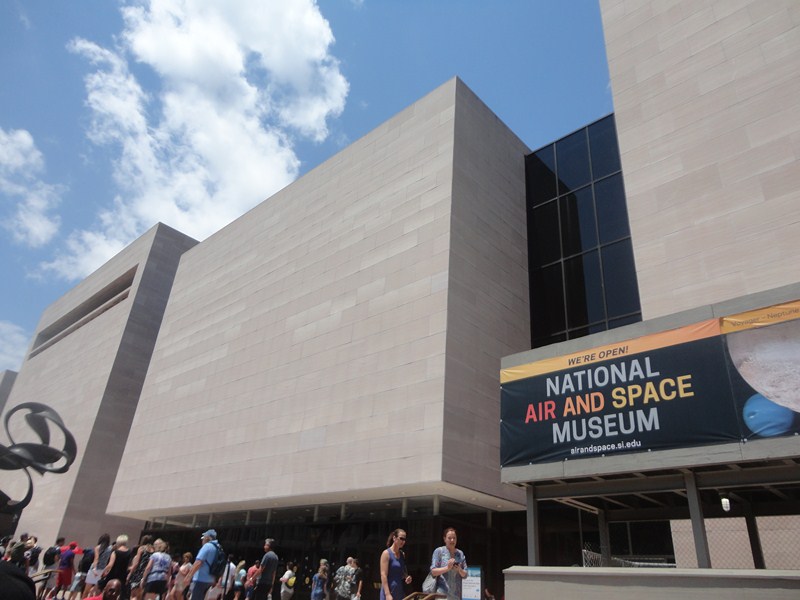
The National Air and Space Museum (NASM) of the Smithsonian Institution is a must-see for visitors to Washington, DC. Established August 12, 1946 as the National Air Museum, it opened at its main building on the National Mall near L’Enfant Plaza in 1976.
It is a center for research into the history and science of aviation, spaceflight, planetary science, terrestrial geology and geophysics. Allow at least 2-3 hours to explore the exhibits.
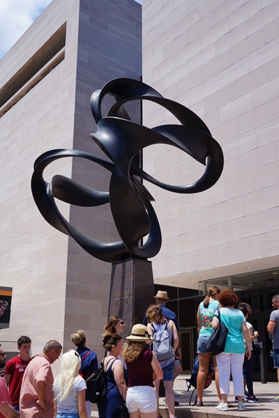
Continuum of the late Charles O. Perry
Here are some interesting trivia regarding this museum:
- It holds the largest collection of historic aircraft and spacecraft in the world.
- In 2014, the museum saw approximately 6.7 million visitors, making it the fifth most visited museum in the world.
- It is the largest of 19 museums included in the Smithsonian Institution.
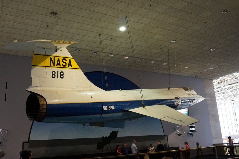
Lockheed F-104A Starfighter at the second floor concourse
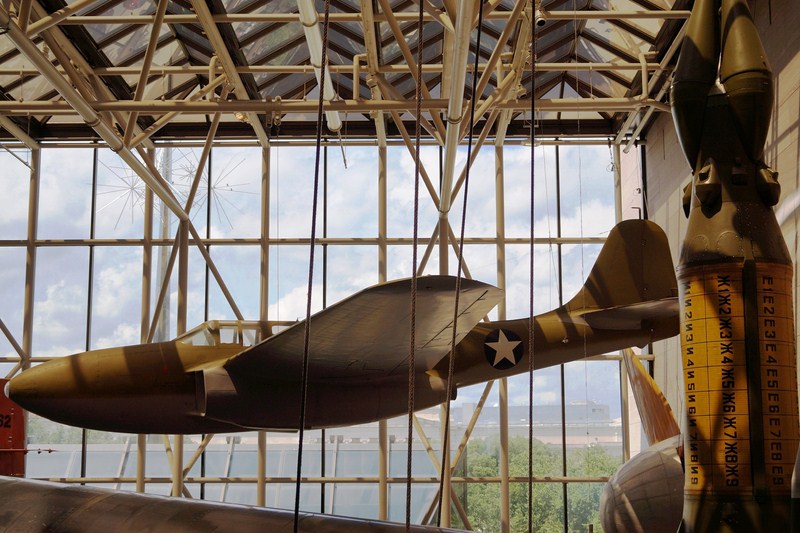
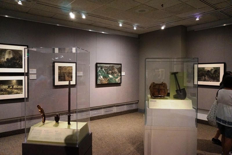
The museum features 22 exhibition galleries, displaying hundreds of artifacts. Many of the exhibits are interactive and great for kids. Almost all space and aircraft on display are either originals or the original backup craft.
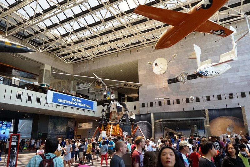
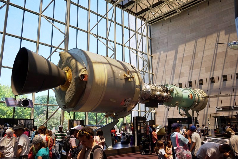
Boeing Milestones of Flight – the main hall of the museum
Designed by St. Louis-based architect Gyo Obata of HOK , the museum, its mass similar to the National Gallery of Art and using the same pink Tennessee marble, was built by Gilbane Building Company and opened on July 1, 1976 at the height of the United States Bicentennial festivities.
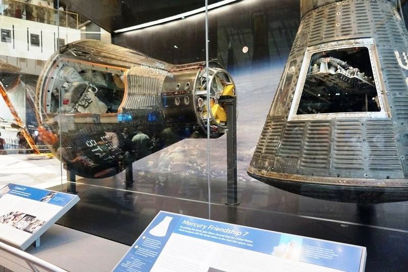
The Mercury Friendship 7 and Gemini IV capsules
It has four simple marble-encased cubes containing the smaller and more theatrical exhibits, connected by three spacious steel-and-glass atria which house the larger exhibits such as missiles, airplanes and spacecraft. The west glass wall of the building, used for the installation of airplanes, also functions as a giant door. On display outside is “Continuum,” a curving metal map of the universe one by the late Charles O. Perry.
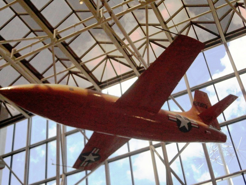
Bell X-1
The Boeing Milestones of Flight Gallery, the museum’s main hall, was reopened in July 2016. This expanded exhibition traces the interconnected stories of the world’s most significant aircraft, rockets, and spacecraft in history, milestones which have made our planet smaller and the universe larger, with digital displays and a mobile experience in a new design that stretches from one entrance to the other.

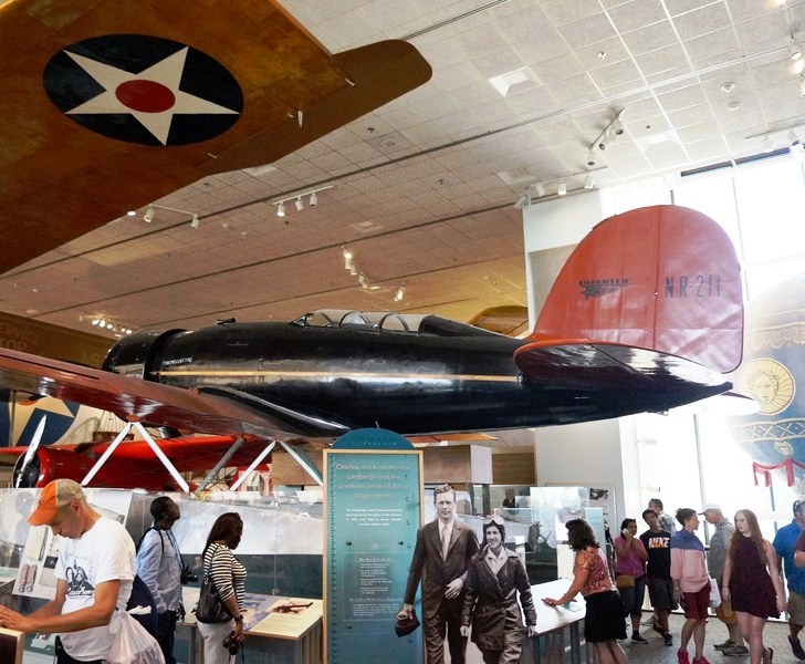
Ryan NYP Spirit of St. Louis

North American Aviation Inc. X-15A 56-6670 hypersonic research rocketplane

SS-20 and Pershing II ICBM Missiles
They also tell tales of ingenuity and courage, war and peace, politics and power, as well as society and culture.
Bell XP-59A Airacomet
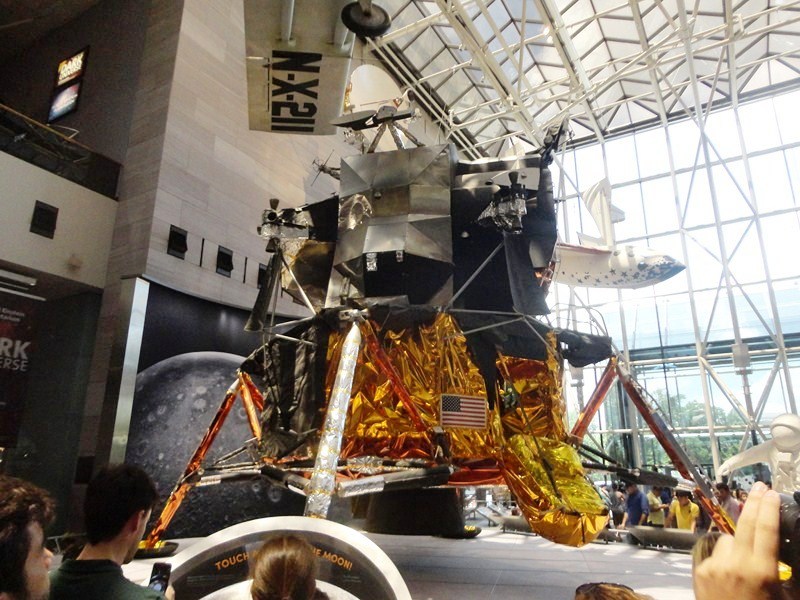
Mock-up of Lunar Module
The displays, taking full advantage of the atrium’s two-storey height, includes the huge Apollo Lunar Module; the Telstar satellite; the model of the “Starship Enterprise” used in the Star Trek television series;, the Ryan NYP Spirit of St. Louis (where Charles Lindbergh’s made his solo trip across the Atlantic); the Bell XP-59A Airacomet (the first American jet aircraft); the Bell X-1 (in which Chuck Yeager first broke the mythical “sound barrier”); the North American X-15 (the fastest aircraft ever flown); the Mercury Friendship 7 capsule (flown by John Glenn); the Mariner, Pioneer, and Viking planetary explorers; and SpaceShipOne (the first privately-developed, piloted vehicle to reach space). You can even touch a Moon rock.
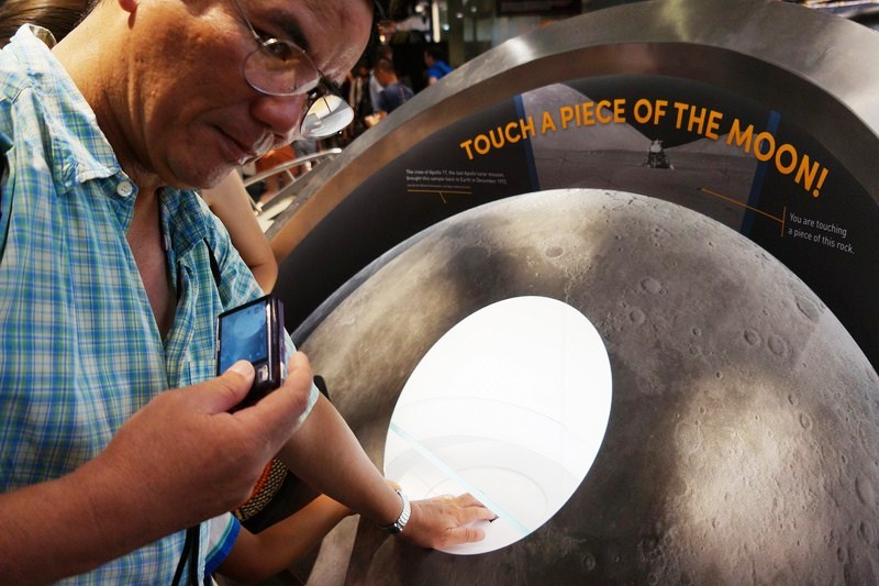
The author touching a piece of the Moon
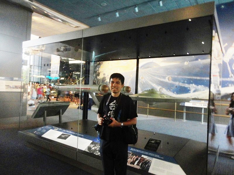
Jandy with the model of the Star Trek Starship Enterprise
The Space Race Gallery tells about that U.S.-Soviet Union space rivalry and its aftermath, from the military origins of the Space Race, through the race to the Moon and the development of reconnaissance satellites, to cooperative ventures between the two former rivals and efforts to maintain a human presence in space.

German V2 Rocket
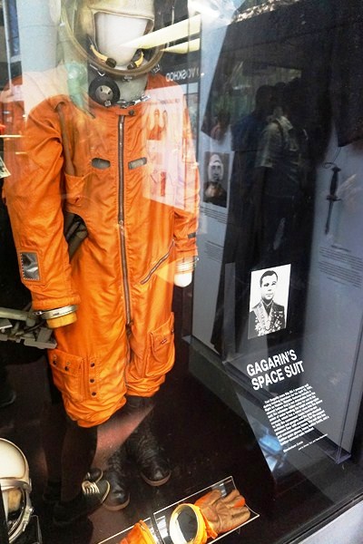
Yuri Gagarin’s Space Suit
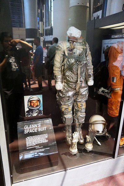
John Glenn’s Space Suit
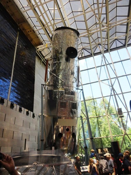
Hubble Space Telescope
Some of the items on display include a German V-1 “buzz bomb” and V-2 missile, Soviet and U.S. spacecraft and space suits, a Skylab Orbital Workshop, and a full-size test version of the Hubble Space Telescope.
1970 Northrop M2-F3 CN 1
Apollo–Soyuz Test Project
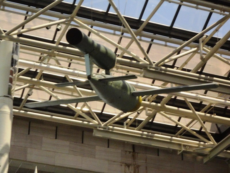
V-1 Buzz Bomb
The Apollo to the Moon Gallery has an unparalleled display of artifacts from the Apollo and earlier missions with displays that range from a huge F-1 rocket engine, a scale model of the Saturn V rocket, spacesuits worn by Apollo astronauts on the Moon to space food and personal items that astronauts took into space.

Saturn V Rocket Engine
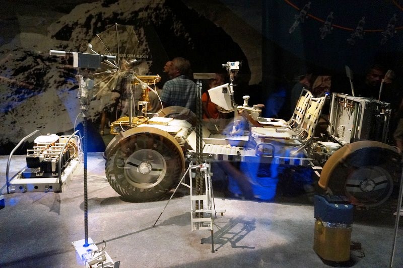
Lunar Roving Vehicle
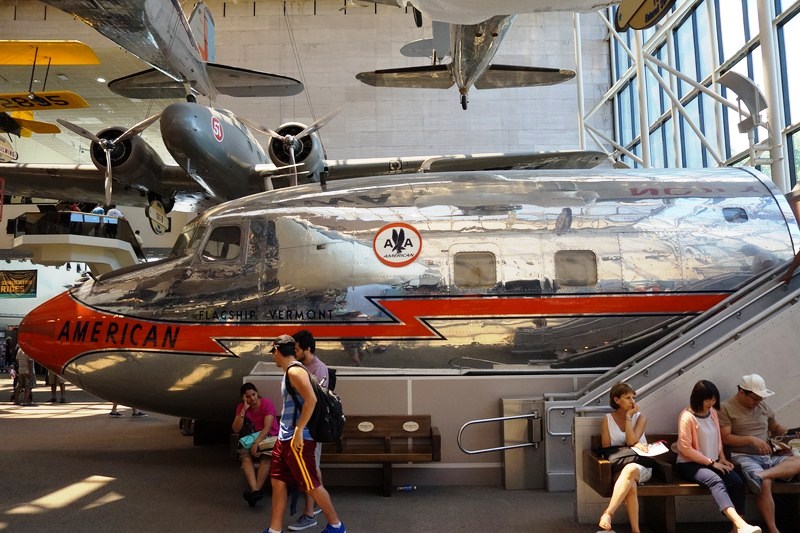
The America by Air Gallery, exploring the history of air transportation in the United States, shows how the federal government has shaped the airline industry, how improvements in technology have revolutionized air travel, and how the flying experience has changed.
The nose section of a DC-7

Boeing 747 Forward Fuselage
Highlights include a Ford 5-AT Tri-Motor, Boeing 247, and Douglas DC-3 airliners; a cockpit simulation of an Airbus A320; and a nose from a Boeing 747 jumbo jet that you can enter.
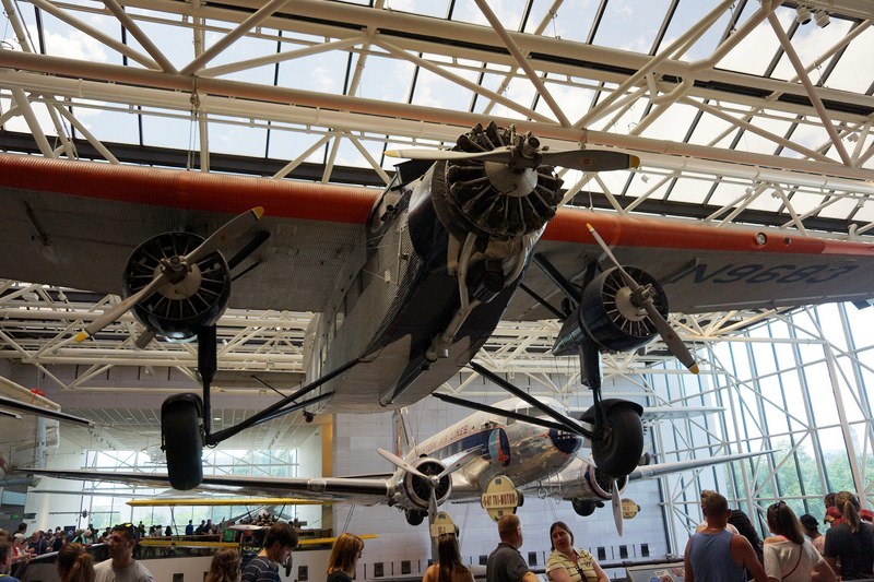
Ford 5-AT-B Trimotor
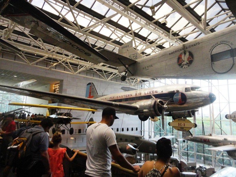
Douglas DC-3

Boeing 247-D
The Barron Hilton Pioneers of Flight Gallery, having to do with people who pushed the existing technological or social limits of flight, contains an impressive, eclectic assortment of aircraft and exhibits, each representing an unprecedented feat, a barrier overcome or a pioneering step.
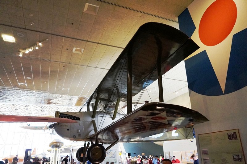
Douglas World Cruiser Chicago
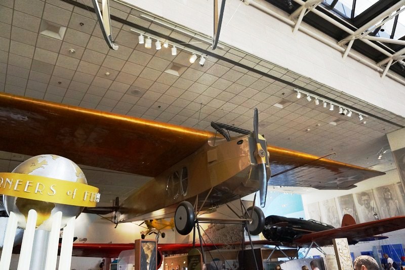
Fokker T-2
Things to see here include the Fokker T-2 (the airplane that made the first nonstop, coast-to-coast flight across the United States); the Douglas World Cruiser Chicago (which completed the first round-the-world flight); a Lockheed Model 8 Sirius (flown by Charles Lindbergh and Anne Morrow Lindbergh), a Lockheed Vega (flown by Amelia Earhart); the Explorer II high-altitude balloon gondola; and “Black Wings,” an exhibit on African Americans and aviation.
Lockheed Model 8 Sirius
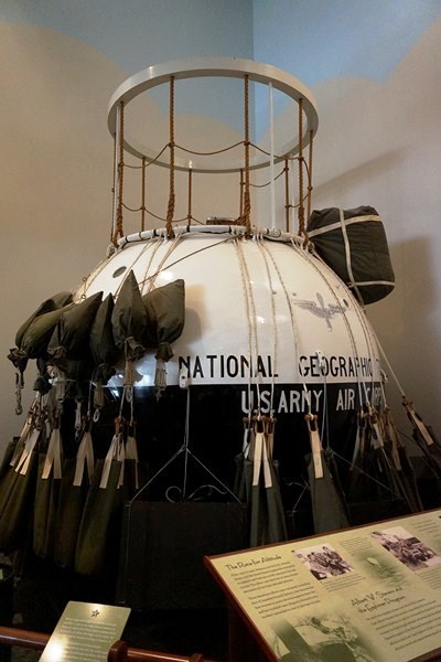
Explorer II high-altitude balloon gondola
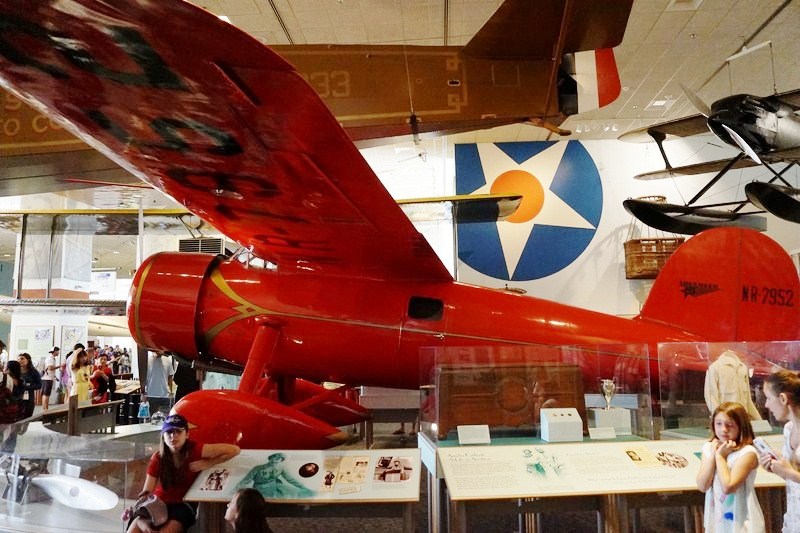
Lockheed Vega 5B of Amelia Earhart
The Explore the Universe Gallery shows how our ideas about the Universe evolved as we developed new astronomical instruments. It presents the Universe as discerned by the naked eye, then shows how the telescope, photography, spectroscopy, and digital technology revolutionized our view. The largest section describes what astronomers today think about the nature of the Universe. Among the many amazing treasures on display are an Islamic astrolabe from 10 centuries ago; the actual telescope tube from William Herschel‘s 20-foot telescope; the observing cage from the Mount Wilson Observatory‘s 100-inch Hooker Telescope; and the backup mirror for the Hubble Space Telescope.
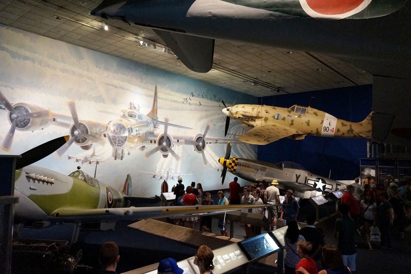
World War II Aviation Gallery
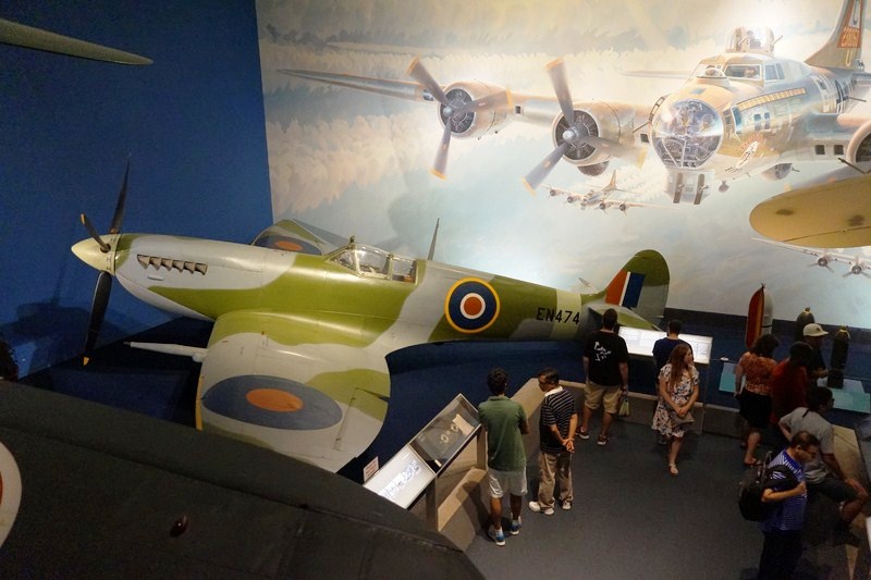
Supermarine Spitfire HF.MK.VIIc
The World War II Aviation Gallery focuses on land-based fighter aviation. Fortresses Under Fire, a Keith Ferris mural filling an entire wall, features a B 17 Flying Fortress, with contrails streaming behind it, roaring out of a clear blue sky.
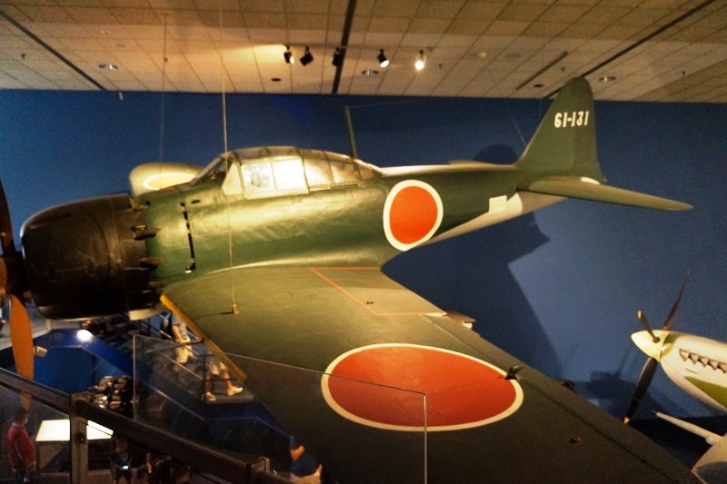
Mitsubishi A6M5 Reisen (Zero Fighter)
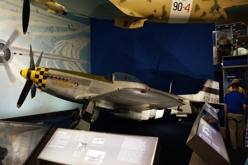
North American P-51D Mustang
The mural serves as a backdrop for five fighter planes – a British Supermarine Spitfire, German Messerschmitt Bf 109, Italian Macchi C.202 Folgore, U.S. North American P-51 Mustang and a Japanese Mitsubishi A6M Zero.
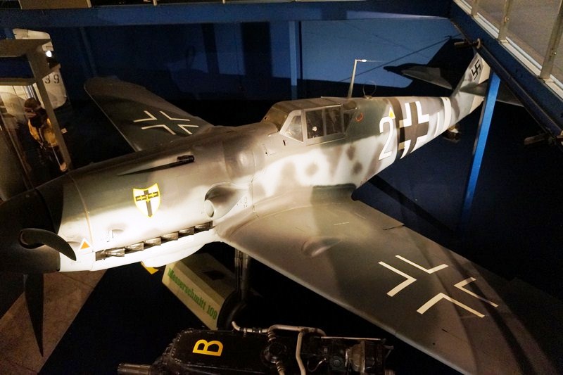
Messerschmitt Bf 109 G (1)

Aeronautica Macchi C.202 Folgore
Also on exhibit are engines, bombs, armament, ammunition, aircrew and service uniforms from several nations, and personal memorabilia.
Artist Soldiers Exhibit
The Artist Soldiers exhibition, a collaboration between the Smithsonian’s National Air and Space Museum and National Museum of American History, examines this form of artistic expression from two complementary perspectives – one from professional artists who were recruited by the U.S. Army and served in the American Expeditionary Force (the first true combat artists) and the other from soldiers who created artwork.

Together, these works of art of soldiers shed light on World War I in a compelling and very human way by first-hand participants.
The Exploring the Planets Gallery takes you on a tour of this remarkable realm, as seen and sensed by the Voyagers and other robotic explorers. Initial sections present some historical highlights and show the various means we use to study other worlds. Sections devoted to each planet form the core of the gallery.
The author with the Blériot XI monoplane
The gaily decorated Early Flight Gallery, celebrating the first decade of flight, evokes the atmosphere of the fictitious Smithsonian Aeronautical Exposition of 1913, an aviation exhibition from that period. The gallery is crammed with fabric-covered aerial vehicles, some fanciful, most real, along with trade show–style exhibits featuring cutting-edge technology of the day.
Swedenborg Flying Machine
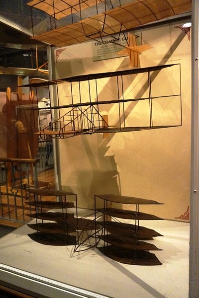
The Chanute Gliders
They include a rare 1894 Lilienthal glider; Samuel P. Langley’s Aerodrome #5 and Quarter-Scale Aerodrome (powered, unmanned vehicles that successfully flew in 1896 and 1903); the 1909 Wright Military Flyer (the world’s first military airplane, it is the most original and complete of the museum’s three Wright airplanes); a Curtiss Model D “Headless Pusher,” an Ecker Flying Boat, and a Blériot XI monoplane.

Curtiss D-III Headless Pusher
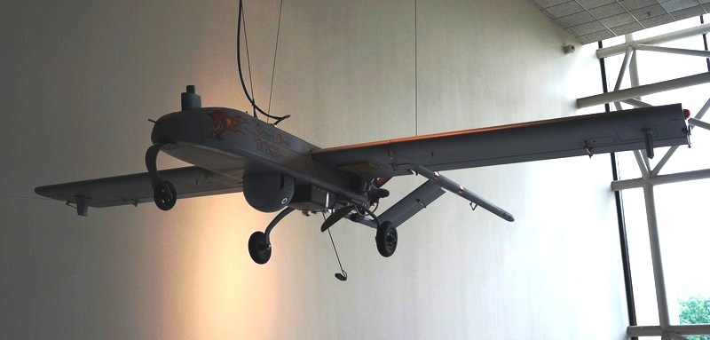
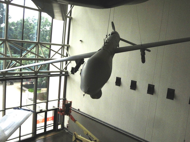
The Unmanned Aerial Vehicles (UAVs) Gallery, made possible through the generosity of General Atomics Aeronautical Systems, Inc., showcases six modern military UAVs that represent a variety of missions and technologies.

Boeing X-45A
They range from large vehicles that can carry offensive weapons to a miniature system whose components are light and compact enough to be carried in a Marine’s backpack.
AAI RQ-7 Shadow UAV
The Golden Age of Flight Gallery features the 1920s and ’30s, the period between the two world wars that saw airplanes evolve from wood-and-fabric biplanes to streamlined metal monoplanes. The military services embraced air power and aviation came of age. Air races and daring record-setting flights dominated the news and aircraft displayed here include planes used for racing and record setting such as Howard Hughes‘ sleek, record-setting Hughes H-1 Racer, the Wittman Buster midget racer (hanging near the entrance) and the Curtiss J-1 Robin Ole Miss (which stayed aloft for 27 days). There are also planes for business travel (Beechcraft C17L Staggerwing) and exploration (the Northrop Gamma 2B Polar Star, which traversed Antarctica).
MQ-1L Predator A
The How Things Fly Gallery, devoted to explaining the basic principles that allow aircraft and spacecraft to fly, emphasizes “hands-on,” with dozens of exhibits inviting you to push, pull, press, lift, slide, handle, touch, twist, turn, spin, bend, and balance. Here you can discover for yourself answers to things you’ve always wondered about flight. You can explore the nature of gravity and air; how wings work; supersonic flight; aircraft and rocket propulsion; flying in space; and more.

1903 Wright Flyer
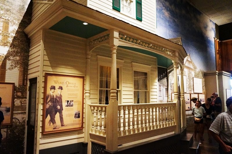
The Wright Brothers and the Invention of the Aerial Age Gallery celebrates the centennial of the Wright brothers‘ historic flights. It has, as its centerpiece, the 1903 Wright Flyer, the world’s first successful airplane and historic craft that ushered in the age of flight, displayed on the floor.
The first part of this exhibition tells the story of how Wilbur and Orville Wright invented the airplane—who they were, how they worked, and what they accomplished.
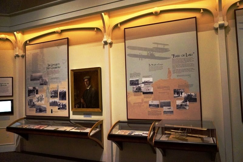

The second part shows how their monumental achievement affected the world in the decade that followed, when people everywhere became fascinated with flight. The exhibition includes many historic photographs and cultural artifacts, along with instruments and personal items associated with the Wrights.
The Moving Beyond Earth Gallery, an immersive exhibition, places visitors “in orbit” in the shuttle and space-station era to explore recent human spaceflight and future possibilities. An expansive view of the Earth as viewed from the space station drifts over one gallery wall, while a fly-around tour of the International Space Station fills another wall. A presentation stage for live events, broadcasts, and webcasts at the center of the gallery serves as the platform for Space Flight Academy, a group quiz game where visitors can test their space smarts and become “flight ready.”
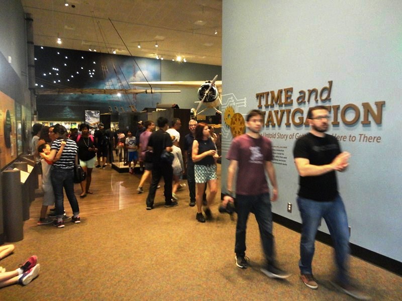
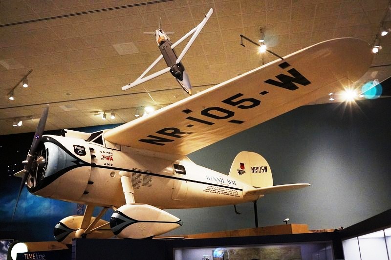
Time and Navigation Gallery
Lockheed 5C Vega – Winnie Mae
The Time and Navigation Gallery explores how revolutions in timekeeping over three centuries have influenced how we find our way.
Model of USS Enterprise
The Sea-Air Operations Gallery, at the quarterdeck of the mythical aircraft carrier USS Smithsonian, a scaled-down re-creation of a hangar deck bay, has surrounding structures and equipment that are from actual aircraft carriers.
Douglas SBD-6 Dauntless
You can poke around in a ready room, a combined living room and briefing area, or go upstairs and visit the navigation bridge and PriFly, the ship’s air traffic control center. From these two rooms you can watch “cat shots” and “traps” (takeoffs and landings) filmed on a U.S. Navy carrier.
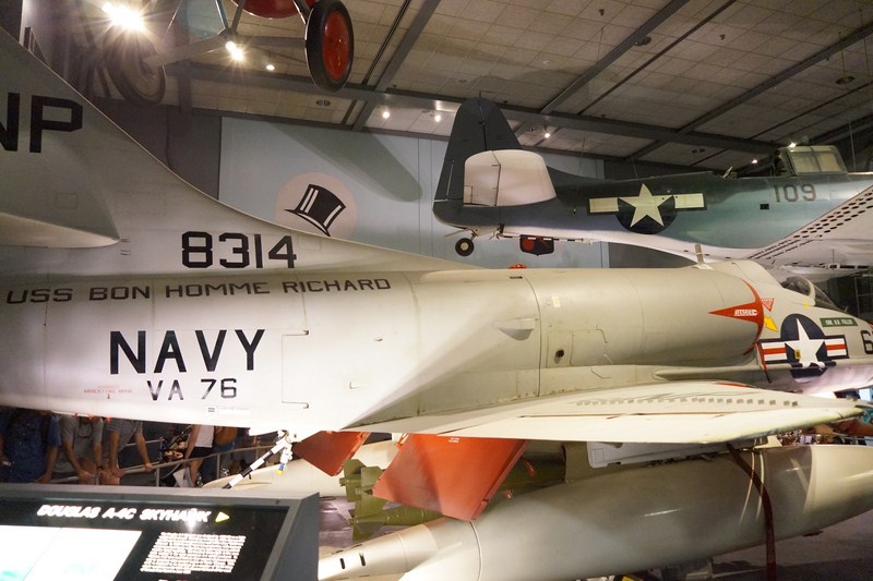
Douglas A-4C Skyhawk
Balconies overlook the four carrier aircraft in the hangar bay – a Boeing F4B-4 biplane, Grumman F4F Wildcat, Douglas SBD-6 Dauntless, and Douglas A-4C Skyhawk. Also here are exhibits on carrier warfare in World War II and on modern carrier aviation.
Boeing F4B-4
The Looking at Earth Gallery, exploring the technology of aerial and space observation and its many uses, displays aircraft and spacecraft and examples of the photographic and imaging devices used on them.
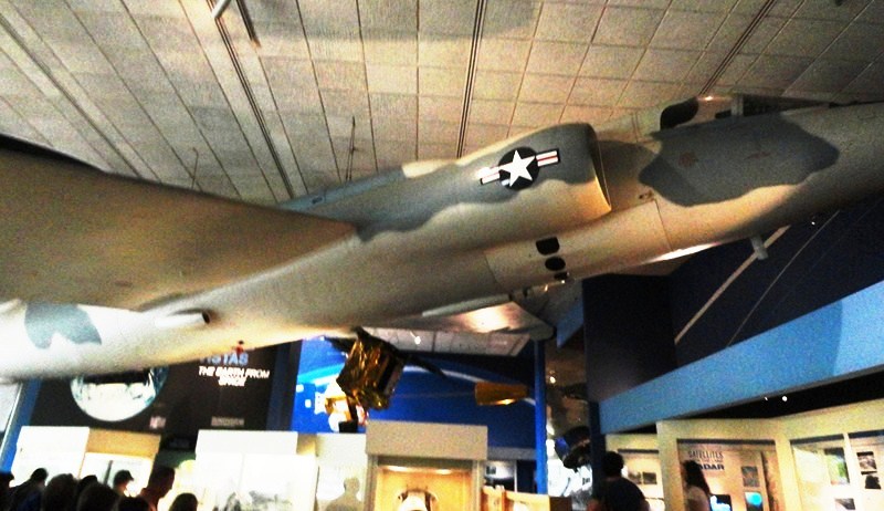
Lockheed U-2C
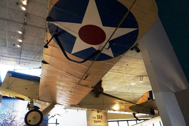
De Havilland DH-4
Throughout the exhibition are countless images taken from above, some are historic; others show scientific, military, or civil applications; others are simply beautiful. All allow us to examine the familiar from unfamiliar perspectives.
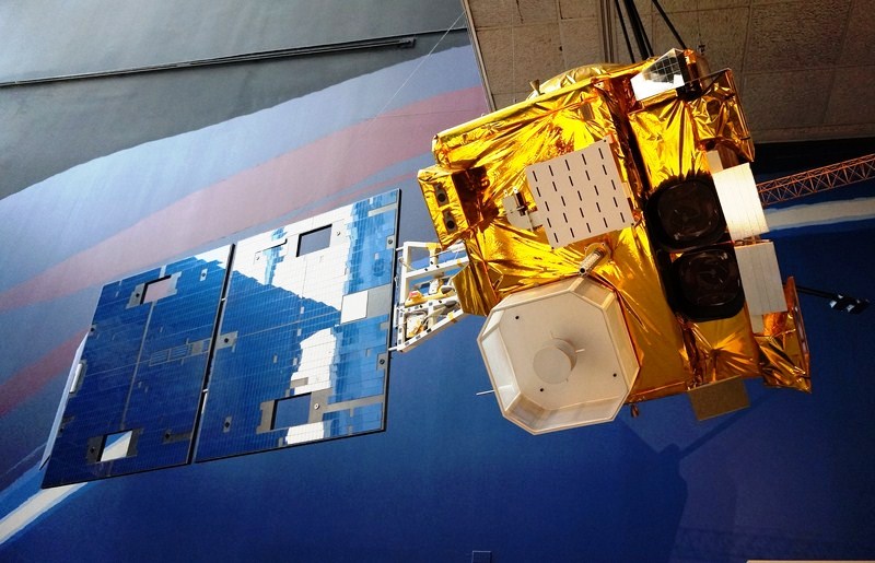
GOES Weather Satellite
Highlights include a De Havilland DH-4 (a World War I aircraft used for aerial observation and photography); a Lockheed U-2 (designed for Cold War aerial surveillance); personal objects of Soviet-captured U-2 pilot Francis Gary Powers; and several generations of weather satellites. A “What’s New” section displays frequently updated images of current interest taken of our planet from space.
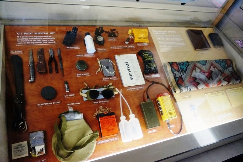
US Pilot Survival Kit
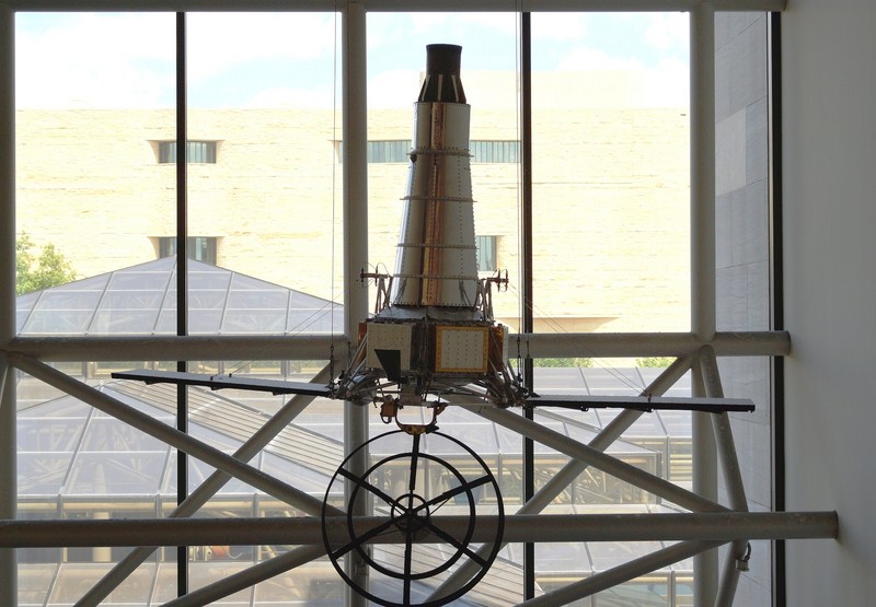
The Lunar Exploration Vehicles Gallery displays a constellation of vehicles used for lunar exploration. Dominating the space is a real lunar module, the second one built for the Apollo program. The orbital test flight of the first lunar module proved so successful that a second test flight was deemed unnecessary. The lunar module displayed here was used instead for ground testing. Six more like it landed astronauts on the Moon.
Engineering Model of Clementine
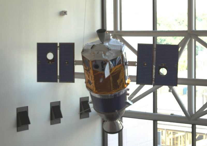
A series of unmanned lunar spacecraft preceded the manned missions. These robotic explorers transmitted images of the Moon, inspected its surface, and searched for Apollo landing sites.
Ranger Spacecraft
Examples of the three types of space probes involved in that effort—Ranger, Surveyor, and Lunar Reconnaissance Orbiter—hang above the lunar module, along with a more recent lunar explorer: the Moon-mapping spacecraft Clementine.

Lunar Orbiter
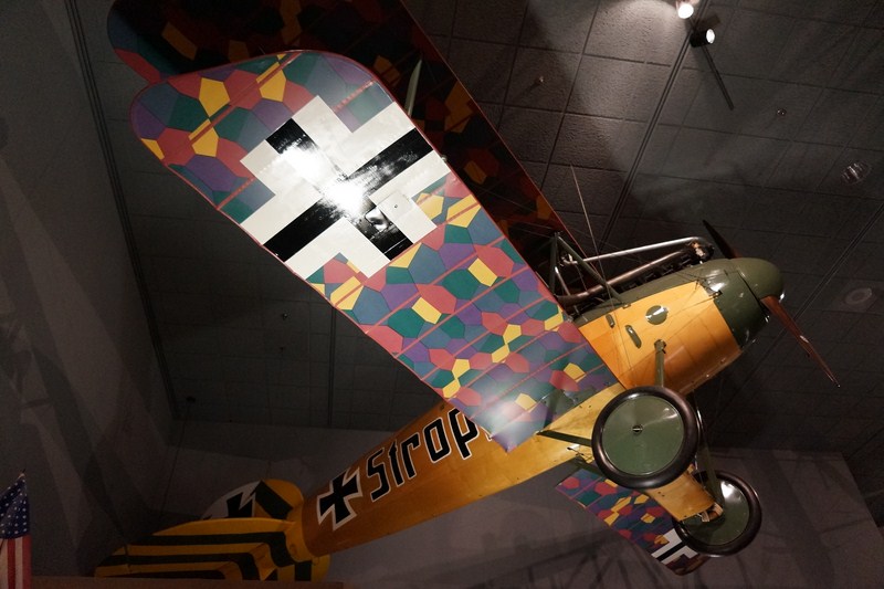
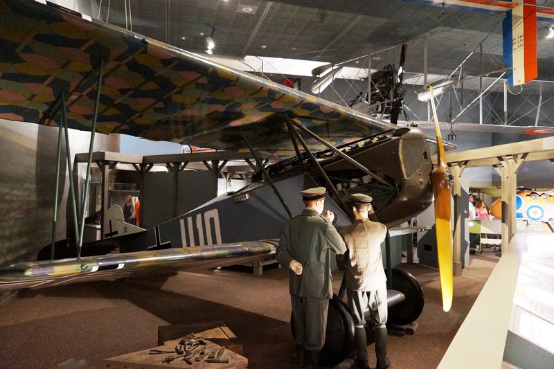
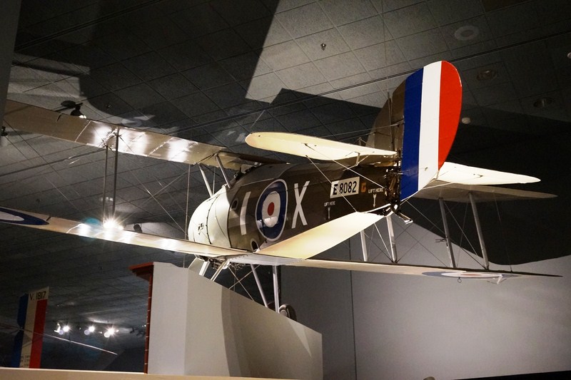
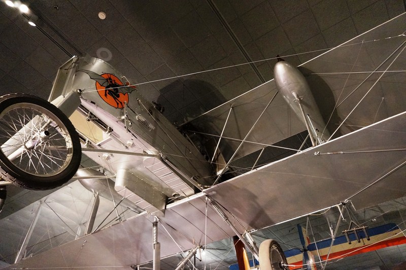
The Legend, Memory and the Great War in the Air Gallery reexamines aviation during World War I and contrasts romance with reality, with displays of popular culture showing how some of these myths were passed on.
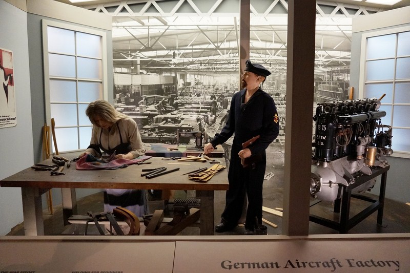
German Aircraft Factory
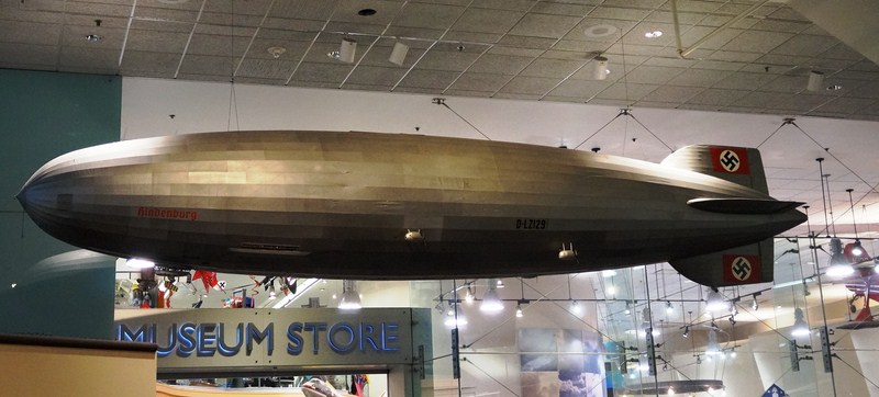
Model of the Hindenburg
Other exhibits examine the many new roles aircraft played during the war, from battlefield reconnaissance to strategic bombing.

Pfalz D.XII
Albatross D.Va
Fokker D.VII
The gallery features several rare airplanes such as the German Pfalz D.XII, Albatros D.Va, and Fokker D.VII fighters; a British Sopwith 7F.1 Snipe fighter; and a French SPAD S.XIII fighter and Voisin VIII bomber.
Sopwith 7F.1 Snipe
Voisin Type 8

Spad XIII Smith IV
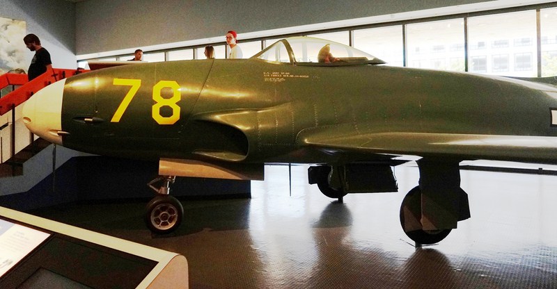
The Jet Aviation Gallery traces the development of jet technology and features many important turbojet engines introduced over four decades, along with three airplanes that helped usher in the jet age – the German Messerschmitt Me 262 A-1a Schwalbe (the world’s first operational jet fighter), the Lockheed XP-80 “Shooting Star” Lulu Belle (the prototype for the first full-production, operational U.S. jet fighter) and McDonnell FH-1 Phantom (the first jet fighter used by the Navy and Marine Corps).
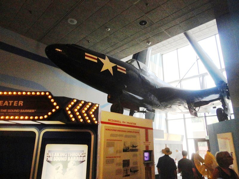
McDonnell FH-1 Phantom
Lockheed XP-80 “Shooting Star” nicknamed Lulu Belle

Messerschmitt Me 262 A-1a nicknamed Schwalbe (German for “Swallow”)
The Lockheed Martin IMAX Theater, with its five-storey-high screen with six-channel digital surround sound, take you on a journey through space or to natural and manmade wonders of the world.

Douglas D-558-2 Skyrocket on display outside of the Lockheed Martin IMAX® Theater
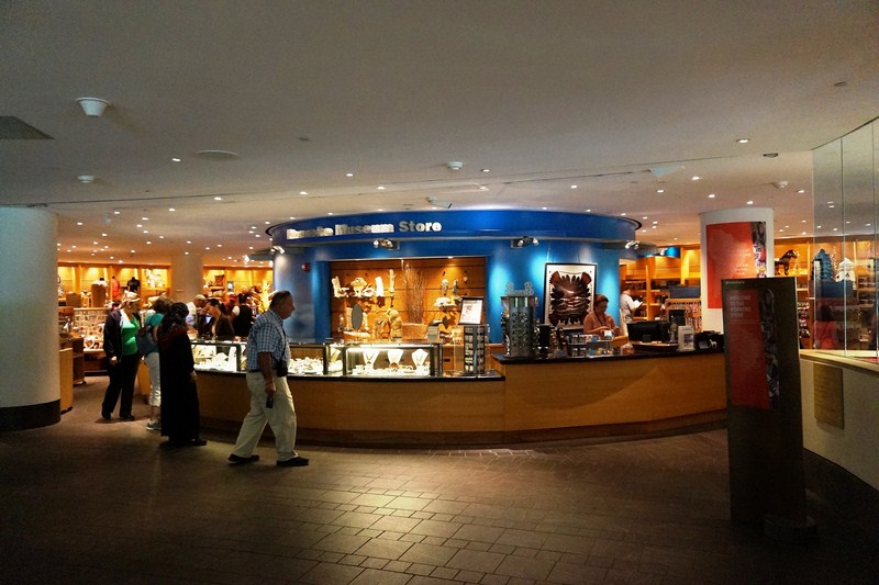
The Albert Einstein Planetarium, with its high tech dual digital projection system, Sky Vision, takes you on a 20-minute tour of the universe. The museum’s three-storey gift shop is a great place to find memorable souvenirs and gifts. A food court- style restaurant is open daily from 10 AM to 5PM.

Museum Shop
National Air and Space Museum: 600 Independence Ave. at 6th St. SW, Washington, D.C. 20560, USA. Tel: +1 202-633-2214. Open aily (except December 25), 10 AM – 5:30 PM. Website: www.airandspace.si.edu.
General Admission: free. The 4-minute flight simulator rides cost US$6.50 per ride. IMAX movies and the Planetarium each cost US$9 per adult or US$7 per child. Shows often sell out, so purchase your tickets before viewing the rest of the museum. Tickets can be purchased in advance at (877) WDC-IMAX. After the September 11 attacks in 2001, new security measures have been created, with extensive queues extending outside the building.
How to Get There: The closest Metro stations are Smithsonian and L’Enfant Plaza.