During our tour, Grace and I could not help but notice the proliferation of fine-dining restaurants and cafes inside portions of the ancient walls, vaulted chambers and some fortifications, notably at Baluarte de San Andres and Puerta de Isabel II, all built in the name of “adaptive re-use,” a concept wherein the past is adapted to keep it as a living part of its newer environs. Here, the argument between conservationists (notably the Heritage Conservation Society, an NGO) and the Intramuros Administration. The first is concerned by this commercial invasion of Intramuros’ past while the latter concerned with the task of preserving it by any and all means. In these days of national budget deficits and cuts and the Asian financial crisis, economic imperatives have necessarily come into the picture. A great deal of funding is needed in the restoration and preservation (and later, the operation) of historic sites such as Intramuros. That is a given. On one side of the coin, the IA is hoping that revenues earned from these restaurant and café endeavors would help in the economic revitalization of Intramuros by creating new jobs, promoting heritage tourism, increasing the area’s property value and, in the long run, attracting new investments. In short, they are hoping that this economic base will eventually support Intramuros’ preservation. “Revitalized” historical districts usually cited include Clarke Quay in Singapore, Covent Garden in London and the Cartagena de Indias Fortifications in Colombia. On the other side of the coin, conservationists and moralists are concerned that these new constructions will violate the IA charter by debasing the structural integrity of the historic walls. The IA charter states that “all walls, fortifications and gates are special zones subject to specific rules and regulations regarding allowable and prohibited uses, specific building requirements and architectural standards”. They also contend that these restaurants and cafes endanger Intramuros’ unique historical atmosphere as well as damage the morals of students studying in the nearby schools and universities. As architects, Grace and I are doubly concerned with how these new commercial developments may compromise Intramuros’ structural, as well as, aesthetic integrity. Just the same, we are also pragmatists who believe, especially in these days of economic uncertainty, that these are viable ways of making restoration and preservation pay for itself. However, it is our hope that, with proper monitoring of building regulations and violations, a compromise might be struck between the two sides.
A Calesa Tour of Intramuros (Manila)
After Jandy and I finished touring Fort Santiago and its Rizal Shrine, a calesawas waiting outside for us. During our absence, my daughter Cheska, always the adventurer, took a fancy for a ride in that horse-pulled contraction and was able to convince Grace to hire one (for PhP200).
It surprised me that the 4 of us were able to fit in a carriage with a backseat made to seat just 2 passengers comfortably. Jandy and later Cheska took turns on the driver’s seat. Our driver, Boy Javier, rode shotgun. Grace and I, plus one of our kids, just managed to squeeze (or should I say contort) ourselves at the back. We all took it good-naturedly and proceeded in high spirits on our nostalgic 1-hour tour which took us from the fort to Manila Cathedral, Plazuela de Sta. Isabel, San Agustin Church, around the walls and gates of Intramuros and back. Boy, quite familiar with Intramuros’ history, acted as our tourist guide.
During the Spanish era, Intramuros was breached by eight main gates or puertas: Aduana (Pasig River), Almacenes, Isabel II (Pasig River), Sta. Lucia (Manila Bay), Sto. Domingo, Parian (landward), Postigo del Palacio (Manila Bay) and Real (landward). The last three were main gates of the original 16th century fortifications. When the Americans took over the 67-hectare walled city, two of the eight gates, Aduana and Almacenes, were torn town to make way for wharves, warehouses and vehicular access.
The Postigo del Palacio, along Calle Postigo (from the Spanish word meaning “door latch”), was built in 1783 and was the private gate of both the archbishop and the governor-general, who would use it whenever they wanted to enter or leave the city incognito. Our National Hero Jose Rizal was led to his December 30, 1896 execution through this gate from his cell in Fort Santiago.
The Puerto Real (Royal Gate), built in 1663, was the gate reserved for the governor for his stately entrance or exit. It was originally located at Calle Real del Palacio (now Gen. Luna St.), at the right side of Baluarte de San Diego facing Bagumbayan. It was destroyed during the British invasion of 1762. Later, it was transferred from to its present site along Muralla St. and was made narrower and lower. Civil and religious parades that used to pass the old gate were later rerouted to Puerto del Parian. Two spiral staircases lead to the ramparts. Its interior holds a collection of church silver. Musical performances take place in the Puerto Real Gardens.
Puerta del Parian, the official gate of the governor after the British invasion, links the city with the bustling Chinese ghetto (Parian de Arroceros, one of Intramuros’ earliest concentrations of Chinese merchants) outside the walls.
Puerto de Isabel II, at Magallanes Drive, diagonally across the Bureau of Immigration, was built as a storage arsenal and was the last gate built by the Spaniards in Intramuros. Opened in 1861 to ease the traffic between Intramuros and Binondo, flanking it are vaulted chambers which served as soldiers’ barracks and arsenals for storing munitions. A bronze statue of Queen Isabel, which once stood in front of Malate Church, was unveiled in 1860 at Plaza Arroceros (now Liwasang Bonifacio) but was moved next to the restored gate for the 1975 state visit of Prince (and later King) Juan Carlos de Bourbon of Spain. Today, its vaulted chambers house a series of seven restaurants and cafes: Aposento, Café Provencal, Capone Bistro, E-hive, Pancake House, Starbucks Café and Tamayo Café. The open area outside are reserved for chairs and tables.
Puerto de Santa Lucia, built in the 18th century, has two side chambers. One chamber has steps leading to a dungeon-like cell that served as a septic tank. The gate led directly to Malecon Drive, a popular promenade ground, through an excavated and restored cobblestone bridge.
Intramuros had a total of 10 bulwarks or baluartes : six of which were in Intramuros proper (Dilao, San Andres, San Diego, San Gabriel, Sta. Lucia and Sto. Domingo) and the rest in Fort Santiago. Three ravelins or revellins (Bagumbayan, Parian and Recoletos), four mini-bulwarks or baluartillos (San Eugenio, San Francisco, San Juan and San Jose) as well as two redoubts or reductos (San Francisco and San Pedro), were added to strengthen weak areas and serve as outer defenses
Baluarte de San Gabriel, once Intramuros’ most important defense to the north, faced the settlements of San Gabriel and Parian, both heavily populated by Chinese merchants, traders and transients. After the British invasion of 1762, its bulwarks were renovated by Spanish Engineer Miguel Antonio Gomez to strengthen its defense.
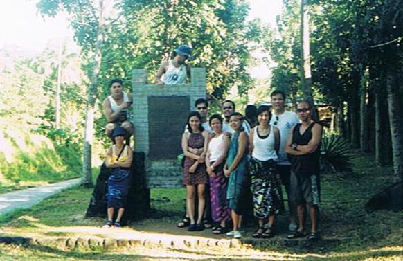
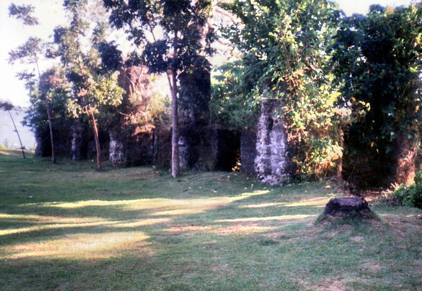
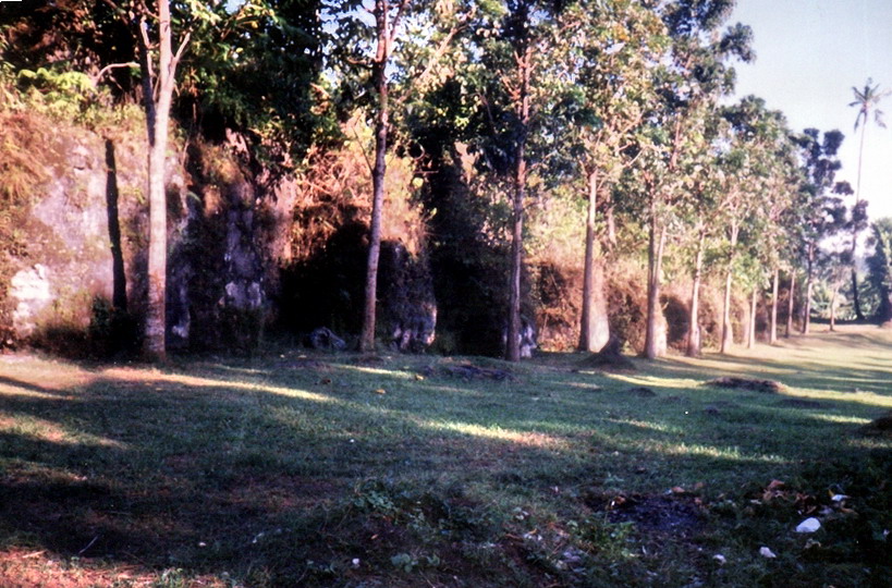
Baluarte de San Andres, formerly known as Baluarte de San Nicolas y Carranza, still has its original lookout tower (logarita), bombproof powder magazine (built in 1733, it contains military artifacts on display), stable house, drainage and foundation. A reconstructed guardhouse overlooks the powder magazine. Today, there are 3 commercial establishments within it: Mas y Mas Music Lounge (opened July 28, 2000) at the far end, Creole Café inside the powder magazine and Ciudad Fernandina (opened December 1999) at the site of the former stable house.
Baluarte de Dilao was also called at different times as San Lorenzo, San Francisco de Dila, San Fernando de Dilao or simply Dilao (after the Japanese suburb it faced across the moat). Part of the original fortification of Intramuros in 1592, it was constructed to reinforce the intermediate space of the walls between Parian and Real called frente de tierra. Reduced to rubble during World War II, its reconstruction in 1984 was based on the original 1773 plans of Engr. Dionisio O’Kelly.
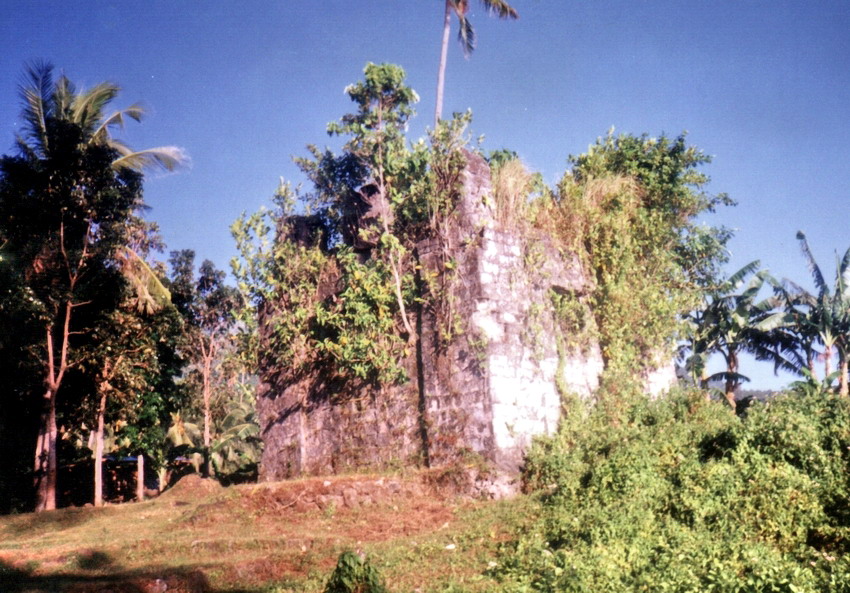
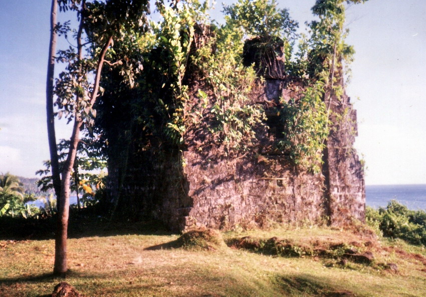
Baluarte de San Diego was known as the Fundicion or foundry. The noted blacksmith, Panday Pira (who built the six lantakas or bronze cannons of Sulayman’s bamboo-palisaded fort), forged cannons for the Spanish at the site. It was the only bulwark facing the sea (although part of it has now been reclaimed and is now the Port Area) and was built and designed by Jesuit Fr. Antonio Sedeno from 1586 to 1587 as a circular fort called Nuestra Senora de Guia, the first stone fort of Manila. It was renovated in 1593 to join the walls of the city. The old fort was of poor quality and it soon fell into disrepair. In 1979, high walls of three concentric circles were discovered and excavated, part of the original fort’s round tower. In 1644, construction of the present baluartewas started and was completed between 1653 and 1663. This subterranean arsenal storage also served as dungeons for the Spanish military’s prisoners. Shaped like an ace of spades it was formerly covered with a big mound of earth. Its walls were breached by the British cannon fire in 1762. After the British occupation, its walls were restored and strengthened. It was again damaged during the 1863 earthquake and destroyed in 1945 during the liberation of Manila. It was again restored from 1979-92 after the archaeological excavation of the old fort.
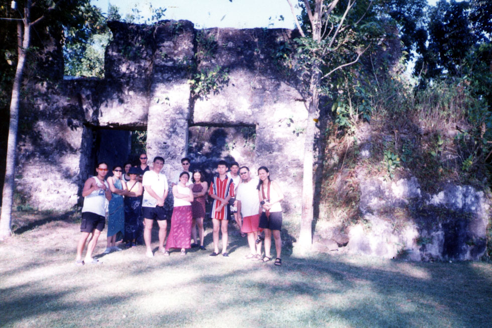
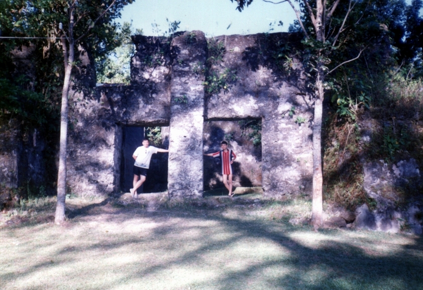
Both are now major attractions in Intramuros. It being so, we all made a stopover here. Preparations for a wedding were then in progress, with the ceremonies to be held at the left of the entry and the reception at the right. The old fort was accessible via a spiral stone stairway. From the bulwark, we had a bird’s eye view of the city as well as the 18-hole Club Intramuros golf course. The old fort is close after 6 P.M. to discourage lovers’ trysts.
Ravellin de Recoletoswas so named because of its proximity to the Agustinian Recollect Church. It served as defense to fill the gap between Baluarte de San Andres and Baluarte de Dilao. The original entrance was sealed off and a new one opened in 1941 to make way for new Victoria St.. It is now converted into the Aurora Gardens (named after the late wife of Commonwealth Pres. Manuel L. Quezon).
Revellin de Real de Bagumbayan, also built in 1663, was used as prison cells during the American period and was later converted into the Manila Aquarium just before World War II. During the Japanese Occupation, it was used as barracks and was damaged during the liberation of Manila in 1945. It was restored in 1969 and additional works were done in 1982. The Manila Aquarium was maintained until its closure in 1983. It was reopened in 1990 with the name Acuario de Manila. It has an impressive collection of Philippine fishes on display. The moat that separated it from the gate is now a garden of tropical greens and coconut palms. It serves as a venue for performing art presentations.
Revellin del Parian, the defensive bastion or outwork of Puerto Parian, was named after the Parian de Arroceros across which lived the Chinese living outside across the moat. It was built in 1603 soon after the Chinese uprising (October 3, 1603, St. Francis Day) and its cannons were hereafter aimed at them. The ravelin was used as a defense line between the curtain walls of Baluarte de San Andresand the Parian Gate. Its vaulted chambers were built in 1739 to house soldiers and military supplies. The entire defense works were completed in 1782 and it was restored, after World War II damage, from 1967-82. Archaeological excavations of the site yielded 17th century artifacts and Japanese Occupation mass graveyards. Some of the gruesome World War II findings include finger bones clutching an unexploded grenade or clinging to a rusty bayonet.
Baluartillo de San Jose, known as “No. 1 Victoria Street”, served as Gen. Douglas MacArthur’s headquarters in 1941. A tunnel-like passage built in with a drainage canal emptying out into the moat, its primary use was to transport ammunition to Reducto de San Pedro.
Reducto de San Pedrois an independent pentagonal structure built outside the walls. A powder magazine during Spanish times, it had its own stockpile of cannon balls deposited in recessed ledges at the entrance. A ramp on one side of the structure leading to the parapet made their transport easier. Gun emplacements looked out. During the pre-World War II period, it was an office of the USAFFE.