|
| Matabungkay Beach Resort & Hotel |
I was invited to join a media familiarization tour of Matabungkay Beach Resort & Hotel in Lian, Batangas on March 23-24, the weekend preceding Holy Week. Our assembly area was the Department of Tourism (DOT) Bldg. near Rizal Park. I left my car at my wife’s office at Gil Puyat Ave, took a fully-packed LRT train, overshot my designated stop which was U.N. Ave. and dropped off instead at Central Station where I decided to just walk, for the exercise, back to the DOT. I arrived at the DOT cafeteria, huffing and puffing and drenched as a newborn kitten, just in time for breakfast.
Check out “Resort Review: Matabungkay Beach Resort & Hotel“
Joining me at the breakfast table were some of the Who’s Who in travel journalism: Mr. Randy V. Urlanda of Panorama, Mr. Frank A. Evaristo of Manila Bulletin, TODAY veteran photographer Mr. Manny Goloyugo, Ms. Arlene Dabu-Foz of Manila Bulletin, Mr. Romark Mayuga of Manila Times, Ms. Claudeth E. Molon of TODAY, Ms. Lala Rimando of Newsbreak Magazine, Ms. Ruby Gonzalez of Travel Weekly East, Ms. Maggie De Pano of Business World Online, Mr. Michael David C. Tan of What’s On & Expat and Mr. Melvin S. Magtaus and Mr. Dennis Lapan of Lifestyle Asia.
Also present, as host, were Ms. Leona DG. Nepomuceno and Ms. Camille Cua of the DOT. Also joining us were Ms. Blessie Zarzuela of Adea Marketing, the TV crews from ABS-CBN (3) and RPN 9 (3) and 2 other DOT personnel.
We left the DOT at exactly 8:30 AM for the 3-hr. airconditioned coaster trip to Matabungay. I sat at the lone bucket seat up front with its wide legroom suitable for my 5’-10” frame. I had to buckle up though. The long 105-km. trip via the Sta. Rosa Expressway was pleasantly uneventful until we reached the junction leading to Lian. Here the coaster was bodily stopped by resident “commissioners” out to make a killing this early. This scene was repeated 5 more times as we approached the town and our hotel, the last one a roadblock set up by the barangay soliciting donations for their fiesta. What a damper!
 |
| Media participants by the Nestea swimming pool |
 |
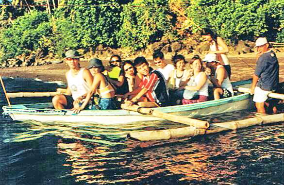
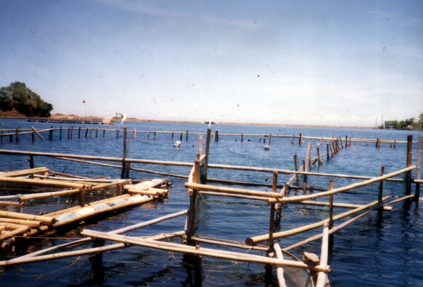
| A fleet of balsas |
After arrival and check in at the resort, we had lunch and, after a short rest, we were all invited by Marissa to take a ride on one of the resort’s floating bamboo rafts (locally called balsa) where a merienda of pancit bihon and canned soft drinks awaited us. Ideal in Matabungkay’s very shallow beach, the shore is lined with lots of these balsas. They are navigated by long bamboo poles sometimes up to the edge of the drop-off and, once a suitable spot is chosen, anchored in place. All rafts have shaded picnic tables and grills. From the balsa, visitors could go swimming, snorkeling and, at the day’s end, sunset watching.
Even after the sun has set, a number of these lighted balsas are used to await fishermen and their much-awaited bountiful catch. These balsas, in effect, have become a very important contributor to Lian’s tourism and livelihood economy. As a tribute to this hardy and durable symbol of Matabungkay, Lian has decided to hold its first Balsa Festival this coming May 17-18.
The 2-day festival, proudly hosted by Matabungkay Beach Hotel & Resort, promises to be activity-packed. Highlights are a Balsa Race and the Parade of Decorated Balsas. Different sectors of Lian and the nearby towns will be invited to participate, 80 for the Balsa Race and 60-70 for the Parade of Decorated Balsas. Students from the town’s different secondary and tertiary schools will also showcase their talents in dance and other production numbers. The festival will be capped, on the evening of May 18, by band performances and a beach party.
 |
| Preparing for my trial dive |
After the raft excursion, Marissa invited us to try our hand at scuba diving at the resort’s swimming pool. I, plus Blessie and Lala, took a crack at it. The others begged off. Mr. Jim Waite, the in-house dive instructor, gave us a brief overview on the basics of diving and its equipment. The much-awaited actual lesson followed and we were soon fitted with masks, snorkel, buoyancy compensator, tanks, weight belts and fins. This being my second dive (my first was a trial dive in Club Paradise in Palawan), I was soon diving about at the pool’s floor like a fish within its element.
After a much-needed shower, a torchlit dinner was served along the beach. Additional lighting was provided by a bonfire. We were also joined by TV crews of ABS CBN and RPN 9 TV. Immediately after that, we were again invited to a round of nighttime entertainment at Gotcha Club. The girls monopolized the videoke while us guys contented ourselves with rounds and rounds of billiards and table tennis. Still others just watched the girls sing to their heart’s content until the wee hours of the morning.
 |
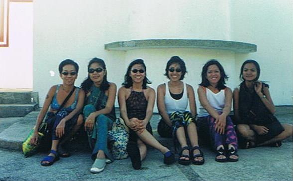
| Press conference by the beach |
The next day, after a sumptuous buffet breakfast at Caballero Café, we buckled down to serious business with a mini-conference held at the beach area. Invited to the conference were Ms. Charlie Leviste-Antonio (the resort’s Vice-President for Operations), Mr. Jim Waite, Ms. Balangue, Mr. Violeta and the town’s Chief of Police. Here we voiced our concerns (the “commissioner” episode, environmental issues, Holy Week security, etc.) and asked questions concerning the resort’s history, facilities and plans, the upcoming Balsa Festival, scuba diving opportunities and Fortune Island (a sister resort).
 |
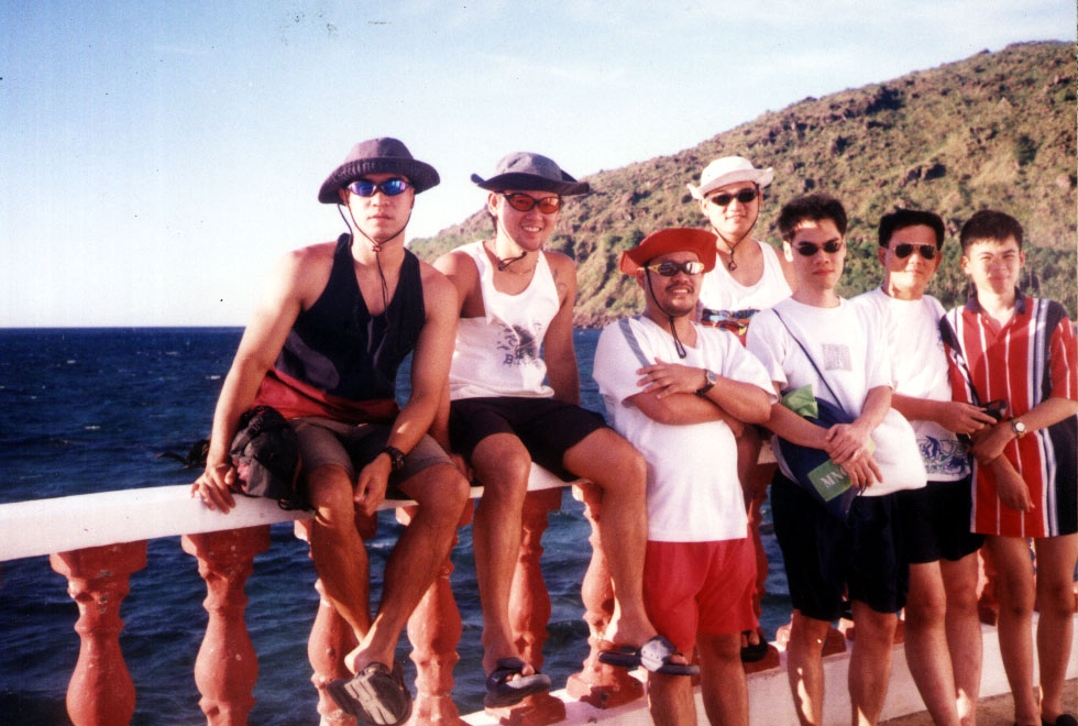
| Posing with our hosts |
Immediately after the mini-conference some of us opted, it being Palm Sunday, for a mass (complete with the appropriate palms) held at the resort’s pavilion. After a late lunch at Café Caballero, we packed up our stuff, had a photo session at the resort entrance and said goodbye to our gracious hosts, Ms. Leviste-Antonio, Ms. Balangue and Mr. Violeta. We left the resort by 2:30 PM and arrived in Manila by 6:30 PM, after a side trip to Calatagan and numerous stopovers at Tagaytay City for fruits, espasol, buko pie and mazapan sweets.