I have heard a lot about this relatively unknown, 900 sq. km. Calbiga Cave System in Western Samar, said to be the largest cave system in Asia, and Jandy and I opted to do some cave exploring there. Jandy and I woke up early, had a hearty breakfast, brought my camera, videocam, flashlight, spare batteries and a pack lunch (prepared by my sister-in-law, Paula) of corned beef sandwiches and bottled water, donned our media jackets (with its many convenient pockets) and proceeded, by jeepney, to the Tacloban City bus terminal by the pier.
 |
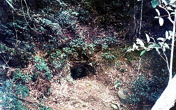
| The low cave entrance |
We made the 59-km. (1 hr.) trip from the city to Calbiga via the 7:30 AM regular bus to Catbalogan, passing the same deplorable road conditions we encountered the day before. Upon our arrival at the town, we immediately registered our names at the municipal hall so that a mayor’s permit could be processed and secured. A group of 9 had registered even earlier, having been in town since 7 AM. Before we were issued permits, Municipal Administrator Mr. Mario Cabujat gave us a short talk on the past history of the caves and the dos & dont’s in exploring the cave. After the briefing, we were all given our respective mayor’s permits. The other group was kind enough to let us hitch with them in their AUV.

The initial 4-km. road going to Brgy. Panayuran was concrete-paved up to a kilometer, becoming rough the remaining distance. Our AUV arrived at the jump-off point by 10 PM and parked our vehicle. We then negotiated with the residents for some guides and working Petromax lamps, settling on PhP250 per guide and PhP50 per Petromax lamp. I got one guide and lamp while the others got another lamp and guide. For additional lighting, some brought along some “Molotov cocktails” (actually kerosene-filled bottles with lighted rags as wicks).
 |
| A phallus-like stalagmite |
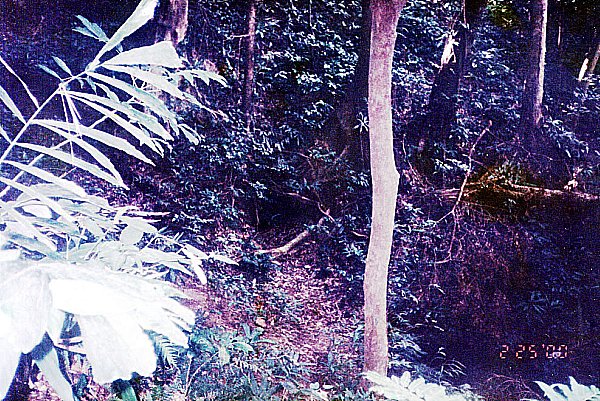
Soon after, our group, now enlarged to 14 (another resident tagged along), started our trek along a well-marked trail passing through tall, 10-ft. high cogon grass. Midway, the trek became steep and rocky as we entered a light forest. We made a number of rest stops and the trail became narrower as we neared the cave. After an hour’s hike, we reached the dark, low cave opening, located below a limestone cliff studded with weathered stalactites. Going down from the main entrance (there are actually 5) was easy but going about this cave was a struggle as one had to hop from one rock to another with hardly any flat area. Deciding on which rock to step on wasn’t easy as a lot were sharp and some were loose. The cave floor was also littered with detached stalactites from previous illegal mining operations. Some passageways were also narrow and low and one has to watch his (or her) head negotiating these areas.
 |
| Vakul |
The first chamber, 5-km. long, 40-m. wide Langun Cave, was huge. Our flashlights could barely penetrate the darkness, much less reach the over 50-m. high ceiling. Surprisingly, bats do not inhabit the caves. The only flying things about are swallows (balinsasayaw). We rested by a beautiful calcite formation with a small, clear reservoir of mineral water and refilled our water bottles and ate our packed corned beef sandwiches here, sharing some with the two guides. Water was occasionally dripping from the ceiling, reminding me that it was seeping water that hollowed out these caves by dissolving the limestone and combining to precipitate calcite over millions of years. Also, the evaporation of water in places, leaves minute deposits of calcium carbonate that hang hollowly from the cave’s roof (stalactites) or rise solidly and more stumpily from the floor (stalagmites). It is said that it takes a hundred years to make 1 cm. of pure white stalactite or stalagmite.
 |
| “Lady with the Lamp” |
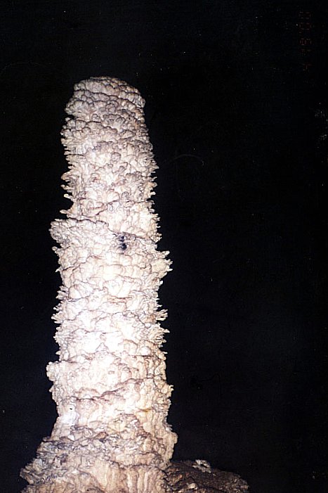
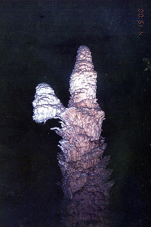
After our half-hour lunch, we resumed our exploration, taking my camera and videocam but leaving behind my backpack with my rubbish inside. Every now and then we would come across beautiful, stalagmites of glittering snow-white calcium carbonate crystal, without a trace of other minerals, carved and combined to form beautiful shapes. Unlike Sohoton Caves, none of them have yet been named. I therefore dubbed one with helictites (an occasional twisted, twiglike growth) as “The Lady with the Lamp” (in honor of Florence Nightingale, God bless her soul!), a beautiful, bullet-like, snow-white stalagmite I dubbed as “The White Phallus” (I could think of no other description), another I dubbed “The Inverted Shoe” (or bakya) and a huge calcite waterfall imbedded with tiny calcite crystals which glittered when lighted by our lamps, I dubbed as “Vakul,” because it reminded me of the Batanes headwear worn by Ivatan women.
 |
| “Casper the Friendly Ghost” |
Our entry into 270 m. long, 160 m. wide Gobingob Hall, the second chamber, was no less easy and quite unglamorous. We had to pass through a floor of soft and moist muck. Our shoes sunk with every step and efforts to raise them was an ordeal. Oftentimes they remained stuck in the mud. One member of our party broke her slipper while others just took them off and walked barefoot. After what seemed an eternity, we were ushered into a huge cathedral-like chamber with huge stalactites hanging from the ceiling. Unlike the previous chamber, the floor here was level, albeit muddy, with long-legged crickets, faded to a pale and sickly hue, hopping around. Inside, too, was an underground stream. Italian spelunkers have found blind cavefish (the first in the country), crabs and other small shellfish here, true troglodytes wholly adapted to sightless existence in caves. Try as I must, even with my flashlight, I could not espy a blind cave fish in the still waters. Other members of the party were able to see one. I was, however, able to observe, up close, a colorless blind crab caught by one of the group. It was later released, unharmed.
 |
| “The Inverted Shoe” |
Our visit to this chamber ended our cave tour. We retraced our steps back to where we left our backpack, proceeded on the cave entrance and emerged, dead tired, at 2:30 PM after 3 hrs. of exploration. The thought of hiking the 3-km. uphill/downhill trail back to the village daunted me and after a few minutes hike, I asked my guide to carry my backpack the rest of the way. We reached the village by 4 PM. After washing up, paying the guides (I paid my guide an extra PhP50 for carrying my backpack) and signing the required guestbook, we left the village at 4:30 PM for the trip back to Tacloban. After 2 or 3 stops due to overheating plus a detour to Basey to drop off some passengers, we reached Tacloban by 8 PM.