Enchanting Claveria (Cagayan)

Claveria Cove

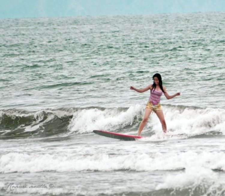
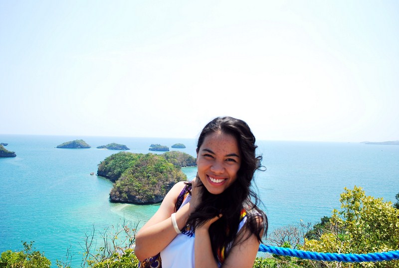
We left Buguey around 1:30 PM and our bus was to travel another 2 hours to get to Claveria, the last Cagayan town prior to entering Ilocos Norte.  It was now raining intermittently when we traversed the beach boulevard facing the town’s clean, 4 km. long brown sand Claveria Cove.  It was very windy when we alighted the bus for some photo ops and the waves along the beach were very turbulent.  On our left, we could sees the hazy outlines of the rock formations Punta Lakay-Lakay (“old man”), Punta Baket-Baket (“Old woman) and Punta Ubing-Ubing (“child”).  The onset of rain necessitated our return to the bus.

Lakay-Lakay Blue Lagoon

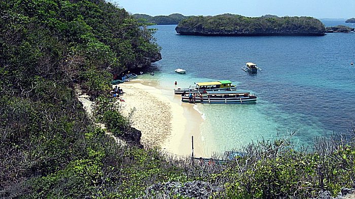
Back on our bus, we proceeded to Taggat to visit Lakay-Lakay Blue Lagoon. This lagoon is also located in a cove, albeit a smaller one.  As the bad weather prevented fishermen from going out to sea, the shore of this fishing village was filled with similarly-colored (blue and white with yellow stripes) fishing boats parked prow-to-bow and outrigger-to-outrigger. Minus the boats and in sunny weather, the panorama before us would have been a photographer’s dream.  Picture a lagoon enclosed by towering cliffs on both sides (the cliff on the right is topped by a cross) and jagged, rocky islands, all lashed and sculpted by the turbulent, churning waves of the sea.   Only in my dreams can I imagine such a scenery. In calmer weather and low tide, I could have swam to those rocky islets. Rain again woke me up from my day dream and we all had to run back to our bus.
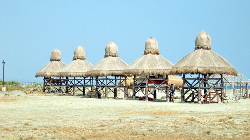
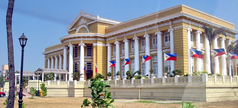
Claveria town hall

Back in our bus, we next proceeded to the Claveria municipal hall where the amiable Mayor Celia Layus and other town officials welcomed us.  A merienda of buko juice, still in its shell, palitaw ( a sweet, flat and glutinous rice cake topped with brown sugar) and ginataan was prepared for us.  During the presscon, Mayor Layus narrated her plans to put up a zip line facility in the lagoon.  Personally, I would prefer that they leave the lagoon as it is and set up the zip line somewhere else in the town.

Buguey: The "Crab Capital of the North" (Cagayan)

El Presidente Beach Resort

After breakfast at Eastern Hawaii Casino and Resort, we next headed west, to Ilocos Norte, with stopovers at Buguey and Claveria. We arrived at Buguey by 10 AM and were dropped off at the El Presidente Beach Resort where we were welcomed by town officials led by Mayor Licerio Antiporda III and his wife. The skies were overcast and it was very windy.  Before entering the conference hall, we were given a welcome drink of fresh buko juice, still in its shell, plus crab sandwiches.  While waiting for the start of the press conference, some sampled the Lamba Sparkle Berry Delight, a cocktail consisting of a 1/3 cup each of the following: native Buguey lambanog (nipa palm wine), sparkle and red berry juice, plus half a teaspoon of sugar; then garnished with lime and cherry and, finally, all the ingredients are shaken, strained and poured into a cocktail glass.

Lamba Sparkle Berry Delight

In his speech at the presscon, Mayor Antiporda enumerated his efforts to further boost the town’s tourism potential as well as to fortify its claim to being the “Crab Capital of the North.”  He also informed us that the local government-run El Presidente Beach Resort will soon be undergoing a total makeover, thanks to a PhP32 million loan from Land Bank, and will be turned into a U-shaped, bungalow-type hotel with 15 guestrooms and two dorms and will be renamed as the Buguey Crab Hotel.

Crab claws anyone….?

Afterwards, we were all invited to partake of the feast prepared for us: steamed shrimps; brackish water crabs, both steamed and cooked in the half shell; breaded prawns; seaweed, oysters, fresh fruits (mangoes, bananas) and bocayo (coconut candy). Some, foregoing the use of spoons, forks and knives, decided to dine kamayan style. While we were doing so, we were regaled with a bevy of native dances performed by schoolchildren and young adults.

Driftwood by the beach

After dining, some of us slipped out the conference hall to burn the excess calories gained as well as to check out the windswept black sand beach, observe people harvesting shells or children playing and to admire the high, turbulent waves breaking on the shore, a consequence of the converging waters of the South China Sea, the Pacific Ocean and the Cagayan River.  Prior to our leaving for Claveria, everyone in the media group was gifted with a bottle of Buguey lambanog to take home (I was given two).

Breathtaking Palaui Island (Sta. Ana, Cagayan)

Palaui Island

We woke up very early in the morning to overcast skies and rain.  After breakfast at the Cagayan Holiday & Leisure Resort, we all checked out of our villa.  We left our luggage at the hotel lobby for transport to the Eastern Hawaii Resort, later to be our second home in Sta. Ana.  Thus unburdened, we all boarded our CEZA coaster for the fish port at Brgy. San Vicente. Point Escarpada, in Brgy. San Vicente, the sailfin capital of the Philippines.  It has the best fishing grounds for marlin, being at the confluence of several ocean currents that carry baitfish and the larger pelagic predators that hunt them.

White sand beach at Punta Engano

At the port, 5 motorized outrigger boats were chartered to bring us to the undeveloped and seldom visited, 3,850-hectare and volcanic Palaui Island, a 7,415-hectare Protected Landscape and Seascape with a shoreline of 20.6 kms., a length of 10 kms. and a width of 5 kms..  The island is inhabited by a community of Dumagats administered by a Filipino church group and is also home to different monkeys, wild pigs, deer, sea turtle and various endemic and migratory birds.  

Cape Engano Lighthouse

The skies were still overcast when we left port.  With me in the boat was Astra Alegre, Izah Morales, Kara Santos, Nina Fuentes and Kim Madridejos.  Our 45-min. boat ride was uneventful until we reached open water when the sea suddenly became choppy, creating mild to wild panic among the other boats but childish exhilaration (except for the visibly worried Astra) with me and my companions with every rising wave.  We first made short landfall at a gray sand Siwangag Cove for some photo ops then returned to our boats for our final landfall at a gorgeous bay with a curving white sand beach and well-preserved coral.  The beach looked really inviting but we weren’t here for swimming or snorkeling.   Instead, we opted to visit its picturesque old Cape Engaño Lighthouse (Faro de Cabo Engaño), the northernmost Spanish-era lighthouse in the country.  Located on the windswept headland of Punta Engaño, it was designed by Engr. Magin Pers y Pers, started in 1887 and completed on December 30, 1892. Upon reaching the end of the beach, we began our ascent up a mildly sloping to steep trail up the 92.75 m. high, cone-shaped hill, pausing at intervals to admire the Batanes-like scenery of its surroundings.

Dos Hermanas

After a 30-min. hike, we finally reached the lighthouse.  Though now run down and a little eerie, it was obviously a sight to behold during its heyday.  The back of the lighthouse had a panoramic view of the rolling waves of the Pacific Ocean breaking on the beach and rocky shore, the rolling, green-carpeted hills below, the two rocky islands of Dos Hermanas beyond and, farther off, the Babuyan group of islands, leaving all of us awestruck by the sheer beauty of nature before us.  It was already drizzling when we went down the hill and returned to our boats.  The return trip was just as exhilarating as the previous.  Upon arrival at the port, a prepared lunch adobo and rice awaited us at the nearby picnic huts.  

Return to the Hundred Islands (Alaminos City, Pangasinan)

View of Islands from View Deck

The last time I’ve been to the Hundred Islands in Alaminos City, Pangasinan was way back March of 2005, Holy Week with son Jandy and 2 lady friends, and we only got to explore 3 of its islands, camping overnight at Marta Island. I considered this a poor batting average considering that there are 127 of these granite and scrub-covered islands and islets, a number of them having white sand beaches.  Again it was Holy Week and this time I, together with Jandy and daughter Cheska, found ourselves in Pangasinan, staying at El Puerto Marina Resort and Spa at the provincial capital town of Lingayen.  The resort offered day tours to the islands and we decided, especially Cheska who was a first-timer to these islands, to join the tour.  Our group included Fil-American Ms. Katrina Nogoy and Malaysian-American Ms. Janet Jun Siew Loh, both visiting school teachers from Japan.  Our guide was resort employee Mr. Viramel “Ram” Velasco. 

Lucap Wharf

The trip, via a van driven by Mr. Nixon Fernando, to Brgy. Lucap, take-off point to the islands, took all of 1 hour. Again, it being a long holiday, the wharf and every island with a white sand beach was packed with tourists.  Although I brought a 5-pax tent with me to Lingayen, camping on an island was out of the question.  However, we decided to explore beyond the normal tourist boat route which only included the partially developed Children, Governor’s and Quezon Islands, this time including the other outlying but interesting islands, paying a hefty PhP800 to do so.  While waiting for our boat, I made a short visit to Lucap’s Marine Museum which has a collection of corals and other marine life.  This 1,844-hectare national park, declared as such on January 18, 1940 through Proclamation No. 667, is believed to be the second largest marine reservation in the world with 2,000 species of marine life.

Lucap Wharf Marine Museum

The whole park can be readily covered, even by a slow banca, in half a day.  Most of the islands we passed are small (the smallest being less than 20 sq. m.), heavily-undercut at the base and have an elevation of 20 m. .  Many do not have trees to shade you from the sun and do not carry a name.  Some that do carry names are fancifully named after luminaries in the country (Marcos Island, Romulo Island, Quezon Island, etc.) while others are named after plants and animals that they resemble (Mushroom Island, Turtle Island, etc.).  An interesting photo opportunity was Cathedral Island, so named after its cathedral-like, fruit bat-inhabited cave with domed rock formations.  

Cathedral Island and Cave

Our first stop was Governor’s Island.  The island had white sand beaches on both sides but lolling around at the packed beaches wasn’t yet in our agenda.  Instead, all five of us decided to climb up the top of the island which, unlike 5 years ago, now had paved stairs and roped railings leading to a concrete view deck with railing (and packed with tourists).  What hasn’t changed, though, was the magnificent and panoramic view it afforded of this mini-archipelago said to have been formed from the tears of a prehistoric lovelorn giant who pined for his lost lady love.   The island also has a not-too-deep, sea-sculpted cave.

Marcos Island

Our next and longest stopover was Marcos Island.  Marked by mermaid statues, the island consists of 3 mounds, a 70-foot drop-off, a nice white sand beach (difficult to land on when the waves are high) and a helipad on the smaller dome.   From the beach, a well-marked trail, on the left, leads to the top of the island where its chief attraction is the bat-inhabited Imelda Cave which can be peered down from a blowhole above. Here, the adventurous and brave could climb down a wooden stairs to a ledge where they can cliff dive to the sea below.    

Waiting in line for our cliff dive
All five of us took a shot at it but the visibly scared Katrina and Jandy (although he knows how to swim) donned life vests just in case.  Upon hitting its suitably deep waters, we swam or clung to the cave walls, out to the cave mouth and back to the white sand beach.  Although Janet and Katrina only tried it once, we liked it so much that we went back for second shots (Cheska tried it thrice).  With our adrenaline rush sated, we finally settled down to lolling around in the rock-shaded portion of its beach. 
Cheska taking the plunge

It was now noontime and, after this exciting but adrenalin-sapping exercise, we were visibly hungry, our previous meal being an early breakfast at the resort.  We got back to our boat and proceeded to Quezon Island (at 25 hectares, the largest in this mini-archipelago).  This most frequented island was truly packed to rafters with tourists as it had, aside from its white sand beach, a pavilion for guests, stores (where one could dine) and toilet and bathing facilities (for a fee).  Again, it being a holiday, prices of goods bordered on the cutthroat but, hungry as we were, still ordered cooked Spam (at PhP250, twice that in Manila) plus rice (at PhP25 per cup) washed down with half-liter bottles of water (at PhP60).  The island also has a nursery for giant clams (locally called taklobo), a demonstration site for 300 clams dispersed here and at Children’s and Governor’s Islands, and all monitored on a regular basis. These, as well as the corals and mangroves, were rehabilitated through a program called “Marine Biodiversity Enhancement,”  a project of the Philippine Tourism Authority (PTA), the University of the Philippines Marine Science Institute (UPMSI) and the Marine Environment and Resources Foundation (MERF). 

Cuenco Island and its Cave
Backed at our boat, we passed by, but did not land, at the similarly packed Children’s Island which has a walkway and a calm, nearly wave-free shoreline suitable for children (hence its name). Cuenco Island, also called Quinco Island, was our last stopover.  This interesting island has two white sand beaches, on two sides, and a huge cave that passes through its center. 

Holy Week in Pangasinan

El Puerto Marina Beach Resort & Spa

Come Holy Week, I got an invitation from El Puerto Marina Beach Resort and Spa owners Roland and Flordeliza Versoza to stay at their resort in Lingayen and, not having any other activity planned for the holidays, decided to accept their offer.

A group of flagellants

A penitent carrying a wooden cross

It was also to be my first visit to Pangasinan’s capital.  For company, I brought along my children Jandy and Cheska and we all left on Wednesday afternoon, the eve of the Holy Week rush.  As such, my 227-km. trip, normally a 4.5-hour drive, took all of 6 hrs., it being a holiday.  We arrived at the resort by 8 PM.

Check out “Resort Review: El Puerto Marina Resort and Spa

Our room for the night

We were welcome by Flor who billeted us at one of the resort’s rustic airconditioned native-style bungalows with bath and cable TV.  Resting on stilts, these bungalows are cantilevered over a fishpond and reached via an S-shaped wooden footbridge. Quite famished, we dined at its equally rustic pavilion before calling it a night.

Cheska at the Hundred Islands

The next day, we joined a group which included Fil-American Katrina Nogoy and Malaysian-American Janet Jun Siew Loh, both teachers in Japan, for a tour of the Hundred Islands  (Cheska was a first-timer to these islands) in Alaminos City. On our way back to the resort, we dropped by the Cathedral of the Epiphany of our Lord in Lingayen.

Check out “Return to the Hundred Islands” and the “Cathedral of the Epiphany of Our Lord” 

Picnic sheds along Lingayen Beach. We pitched our tent at the second hut from the right

On our second night at the resort, I brought out my 5-pax Coleman tent and  went camping along this adjoining, gently-sloping, cool, quiet gray sand beach. A bonfire was set up that night by the resort.

One of the resort’s resident arapaimas

The next day, we watched 2 big South American arapaimas being fed at the resort’s  koi pond. Later, Katrina and Janet joined us as we toured Lingayen, visiting the Pangasinan Provincial Capitol, the Sison Cultural and Heritage Center and the War Memorial Museum.

Check out “Pangasinan Provincial Capitol,” “Sison Cultural and Heritage Center” and “War Memorial Museum

Cathedral of the Epiphany of Our Lord

Provincial Capitol

The author (left) with Cheska and Jandy at War Memorial Museum

Sison Cultural and Heritage Center

El Puerto Marina Beach Resort and Spa: Don Martin Domingo St., Pangapisan North, Lingayen, Pangasinan.  Tel: (075) 542-5328.  Fax: (075) 542-2285.  Mobile: (0917) 867-3908 and 3906. Manila tel: (632) 852-3404, 986-3404 and 775-6789.  Fax: (632) 824-7384.   E-mail: inquiries@elpuertomarina.com.  Website: www.elpuertomarina-pangasinan.com.

Calicoan Island (Guiuan, Eastern Samar)

Talisay Beach

One of the 2 reasons why Jandy and I dropped by Guiuan (the other was the town itself) was to visit Calicoan Island.  Called the “Sleeping Beauty of Eastern Samar,” this island is blessed with long stretches of unspoiled white sand beaches; limestone cliffs (tempting for rock climbers); alien abstract rock formations (great for camera buffs); dive destinations (Pearl Island, Binabasalan Island and Baul Island); crystal clear blue waters; numerous, cathedral-like caves for spelunkers (the large Buro Cave is accessible during low tide) with stalactites along the seashore; 20 isolated and romantic coves; 6 huge and unexplored saltwater lagoons and nature trails inside tropical virgin forests (50% of the area).

Causeway to the island

Come morning, after a hearty Filipino breakfast at the Calicoan Surf Camp’s restaurant, we opted to burn calories by exploring the island on foot (for me still the best way), bringing along resort staffer Mr. Marcial Orocay as guide.  From the resort, we cut across the 3-km. width of the island, to the western side which faces the calm waters of Leyte Gulf, its 8-km. long beach ideal for swimming, snorkeling, picnics and watching magnificent sunsets.   The forest along the way is said to be home to mischievous monkeys, monitor lizards and colorful birds.  Though we didn’t get to see any up close, we did get to see a snake crossing our trail.

Sulangan Beach

Skirting the western coast, we visited Sulangan Beach, the habitat of the world-famous and rare Golden Cowrie (Conus gloriamaris) shell. These shells were being sold (at a whopping PhP1,500 per piece) at souvenir shops at nearby  St. Anthony of Padua Church, also a notable pilgrimage site.  With its schools of multi-colored fish, Sulangan Beach is also an ideal site for scuba diving.

The original 3149 Base flagpole

Caliocan Island, a low coralline island in Brgy. Ngolos, 23 kms. from the town was, during World War II, the site of the U.S. Navy’s 3149 Base.  The base’s original flagpole still stands.  The late U.S. Pres. John F. Kennedy, a PT boat commander during the war, was also stationed here.

Guiuan Airport runway

The runway of the former U.S. Navy airbase, located on the eastern edge of the town, was once one of the biggest U.S. bases in the Pacific and was also used actively until the Korean War.  Its 60 m. wide and 1.9 km. long runway was built, during the liberation, by U.S. Army engineering battalions in December 1944.  Here, the B-26 Superfortress bomber Enola Gay, which dropped the atomic bomb on Hiroshima, Japan (August 6, 1945), was launched.  Disused for some time after its turnover to the Philippines, it is now undergoing a PhP142 million rehabilitation (its runway, now with an overlay of asphalt, is now 2.134 kms. long) and will opened this October as a feeder airport for chartered or regular flights.  Its opening would be heaven-sent as it would make Guiuan easily accessible by plane (cutting its dependence on Tacloban City’s airport), thus supporting the commercial and tourism industry in the region, most especially Calicoan Island, an upcoming island resort which boasts of miles of white sand beaches as well as powerful swells rolling in from the Pacific over the 10,000 m. Philippine Deep, making it a surfer’s paradise. A PhP38 million water system that would supply the island resorts’ operational requirement is also nearing completion. All these aim to promote Guiuan as the next eco-tourism hub in the country, a place that offers visitors a lot when it comes to cultural and historical heritage sites, natural beauty plus the warmth and hospitality offered by its 38,694 Guiuananons.

Isla Malipano (Island Garden City of Samal, Davao del Norte)

On our second day at Pearl Farm Resort, Grace, Jandy, Cheska, my in-laws and I decided to crossed over (a 2.5-min. boat ride) to the secluded, 7-hectare Isla Malipano and check out its facilities.  We were dropped off at the 200-pax, octagonal and multi-functional Malipano Gazebo at the other end of the island, a perfect alternative for weddings, theme parties and other occasions.  My in-laws decided to stay here while we went around the island.

Check out “Resort Review: Pearl Farm Resort” and “Pearl Farm Resort

Malipano Gazebo

Also a part of the resort, Isla Malipano has a white sand beach, an offshore reef plus 7 lavishly-decorated, 3-storey private luxury villas, each with a wide veranda with breathtaking views of the Davao Gulf. Small barbecue parties can be held at the veranda.

Check out “Resort Feature: Malipano Villas

The island’s sparkingly white sand beach

The villas are composed of 3 octagonal structures with reception areas, guest suites and dining area, all around a cantilevered deck. Their roof design is patterned after the salakot (traditional Filipino hat).  Four of the villas are perched on stilts directly above the sea while the 3 other villas are built over rock outcrops on the beach.

The Malipano Villas

Five villas have 3 bedrooms (with 2 queen-size beds and 2 single beds or 3 queen-size beds) while 2 villas have 4 bedrooms (with 3 queen-size beds and 2 single beds or 4 queen-size beds).

Veranda with a great view

All villas are airconditioned and equipped with minibar, coffee and tea making facilities, safety deposit box (at the master’s bedroom), cable TV, hair dryers, spacious living room and toilet and bath (the master’s bedroom has a bathtub).  Butler service is available for food orders and other guest assistance while a standby speedboat is available to transport guests to the restaurant and other resort facilities.

One of the villa’s master bedrooms

The island is also ideal for scuba diving as the wrecks of two World War II Japanese freighters are located 60 m. away and in front of the resort.  The 40-m. (132-ft.) long Wreck I is located just a few meters from the resort’s Samal houses, in 35 m. (115 ft.) of water.  Here, you can find groupers, jacks, moray eels and others.  For advanced divers, an open bay hatch allows safe penetration.   It is also recommended for underwater photography.  The slightly smaller, 35-m. (115-ft.) long Wreck II rests on its side at a shallower dept of 28 m. (98 ft.) of water.

Pearl Farm Resort: Kaputian District, Island Garden City of Samal, Davao del Norte.  Tel: (082) 221-9970 to 73.  Fax: (082) 221-9979.  E-mail: pearlfarmresort@fuegohotels.com.  Website: www.pearlfarmresort.com.  Davao Citysales office: G/F, Anflocar Corporate Center, Damosa Bldg., Lanang.  Tel: (082) 235-0876 and 234-0601.  Fax: (082) 235-0873.  E-mail: dvosm@pearlfarmresort.com.  Manila sales office: 15/F, 1504 Corporate Center, 139 Valero St., Salcedo Village, Makati City.  Tel: (632) 750-1896 and 98.  Fax. (632) 750-1894. E-mail: mlasm@pearlfarmresort.com.

Dicasalarin Cove (San Luis, Aurora)

After lunch, the Sen. Angara invited us to explore the compound and climb the hill.  We were particularly impressed by and enjoyed exploring the compound’s Ifugao Village, a mini-complex of quaint Ifugao-inspired cottages.  

View of Dicasalarin Cove from Lighthouse Hill

Then, with some guides, we decided to explored the cove itself, its stunning beauty as rough as the continually crashing waves of the Pacific Ocean.  Its beauty remains so as there are no resorts and visitor facilities along the beach.  Instead, scattered along this cove are unique rock formations, each with a unique charm of its own.

Unique rock formations at Dicasalarin Cove
Exploring the cove

On the right side of a peninsula we discovered a sea-sculpted cave and did some swimming inside.  This short cave, seemingly accessible only during low tide, is well-lighted as it is open on both sides of the mountain.

Exploring the sea-sculpted cave

Nearby is Birhen Island, a rock formation sculpted by natural erosion to resemble the figure of the Blessed Virgin praying amidst the pounding waves. On our way back, we then climbed a steep imposing hill, the site of the senator’s future lighthouse.

The route up Lighthouse Hill
The gang’s all here

Steps, with ropes tied to wood posts as railings, were cut along the hill to provide access.  The 15-20 min. climb was exhausting but the rewards were great when we reached top as we had a panoramic and breathtaking, 360 degree view of the cove, the Sierra Madre Mountains, sheer cliffs and the pounding waves of the Pacific Ocean.  The way way down was easier but harder on the heels.  Back on the beach, we gave our tired bodies a break with a brief but welcome frolic at the sea.

Relaxing along the beach after a tiring trek

Returning to the resthouse, we met up with Ms. Alexandra “Alex” Angara, the London-educated daughter of the senator, and her boyfriend Joseph “Joe” Cole and her pet dog Huckleberry.  Alex invited us to stay the night and we were really tempted to accept the offer.

With Alex Angara (third from left)

However, we only planned our visit as a day trip and didn’t bring enough clothes.  Besides, we had to leave very early in the morning for our long-haul return trip to Manila.    Thus, it was with some difficulty that we declined the invitation.

The beauty that is Dicasalarin Cove

After washing up, Alex graciously accompanied us to the beach where our speedboat was waiting to bring us back to Cemento.   Truly, our visit to Dicasalarin Cove was the piece de resistance to our 4-day visit to the beautiful province of Aurora.

How to Get There: As the cove is privately-owned, you have to secure a gate pass (PhP300/pax) at Bahia de Baler Garden Resort before heading for the cove.  The cove is open for guests at the resort.  By land, you can get there in 30 mins. by car via a steep (too steep for a tricycle) and narrow  road with scenic views of the cove.  By sea, you can charter a motorized boat at Sabang.  The trip takes 45 mins.

An Audience with Sen. Edgardo J. Angara (San Luis, Aurora)

Once settled in at Carlito’s Inn, I got a call in the evening from Sen. Edgardo J. Angara’s secretary approving my request, made at the Provincial Tourism Office booth at Ermita Hill, for us to visit his resthouse at Dicasalarin Cove in nearby San Luis town.  Come morning and after breakfast at the inn, we proceeded to the Fish Port at Brgy. Cemento, our pickup point, and parked the Toyota Revo there.  From hereon, it was all sea travel as the road to the cove, previously attempted by us the previous day, was still unpassable.  Normally, scheduled boats (available up to 2 PM only) transport visitors to Dicasalarin Cove from Sabang in about 45 mins. and we were expecting to be picked up by an outrigger boat.  You can only imagine our surprise when the senator’s speedboat was, instead, waiting for us at the pier.  Thus, we got there in style and in less than half the time, all of us thoroughly enjoying this welcome and unexpected treat.

Traveling in style and speed

Upon nearing the cove, the boat slowly inched its way to a delta where a river met the sea.  The cove lies where the foothills of the Sierra Madre Mountains meet the Pacific Ocean.  Upon alighting, it was just a short hike from the secluded white sand beach to the resthouse’s simple log gateway.  Picnic huts and wooden tables, ideal for al fresco dining and all shaded from the hot sun by trees, plus interconnected log cottages, all covered with thatched roofing, are found all over the compound. We were billeted in one of the cottages where we freshened up for our meeting with the senator.

The Ifugao Village

Our gracious host, fresh from his working tour around his property, soon arrived and joined us all at an open-air cabana where a delicious seafood lunch was prepared.  The senator, who also happened to be U.P. president during my college days in the late 1970’s and early 1980s, narrated his plans for the place, providing a land route by clearing and paving the road we previously attempted, creating an Artists Village and also building a lighthouse atop the hill.

With Sen. Edgardo Angara

Camping and Surfing at Sabang Beach (Baler, Aurora)

Cheska on her surfboard

Baler Tourism Coordinator Riza del Rosario sadly informed us that there wasn’t any accommodation available whatsoever for us, at least for this day.  I wasn’t surprised as it was the holidays and Baler was packed with tourists.  Anticipating this, I brought along my new Coleman 5-pax tent which I received last Christmas.  It measures 3 m. by 3 m. and has a 1.83 m. head clearance, convenient if you need to stand up while dressing.  From the town proper, I first drove to the Hanging Bridge at Brgy. Zabali where my 4 companions gamely crossed to the other side.  Motion sickness, caused by the swaying bridge, made me stop midway during my crossing and forced me to turn back.  After this adrenalin-filled crossing, we returned to the Revo and drove on to the gray sand Sabang Beach in Brgy. Sabang.  Most of the accommodations in Baler are located along this beach but, since all were fully booked, I just rented a picnic hut and pitched my tent on the grassy ground beside it.     

The gray sand Sabang Beach

Long before the movie Baler, the town was known as one of the country’s top 5 surfing areas. The waters of the Pacific formed strong, sharp break waves that provide an exhilarating high among experienced surfers. The best waves come in from October to March when the northeast monsoon blows down from China but surfing waves are present all year round, even during our visit.  Glassy right and left waves occur in the early mornings. They are not usually big, except during typhoons.   Thus, Sabang Beach is a good site for beginners and novice surfers.  Jandy and Cheska, as well as Lulu, all beginners, opted to take some surfing lessons (PhP350/pax for 1 hr.) while Vi, an avid photographer, just took pictures.  I stayed behind to watch the tent and our belongings. 

Fish catch being hauled in
Sabang Beach has three surfing sites: Cobra Reef, Charlie’s Point and Secret Spot.  Charlie’s Point, located north of Sabang Beach, within walking distance from the town proper, was where the surfing scene of Francis Ford Cuppola‘s 1979 Apocalypse Now was filmed.  It is known for its medium-quality, right and left breakwaves on sand and gravel bottom. The waves are best from December to January. Secret Spot is located at the mouth of the Cemento River. Further north of Sabang Beach is the newly discovered surfing spot called Lindy’s Point, a 15-min. hike from Bay’s Inn.