A very big item in my travel Bucket List is to climb the three highest mountains in the Philippines – the 2,956 m. high Mt. Apo and the 2,938 m. high Mt. Dulang-Dulang, both in Mindanao, and the 2,922 m. high Mt. Pulag in Luzon, all in that order. Of course, it made sense to first climb the latter, the nearest to home of the three.
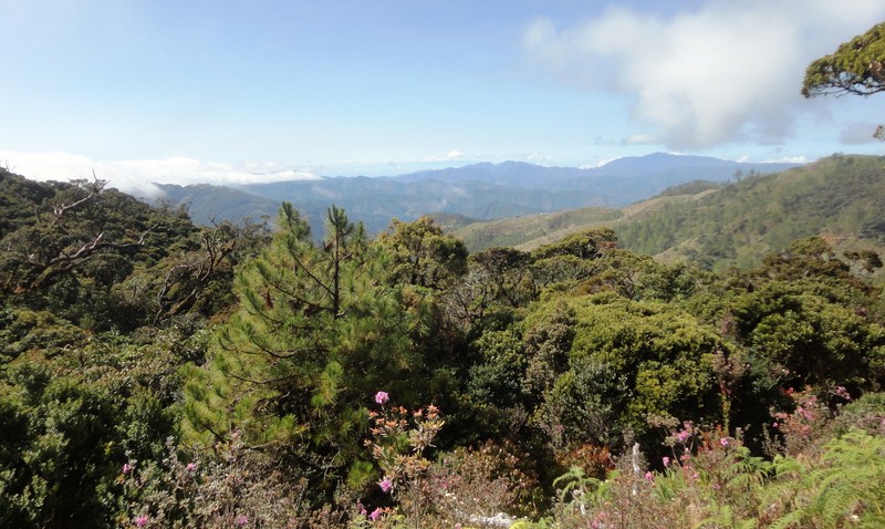
Mt. Pulag National Park
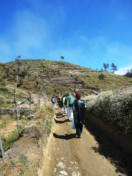
I booked my climb to Mt. Pulag, with my son Jandy, through good friend Violeta Imperial, Exec. Director of Nature Awareness and Conservation Club, Inc. All in all, we were 12 (our 13th member, Mr. Maki Las was to meet us in Baguio) in our group. There are four different trails going to the grassland summit of Mt. Pulag – the Bokod (also called Ambangeg) Trail, the 2 to 3-day Akiki (called the “Killer Trail,” it is the steepest) Trail, the leech (limatik)-infested Tawangan Trail and the Ambaguio (the longest) Trail in Nueva Vizcaya. and we were going to climb the mountain via the easy Bokod Trail (also called the “Executive Trail”) which is the safest and has the mildest grade.
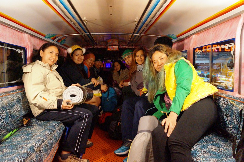
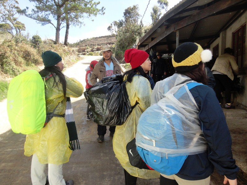
The ladies at our chartered passenger jeepney
Joining Violet, Jandy and I were Expedition Leader Mr. Rexbello “Rex” Alfafara (mobile numbers 0920-4651626 and 09327435252) of Sierra Adventurers and Mountain Explorers, Inc.; good friends Ms. Rayhil Palaganas (Financial Advisor – Sun Life Financial), Ms. Rosemarie S. Palmera and Ms. Marceju Aizza A. Ragat (JDE Finance Functional Consultant – Cyret Technologies, Inc.); Ms. Almira Ablan Tinonas (De La Salle University student/artist); Ms. Celeste Marie “Lelet” Garcia (HR Manager – Phoenix Petroleum); and Ms. Lorelie Mandela (Project Manager – Global Business World) with her children Celene and Arvin.
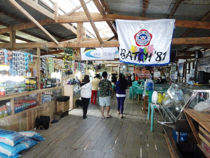
Country Road Cafe and Restaurant
We all assembled at the Victory Liner Terminal in Pasay City and left on the 9 PM bus for Baguio City, the jump-off point for our climb. After running the gauntlet of traffic along EDSA and 2 stopovers at Tarlac City and Sison (Pangasinan), we arrived at the city’s Victory Liner Bus Terminal by 3:45 AM. We then boarded a passenger jeepney chartered by Rex for our climb. Up ahead was a 2-hour/80 km. roller coaster drive, through the winding zigzags of the fabled Ambuklao Road, to Kabayan town. I shouldn’t have slept through part of the trip as I woke up sick on my stomach. We had our breakfast at Country Road Café and Restaurant but I didn’t eat much.
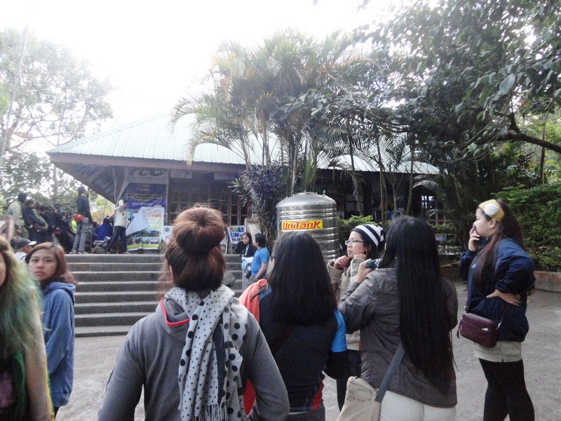
DENR Mt. Pulag Park Office
That done, we returned to our jeepney for the short drive to the DENR Mt. Pulag Park Office to register and secure a permit, both done by Violet, and be given a short briefing. Climbers are asked to register for orientation either here or at the Babadak ranger station at Bashoy village in Kabayan.
L-R: Almira, Rose, Rayhil, Marceju, Lorelie, Arvin, Celeste and Celene
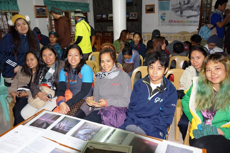
There were lots of would-be and real mountaineers waiting for orientation prior to their climb. We were on the second batch. During our orientation, DENR Superintendent Emerita Albas gave our group a short environmental briefing on the dos and don’ts, the harsh environment and the basics of mountaineering for trekking Mt. Pulag National Park. The orientation was necessary for the climbers’ safety and the park’s environmental protection. Here are some tips and park rules to follow when climbing Mt. Pulag:
- Garbage in, garbage out. Trash, whether organic or non-biodegradable should all be brought down and disposed of properly.
- No intimacy at the campsite.
- Stay on the established trails to minimize damage to vegetation and prevent further destruction of the mountain slopes. Walk single file in the middle of the trail, even when it is wet or muddy.
- Respect the serenity of the place by keeping noise to a minimum level. Wildlife such as birds may get scared and interrupted from their normal routine.
- Strong hikers, especially for big groups, should be designated to act as sweepers to take care of stragglers. In this way, weaker members are assured that they could get help from others should they be in trouble.
- All hikers must always be guided by the Mountaineer’s Creed – take nothing but pictures, leave nothing but footprints, kill nothing but time.
- On the way up, slower hikers must give way to stronger hikers. On the other hand, stronger hikers should not tailgate weaker hikers.
- If there are no trail signs at trail junctions, advance group members should make temporary directional signs (e.g. Sticks, scratch on the soil, etc.) for others to follow.
- It is always best to be on the side of caution especially when hiking along slippery trails. Light walking sticks, canes and trekking poles help a lot as it acts like another foot. Help, especially medical in nature, may take some time to reach anybody. In case of trouble or emergencies, attract help by making as much noise as possible by hollering or shouting.
- To avoid creating wildfires, smokers must properly put off their cigarettes as the pine forest floor is susceptible to fire, especially during summer months. Smoking in the grassland is highly discouraged. Bonfires at the campsite are also prohibited. For cooking and boiling water, bring a portable stove.
- Before hiking, fill up your canteens or water bottles (1.5 to 2 liters of water is recommended per person). At camp 1 and Camp 2, there are springs nearby and the water is potable. For people who have sensitive stomachs, the use of purifying tablets is advisable. If you are bringing bottled water with you on your hike, please keep the empty bottle and bring them back down and out the national park when you leave.
- The weather on the mountain is unpredictable and it could rain anytime. It is therefore advisable for hikers to bring with them rain gear (raincoat, poncho, etc.) and warm clothing (jackets, sweaters, scarves, bonnets, gloves, thermal underwear, socks, blankets, etc.) to ward off cold temperatures. But don’t wear your warm clothing yet on your hike to Camp 2 as your body will heat up from all the energy you burn. Waterproof your things. Bring a waterproof backpack cover, plastic bags or black garbage bags and a drybag for your camera.
- As your feet are the most important part of your body during a trek (once you injure them, you have no way of going back down, lest you are carried down), wear comfortable yet sturdy shoes with good traction (you will slide and stumble, at one point or another) underneath. Make sure the shoes you wear are broken-in and comfortable.
- For those bringing their tents, use a three or four-season tent that can withstand the cold wind and rain.
- Bring only what is necessary as loads get heavier for every kilometer traversed. The lesser the weight on your bag, the easier your trek will be.
-
Park officers reserve the right to randomly inspect baggage to determine whether banned items (liquor, dangerous drugs, deadly weapons, etc.) are present. Such items, when found, will be automatically confiscated and kept for safekeeping.
- Communicate with your expedition leader and/or designated/hired guide. He possesses knowledge of the area.
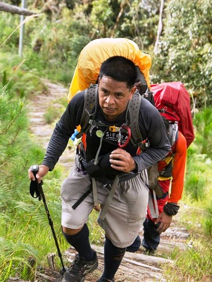
Expedition leader Rex Alfafara
- Respect the indigenous people’s (Ibaloi, Kalanguya, Kankana-ey and Ibanag) culture. Their culture may be different from yours but it is their culture. Most of them consider Mt. Pulag as a sacred place not only because it is a resting place and playground of their gods but also a place where they bury their dead. You are in their cultural ground.
- If climbers reach the Badabak ranger station at 5 PM, they are advised to spend the night there and not persist on hiking to the grassland area or camping area since the area, after 5 PM, is always misty and cloudy, making directional signs and trails not easily visible.
- Hiking is not a race. It should be fun and is free. Take time to regulate your breathing, look around and enjoy the scenery that nature offers.
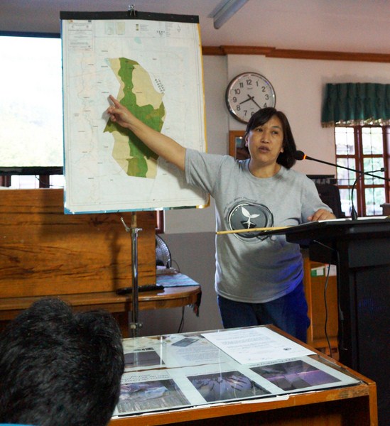
DENR Superintendent Emerita Albas
DENR-PASu Office: Sitio Ambangeg, Brgy. Daclan, Bokod, Benguet. Tel: (074) 444-3592. Mobile number (0919) 631-5402 (Ms. Albas).
Current park fee rates (the first two are remitted to the Integrated Protected Area Fund or IPAF while the third is remitted to the Kabayan local treasury for their use):
- Entrance fee: PhP100.00
- Camping fee: PhP50.00
- Green fee: PhP25.00
Aside from the fees, hikers are required to engage an accredited guide (member of MPITGA) with a ratio of 1-7 hikers to 1 guide. The pay is P500.00 per guide per overnight.
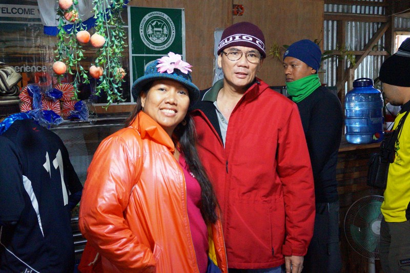
The author with tour organizer Violeta Imperial
Nature Awareness and Conservation Club, Inc.: 18 Pioneer St., Moonwalk Village, Las Pinas City, Metro Manila. Tel: (632) 806-1720. Mobile numbers: (0915) 510-1600 and (0932) 243-9478. E-mail: mother_nature888@nacci888.org.
Sierra Adventurers and Mountain Explorers, Inc.: E-mail: sierra.org.ph@gmail.com, Website: www.sierra.org.ph.