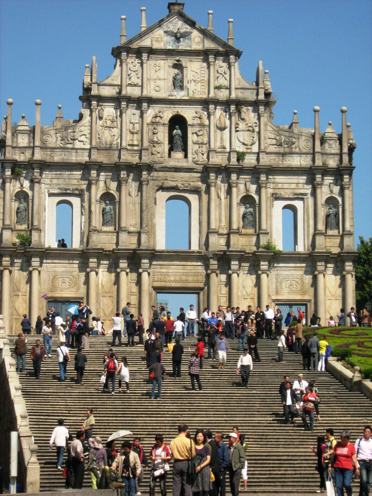
Exploring Baler’s Environs (Aurora)

Dimadilangat Island

After surfing lessons at Sabang Beach, we packed up our tent and belongings, loaded it at the Toyota Revo and decided to spend the rest of the afternoon doing some sightseeing.  First on our itinerary was the Ermita Park in Brgy. Zabal, the highest point in the town.  According to the locals, many of the town’s inhabitants sought refuge here when a tidal wave struck and completely engulfed Baler on December 1735.  Today, it has a huge white cross (which is lighted at night), picnic huts, a chapel and a mini-zoo.  To get to the cross, we had to climb over a hundred steps but the effort was well worth it as it has, from its concrete view deck, an excellent view of the town, the Sierra Madre Mountains, Cemento and Sabang Beaches, Lukso-Lukso rock formation and the offshore islands of Dimadilangat and Aniao. 

The cross at Ermita Hill

Having seen the the latter islands from Ermita Hill, we next drove down the hill to visit Dimadimalangat Island.  Located off the reef shore, it serves as a point identifying the southernmost tip of Baler Bay.  This rock formation is approachable during low tide and, during the calm months of April to June, the place becomes a haven for wall divers.   It is also a good dive and snorkeling site.

Aniao Islands

We next drove further south to the Aniao Islands, just off the coast of Brgy. Zabali.  These two small but imposing, shrub-covered islands are a habitat for kingfishers, gulls and even hawks and its peaks are a challenge for rock climbers.   Towering waves adamantly pound the island’s base. The islands are a 20-min. boat ride from Sabang.

Diguisit Falls

I wanted to continue on to the Radar/Weather Station at Cape Encanto and, beyond, to Dicasalarin Cove in neighboring San Luis town but boulders were blocking the already bad road so I decided to turn the Revo around and return to the town.  On our way back to the town proper, we also made a stopover at roadside Diguisit Falls (a.k.a. Natulo Falls).  Located 10 kms. from the town proper, it was said to be the first potable water source  for the people of Baler, made so through the efforts of Dona Aurora Quezon.  

Camping and Surfing at Sabang Beach (Baler, Aurora)

Cheska on her surfboard

Baler Tourism Coordinator Riza del Rosario sadly informed us that there wasn’t any accommodation available whatsoever for us, at least for this day.  I wasn’t surprised as it was the holidays and Baler was packed with tourists.  Anticipating this, I brought along my new Coleman 5-pax tent which I received last Christmas.  It measures 3 m. by 3 m. and has a 1.83 m. head clearance, convenient if you need to stand up while dressing.  From the town proper, I first drove to the Hanging Bridge at Brgy. Zabali where my 4 companions gamely crossed to the other side.  Motion sickness, caused by the swaying bridge, made me stop midway during my crossing and forced me to turn back.  After this adrenalin-filled crossing, we returned to the Revo and drove on to the gray sand Sabang Beach in Brgy. Sabang.  Most of the accommodations in Baler are located along this beach but, since all were fully booked, I just rented a picnic hut and pitched my tent on the grassy ground beside it.     

The gray sand Sabang Beach

Long before the movie Baler, the town was known as one of the country’s top 5 surfing areas. The waters of the Pacific formed strong, sharp break waves that provide an exhilarating high among experienced surfers. The best waves come in from October to March when the northeast monsoon blows down from China but surfing waves are present all year round, even during our visit.  Glassy right and left waves occur in the early mornings. They are not usually big, except during typhoons.   Thus, Sabang Beach is a good site for beginners and novice surfers.  Jandy and Cheska, as well as Lulu, all beginners, opted to take some surfing lessons (PhP350/pax for 1 hr.) while Vi, an avid photographer, just took pictures.  I stayed behind to watch the tent and our belongings. 

Fish catch being hauled in
Sabang Beach has three surfing sites: Cobra Reef, Charlie’s Point and Secret Spot.  Charlie’s Point, located north of Sabang Beach, within walking distance from the town proper, was where the surfing scene of Francis Ford Cuppola‘s 1979 Apocalypse Now was filmed.  It is known for its medium-quality, right and left breakwaves on sand and gravel bottom. The waves are best from December to January. Secret Spot is located at the mouth of the Cemento River. Further north of Sabang Beach is the newly discovered surfing spot called Lindy’s Point, a 15-min. hike from Bay’s Inn.

Church of San Luis Obispo de Tolosa (Baler, Aurora)

From the Baler Museum, we walked a short distance to the small but venerable San Luis Obispo de Tolosa Church, the site of the siege depicted in the movie.  Commonwealth Pres. and native son Manuel L. Quezon was also baptized here.  However, the present masonry church is nowhere near  the appearance of the wooden church depicted in the movie Baler which deteriorated later and was rebuilt in brick and stone in 1939.

Church of San Luis Obispo de Tolosa
The church was declared as a National Historical Landmark on February 29, 2000.  On the left side of the church is a marker, installed in 1931, to commemorate the capture of Lt.-Cmdr. James C. Gilmore and 16 American marines of the U.S. gunboat Yorktown who attempted to relieve the Spanish garrison.

Museo de Baler (Aurora)

Museo de Baler

We arrived in Baler by 3 PM, Holy Thursday, and we were met at the quaint, 2-storey Museo de Baler by Baler Tourism Coordinator Ms. Riza del Rosario who tried to secure accommodations for us (there weren’t any).   While waiting, we took time to explore the museum both  inside and out.   At the building’s facade is “The Baler Historical Mural” done by sculptor Toym Imao (son of National Artist Abdulmari Imao) and unveiled on June 30, 2008.  It depicts 400 years of Spanish rule in the Philippines, from their arrival until the Siege of Baler, plus images depicting progress and development in Baler and in other towns of Aurora.

Museum exhibits

Opened on June 30, 2003 (Philippine-Spanish Friendship Day), the museum exhibits historical records dating back to the Spanish period; splendid photographs covering the images of Baler and the rest of the province; centuries-old Chinese ceramics; memorabilia of Lt.-Gov. Pedro Guerrero; old bells of Baler Church; sabutan weaving products;  art works, costumes, etc. One notable exhibition is devoted to the life and career of Commonwealth Pres. Manuel L. Quezon, Baler’s foremost son (born here on August 19, 1878), while another highlights Aurora’s indigenous peoples, preserving Ilongot as well as Dumagat artifacts.  The museum’s wall is decorated with a mural commissioned by local son Sen. Edgardo Angara to remind the locals about the heroism of their ancestors.

Quezon Memorial Park

Standing beside the museum, at Quezon Memorial Park, is a replica of the bahay kubo where Pres. Quezon’s was born and grew up (Casa de Maestro Lucio Quezon) plus a Spanish-era cannon, mini-lagoon and a sitting bronze statue of Quezon, set on a circular platform, designed by Julie Lluch and installed in 2006.  Baler is also the birthplace of Quezon’s wife Doña Aurora Aragon Quezon (February 19, 1888), after whom the province was named.  As First Lady, she initiated the rebuilding of Baler’s old church.  marker for her is located a block away.

Millennium Tree (Maria Aurora, Aurora)

The Millennium Tree of Maria Aurora

The eerie and somewhat creepy Millennium Tree, a  massive, 49-m. high, 10-15 m. wide balete or weeping fig tree (scientific name: Ficus balete Merr.) amidst papaya plantations, is the star attraction in Maria Aurora town. Southeast Asia’s (others say in Asia) largest banyan tree, it has been carbon dated to be between 400 – 600 years old (not quite millennial) and is one of the oldest in the country,

Aerial roots

A cave-like opening among the roots

They say it takes 40 to 60 people to encircle the gigantic trunk. The incredible tree’s thick aerial roots have grown above the ground, forming “caves,” and one can also enter the hollow interior of the tree which was once another tree clung to and killed by the balete tree.  Its 60 m wide crown has survived numerous extreme typhoons. The trunk occupies around 190 sq. m..

The author with Cheska and Jandy

Millennium Tree: Balete Park, Brgy. Quirino, Maria Aurora, Aurora. Admission: PhP10/pax.

How to Get There: Balete Park is located 3.5 kms. from Maria Aurora. From Baler, hire a tricycle to get there (30-min. travel time).  Coordinates: 15.7698N 121.4770E.

Pangatian War Memorial (Cabanatuan City, Nueva Ecija)

Pangatian War Memorial

Pangatian War Memorial

Used as a military training camp for twenty years before World War II, the camp was converted into a concentration camp for U.S. and Filipino prisoners-of-war (POWs) captured at Bataan and Corregidor by the Japanese imperial forces. Nearly 2,000 Americans died of hunger and disease during the first two months of captivity.

The Soldier's Trust

The Soldier’s Trust

On January 30, 1945, the camp and its 516 inmates were bravely rescued and liberated, without much bloodshed, by Alamo Scouts and the US 6th Ranger Battalion under Lt.-Col. Henry Mucci, with the assistance of Filipino guerillas led by Captains Eduardo I. Joson (Squadron 213) and Juan Pajota (Squadron 201) who effectively prevented the Japanese reinforcements from proceeding to the camp. This rescue was described as one of the most daring and successful missions of its type in the annals of US military history.

Dirt road lined with cypress trees

Dirt road lined with cypress trees

That event, now immortalized in marble in the elevated, circular Pangatian War Memorial (started in 1982 and inaugurated on May 4, 1985), also contains monuments and memorabilia of the events that transpired during the occupation. A long dirt road, between rows of cypress trees, leads to the memorial. The focal point is a huge marble niche with
simply the name “Cabanatuan” engraved on it.

Marble niche with Cabanatuan engraved on it

Marble niche with the word “Cabanatuan” engraved on it

The roof deck has a large mural of Filipino and American soldiers carrying each other, arm-in-arm,  in battle. The concrete foundations of a water tank, at the back of the memorial, is the only structure that remains of the original Pangatian Concentration Camp.

Memorial wall on the left

Memorial wall on the left

Two long memorial walls, at the far end of the compound, are inscribed with the names and ranks of the American servicemen imprisoned in the camp (some of them West Pointers). Atop a circular platform are two identical markers, one in English and  the other in Filipino, from the National Historical Institute.

Memorial wall on the right

Memorial wall on the right

The shrine, one of the few places in the country where the American flag flies side-by-side with the Filipino flag, is maintained and managed by the American Battle Sites and Monument Commission.  The Pangatian Heroes Hall, a second memorial inaugurated on April 6, 2003 on a piece of land adjacent to the U.S.-maintained memorial, is owned and maintained by the Nueva Ecija provincial government. Sitting in the middle of a lush mango orchard, it pays tribute to the Filipino guerrillas who participated in that momentous rescueCamp Pangatian (11)

The rescue was made into a movie in 2005 called The Great Raid starring Benjamin Bratt, Joseph Fiennes, James Franco and local actor Cesar Montano as guerilla Capt. Juan Pajota.  However, unlike the film Baler, this was filmed, not in the actual site (nor in the country for that matter), but in Queensland, Australia.

Camp Pangatian: Cabanatuan-Palayan Rd., Brgy. Pangatian, Cabanatuan City, Nueva Ecija.

How to Get There: Camp Pangatian is located 8 kms. from Cabanatuan City.

On the Road to Baler

Canili-Diayo Dam (Alfonso Castaneda)

Baler, the provincial capital and center for trade and industry of Aurora province, recently hit it big when its namesake movie Baler won Best Picture and a host of other awards in last year’s Metro Manila Filmfest, its plot based on the 337-day (June 27, 1898-June 2, 1899) siege of its Spanish garrison by Filipino rebels.  When it finally surrendered (the last to do so in the country), Gen. Emilio Aguinaldo, in admiration, declared, on June 30 (now Philippine-Spanish Friendship Day), that the remaining 33 Spanish soldiers were not be imprisoned but honored as friends.  Me and my family watched it and, being actually filmed on location, I was also impressed by its rugged scenery and decided to visit it, doing so on Holy Week.  Joining me were my two kids, Jandy and Cheska, plus lady friends Ms. Lourdes “Lulu” Siguenza and Ms. Rosevie “Vi” Sevilla, an avid photographer.

As we left Manila late afternoon of April 8, Wednesday.  Traffic was relatively light considering it was the eve of the Holy Week break but, once out at the North Luzon Expressway (NLEX), I took the wrong exit and was, instead, on our way to Zambales before I realized my mistake and backtracked, losing valuable time (not to mention the gasoline) in the process.  Dinner was at a Chowking outlet at a rest station along NLEX.  Late evening caught us in San Leonardo, Nueva Ecija, and tired from all these misadventures, decided to call it a night, pulling into a roadside drive-in motel.  I was speechless when Cheska inquired as to the strange furniture as well as the bathroom with the see-through glass in our room.

Camp Pangatian

Come morning, we continued on our way and made a short stopover, along the Cabanatuan-Palayan Rd., at Camp Pangatian, 8 kms. from Cabanatuan City.

Check out “Pangatian War Memorial

Provincial Capitol (Palayan City)

There are 2 routes to Baler – the Baler-Bongabon (Nueva Ecija) Road and the longer Pantabangan-Canili Road. As the former was impassable during the rainy season, we opted for the latter.  Just the same, at least 20 kms. of the trip was along gravel roads at Alfonso Castaneda (Nueva Vizcaya), the last town before entering Aurora province.  Here, we made photo op stopovers at Pantabangan Lake (a man-made lake resulting from the construction of the Pantabangan Dam) and its tributary, the Canili-Diayo Dam and Reservoir, probably the most picturesque irrigation dam in the country.

Check out “Canili-Diayo Dam and Reservoir


Millennium Tree

We entered Aurora province at Maria Aurora town (the province’s biggest).  Here, we made another stopover at  Balete Park and its star attraction – the Millennium Tree, a  massive, 49-m. high, 10-15 m. wide balete tree.

Check out “Millennium Tree

Light and Sound Museum (Manila)

Light and Sound Museum
One of my son Jandy’s subjects in Asia Pacific College was “Rizal Life and Works” and one of the subject’s requirements was a scheduled visit, with his classmates, to the Light and Sound Museum in Intramuros.  I decide to accompany him there. This 2-storey, 1,800-sq. m. museum used to be the Beateria de San Ignacio, the first nunnery established in the Philippines.
Execution of Gomburza
Inaugurated last 30 November 2002, this museum, a tourism project of Sen. Richard Gordon, chronicles the Filipino’s pursuit for freedom under the leadership of National Hero Dr. JoseRizal, and other revolutionary leaders such as Cebuano warrior Lapu-Lapu, RajahSoliman and Andres Bonifacio. It features, in dramatic, historical tableaux, up to 140 moving mannequins dressed in life-like costumes, its overall presentation showing the Filipinos’ resiliency, intelligence and self-worth throughout its history.  
Rizal in Europe
Characters in Rizal’s novels
The sets and other effects took us through a 45-min. tour, with voice-over script, of Philippine history: from prehistoric times, the arrival of the Spaniards and Christianity, the shaping of Filipino culture under the friars and the brewing revolutionary movement, up to Rizal’s execution in 1896.
Jandy at Printing Press of La Solidaridad
Rizal writing his novel Noli me Tangere
Rizal in Dapitan
The entire ground floor focuses to the Spanish annexation of the Philippines as a province. The second floor recounts Dr Jose Rizal’s saga and describes his prolific days as a student at the Ateneo Municipal de Manila as well as his trip to Europe where his burning desire for Filipinos to be treated fairly by the colonizers was ignited. It also features his two books Noli Me Tangere and El Filibusterismo which exposed the ills of the Spanish society.
Trial of Rizal
Rizal visited by his mother
Rizal walking to his execution
There was also a huge room tracing Rizal’s martyrdom. The room replicates the scenario at Bagumbayan where Rizal tried to face the executioners to prove his innocence.  Another area shows details of Filipino uprisings steered by Andres Bonifacio. Bonifacio and his followers tear up their cedulas or residence certificates, a symbol of Spanish dominance during that time. 
Execution of Rizal
In addition, there is the Bagumbayan exhibit with its symbolically collapsed walls depicting a prelude to something new for Filipinos.  Towards the end of our tour, we all walked along a dim corridor leading through the exit made of heavy wooden doors facing the set up of the new Intramuros overlooking the well-lighted city golf course in the perimeter of the walls. 
Death of Rizal
Light and Sound Museum: Sta. Lucia cor. Victoria St. (near Baluartillo de San Diego), Intramuros, Manila.  Admission: PhP100 per person for a group of ten. First show starts at 10 AM and last show starts at 6 PM.  Tel: (632) 524-2827.  Fax: (632) 524-0823.

Central United Methodist Church (Manila)

The beautiful Central United Methodist Church (CUMC), the first Protestant church in the Philippines, was founded on March 5, 1899 during the American Occupation and originally named the Central Methodist Episcopal Church.  The church’s history is closely intertwined with that of Knox United Methodist Church.  Both churches were the result of Filipino-American ties during the surrender of Manila in 1898.

Central United Methodist Church (CUMC)

On August 28, 1898, the first Protestant worship service in the Philippines, officiated by Rev. George C. Stull, was attended by both American soldiers and Filipino civilians.  During the Philippine–American War, the congregation separated itself from Knox United Methodist Church, the American component, who transferred its services to the YMCA and was organized in 1899.

The massive pointed, Gothic-style arch of the facade

On December 23, 1901, its first chapel of the CUMC was completed but, in November 1906, it was replaced by a structure, designed by C.B. Ripley, made of stone. In 1916, the church was renamed as the Central Student Church and, in 1932, the present structure, the third church on site, was designed by Juan Marcos Arellano using Gothic Revival architecture,  was completed and inaugurated on June 19, 1932.  That same year, it was elevated to a cathedral.  Among Methodists the church is known as  the “cathedral.”

National Historical Institute (NHI) plaque installed in 1985 (Tagalog)

During the Liberation of Manila in 1945, fighting between the combined Filipino and American troops and the Japanese Imperial forces severely damaged the CUMC and rendered it unusable. Its congregation was again reunited with Knox United Methodist Church until 1949, when the CUMC was rebuilt, following its original Arellano design, in its original site along San Luis Street (now T.M. Kalaw Street). The rebuilt church was inaugurated on December 25, 1949.  In 1985, a historical marker was installed by the National Historical Institute.

Since then, membership of CUMC has shifted rapidly, from predominantly American to a mixed Filipino and American demographic. Former Chief JusticeJosé Abad Santos and Dr. Jorge Bocobo (former Justice of the Supreme Court of the Philippines, 1942-44) used to congregate here.

Central United Methodist Church: 694 Kalaw Ave.cor. Taft Ave., Brgy. 666, ErmitaManila, 1000 Metro Manila. Tel:  (02) 8525 7329.  Fax: (02) 8525-7590. E-mail: info@cumc-manila.org.  Website: www.cumc-manila.org.   Sunday church services here are held in Tagalog (8 AM), Ilocano (9:20 AM) and English (10:40 AM). Vesper at 5:30 PM. Coordinates: 14.582662°N 120.983586°E.

How to Get There: Take the LRT to United Nations Avenue Station.  The church is across from Plaza Olivia Salamanca.

A Historical Tour of Clark (Pampanga)

After watching the early morning flight of Clark’s famous hot air balloons, Jandy and I returned to our Toyota Revo and made our way out of Clark as we still wanted to explore nearby Angeles City.  Along the way we made brief stopovers at some of Clark’s historical sights.  Our first stopover was at the old parade grounds.

Fort Stotsenberg Gate Posts

The Fort Stotsenberg Gate Posts once stood at the Dau Gate, the first gateway to Fort Stotsenberg , from the early 1900s until the Japanese Occupation in 1942 when they were removed and buried as landfill.  Unearthed intact in 1965,  these posts were moved to the American Legion Post (near the Personnel Office and not far from the Clark Gym) and finally relocated to the south side of the entrance of the parade grounds in 1984.

Clark Museum

Near the old parade grounds, on the original site of the 217-bed base hospital (dating to September 1903) and the Base Commander’s office, is the Clark Museum, also called the Kapampangan Museum.


Check out “Clark Museum

Death March Marker

At the entrance of the Clark Veterans Cemetery, along the main entrance road, just past the main gate, is the Death March Marker.  This memorial marker was erected by the Manila BPO Elks lodge in honor of fellow Elks, American and Filipino POWs, who passed this spot during the infamous Bataan Death March in 1942.

Clark Veterans Cemetery

Just inside the Main Gate, along the Mitchell Highway, is the 20.365-acre, 12,000 plot Calrk Veterans Cemetery, formed between 1947 and 1950 to house 7,559 military and civilian remains.  There are headstones/markers and remains from at least 4 other U.S. military cemeteries (Fort Stotsenberg 1 and 2, Fort McKinley and Sangley Point Naval Cemetery).  These include 2,030 fallen American soldiers, including at least 638 Philippine Scouts (PS) from the pre-World War II era.  Some, but not all, were veterans of the Spanish-American war and the Philippine-American War.

Graves of the unknown dead

Others are graves of U.S. veterans from the U.S. Army, U.S. Navy, U.S. Marine Corps, U.S. Coast Guard and U.S. Air Force who died after World War II (all World War II dead were moved to the American Cemetery in Manila) and during the Korean and Vietnam War.  The largest category interred is civilian, mostly U.S. and Filipino, all of whom worked for the U.S. government, and their dependents.  In addition, nationals from France, Spain, Canada, Japan, China, Vietnam and India are also buried there.  A little over 1,600 remains are still unidentified.  The cemetery is also the only place in the former U.S. 13th Air Force base where the U.S. flag flutters alongside the Philippine flag.

Salakot Arch

Finally, at the main gate entrance to the Clark Freeport Zone, at Bayanihan Park, is the Salakot Arch, a cavernous welcome landmark fashioned after a farmer’s hat built in 1979.  It stands as a sign of Philippine-American friendship over the years and was originally built to symbolize the historical March 14, 1947 signing of the RP-US Military Bases Agreement.  Beyond the arch is Angeles City.