
Fort San Antonio Abad
Relatively unknown to many, Manila has another Spanish-era fort, aside from the well-known Fort Santiago, located south of Intramuros and this one is not easy to visit as it is located within the confines of the high-security Bangko Sentral ng Pilipinas (BSP) Complex – the 1.2-hectare, trapezoid-shaped and equally historic but hidden Fort San Antonio Abad.
Exploring the fort with our guides
Considering its current location, tightly sandwiched between the imposing main tower of the BSP and the old Manila Metropolitan Museum Building (now transferred to its new home at Bonifacio Global City in Taguig City), the fort is understandably overlooked these days.
Check out “Metropolitan Museum of Manila”
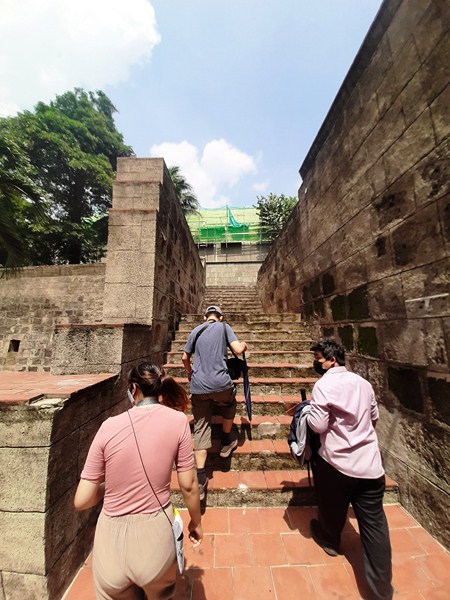
Stairs leading up to the ramparts
Visits to the fort are by appointment and my son Jandy and I had to arrange our visit in advance via email. It was only upon approval of our request that we were allowed to proceed to the Bangko Sentral ng Pilipinas Complex. Upon registering ourselves, we met up with our guides, Ms. Regyn Avena and Mr. Lauro E. de los Santos, Jr. who were to tour us around the fort.
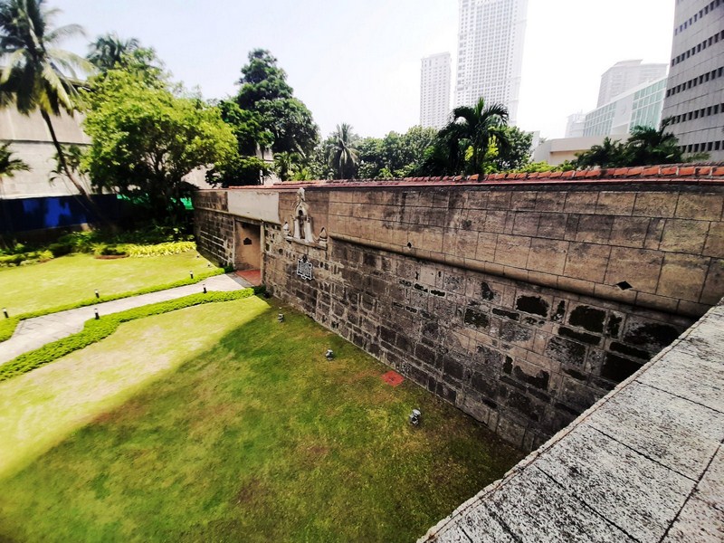
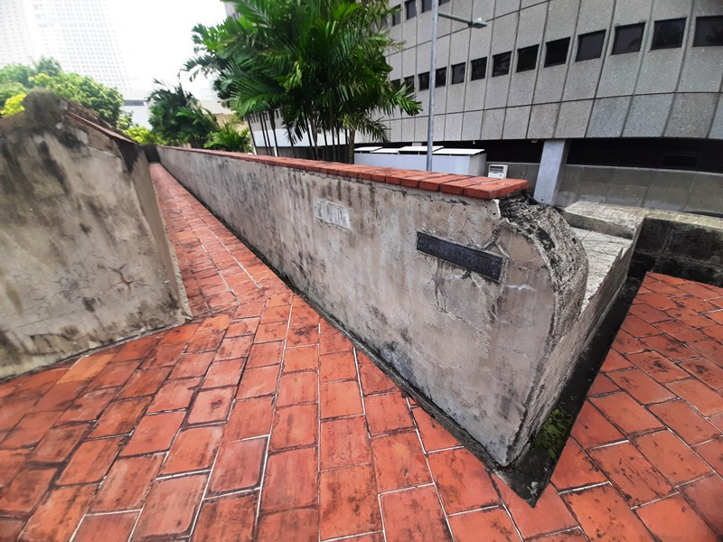
The view of the South Wall from the East Bastion
Also known as Fort Malate or Fort San Antonio, this fortification was completed in 1584 and named in honor of its patron saint, Saint Anthony the Abbot (feast day: January 17). Like the walled city, the fort evolved into a variety of stone fortress popularized by renowned French military architect Sebastien Le Prestre de Vauban, with two signature bastions at the corners of the canted walls.
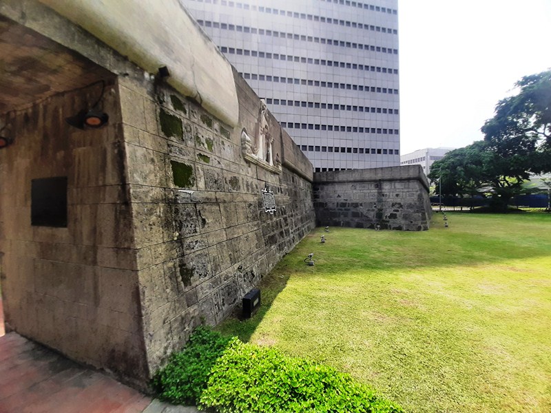
The canted South Wall
Though relatively small in size, it certainly occupies a significant place in the history of Manila as it played a role in three great conflicts – the Seven Years’ War,e vents prior and during the Philippine–American War and World War II. Located in what was then a separate hamlet of Malate, the fort served as a rear protection for the Manila as well as to guard the Manila–Cavite route.
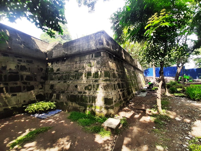
The West Bastion at the North Wall
The Spanish used the fort as a polvorista (“little fortress” or gunpowder magazine to safely store gunpowder) known as Fuerte de Polverina. On September 26, 1762, during the Seven Years’ War, it was captured by British forces under Rear-Admiral Samuel Cornish and Brigadier-General William Draper when they invaded Manila. They transformed the fort into a garrison, setting up an artillery battery. From here, the British forces launched their land offensive against the Spaniards defending Intramuros.
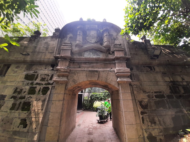
The exquisitely designed North Entrance
On March 26, 1764, upon the end of the British occupation of Manila, the fort was returned to Spanish control and rebuilt, again becoming a gunpowder storage facility. On August 13, 1898, after bombardment by U.S. warships during the sham Battle of Manila, the fort was captured and the first American flag hoisted by the First Battalion of the First Colorado Volunteer Regiment under the command of Lt.-Col. Henry Bayard McCoy.
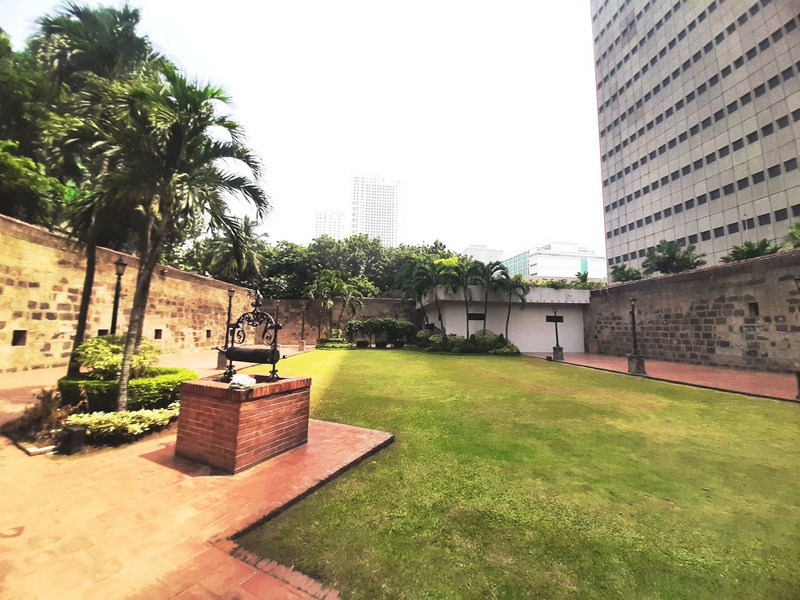
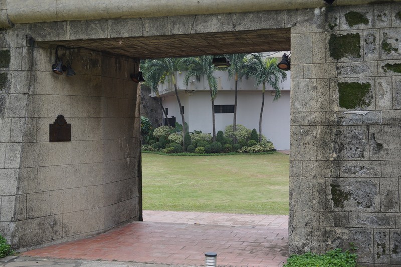
The grassy courtyard. On the left are the square embrasures
Also, during the Philippine–American War, U.S. military authorities used the prison to carry out multiple executions by hanging. Harry Cline, an American civilian under the employment of the United States Army, was the first American to be executed by U.S. authorities after he shot, with a revolver, four small Filipino boys from Parañaque gathering grass, wounding three and killing the fourth (Agaton Rivera) on April 8, 1901. Cline was tried by an American military court, found guilty of murder and three counts of assault with intent to kill, and sentenced to death by hanging which was carried out on September 20, 1901.
The fort ramparts
During World War II, Fort San Antonio Abad was seized by occupying Japanese troops and it was used as a bunker, with a cannon installed. During the Liberation of Manila, the fort suffered considerable damage. After World War II, the very young Offshore Patrol, with the Manila Naval Station (MNS) as its main support unit, set up its headquarters at the fort. They vacated the place in 1965.
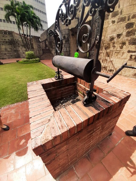
The now unused well with windlass
On June 1974, coinciding with the establishment of the new main office complex of the BSP, the restoration of the fort was again started (the first restoration was at the beginning of the 19th century) by Architect Carlos E. Da Silva, during the term of former Bangko Sentral ng Pilipinas Gov. Gregorio S. Licaros, and completed in 1976.
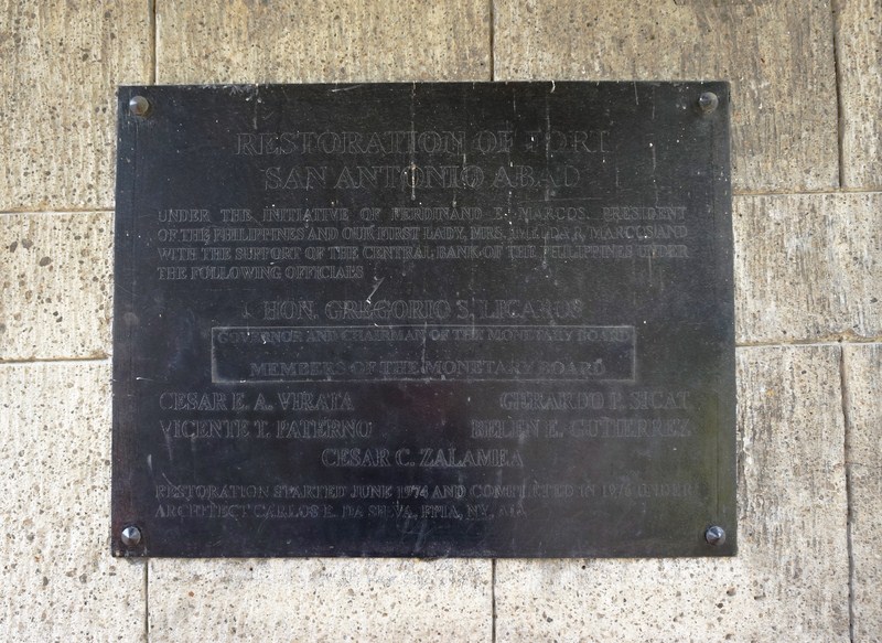
1976 Restoration Plaque
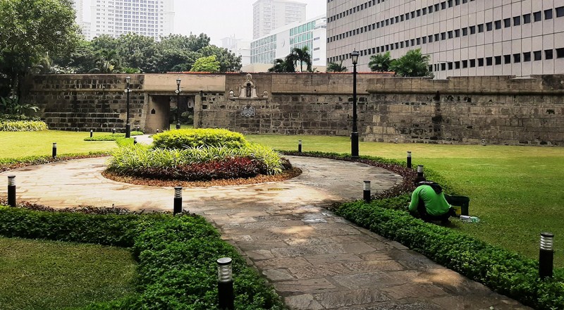
This battle-weary and proud structure is now a beautiful little park and events place with paved walkways and street lamps. Where guards once stood, there are now roaming gardeners keeping the manicured garden trim. Within the garden is a now unused well with a windlass for raising water.
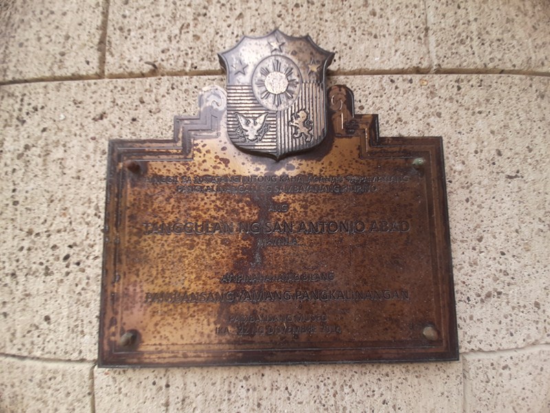
National Historical Treasure plaque
In 2018, together with Intramuros (collectively known as the “Fortifications of Manila”), the fort was named a National Cultural Treasure (NCT), for their architectural, historical, scientific and archaeological significance, by the National Museum of the Philippines. Both forts were essential parts of the defense of Spanish Colonial Manila and scientifically important in terms of military and structural engineering. The NCT marker is now installed there and in Plaza Roma in Intramuros.
The unadorned south entrance. In my opinion, this entrance seems like a recent addition as there as its walls show no signs of weathering
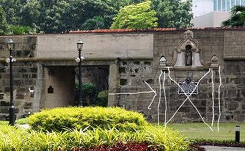
At the fort’s south entrance, two historical plaques (the 1976 renovation plaque and the NCT plaque) are mounted. A Historical Research and Markers Committee (now the National Historical Commission of the Philippines) marker, installed in 1937, is mounted on the wall to the right of this entrance, is topped by a semicircular arch niche, flanked by Doric columns, with an antique wooden statue of St. Anthony Abbot within.
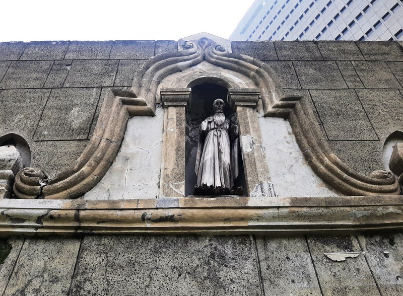
Niche with statue of St. Anthony Abbot
In turn, the niche is framed by a decorative moldings ending in scrolls. The original segmental arched main entrance of the fort, with its quaint iron gate, faces north. This latter entrance is decorated with a bas-relief of the traditional Spanish coat of arms of Leon (the lion) and Castille (the castle) and topped by finials.
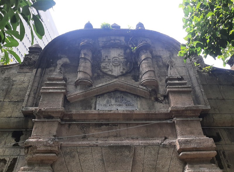
Bas-relief bearing the Spanish coat of arms at the North Entrance
The fort can be quickly explored in less than half an hour. At the lower level of the fort are a series of square embrasures, openings in fort’s walls where cannons can be fired. These openings, flared outward to enlarge their field of fire, once faced the sea but are now facing the back of the museum.
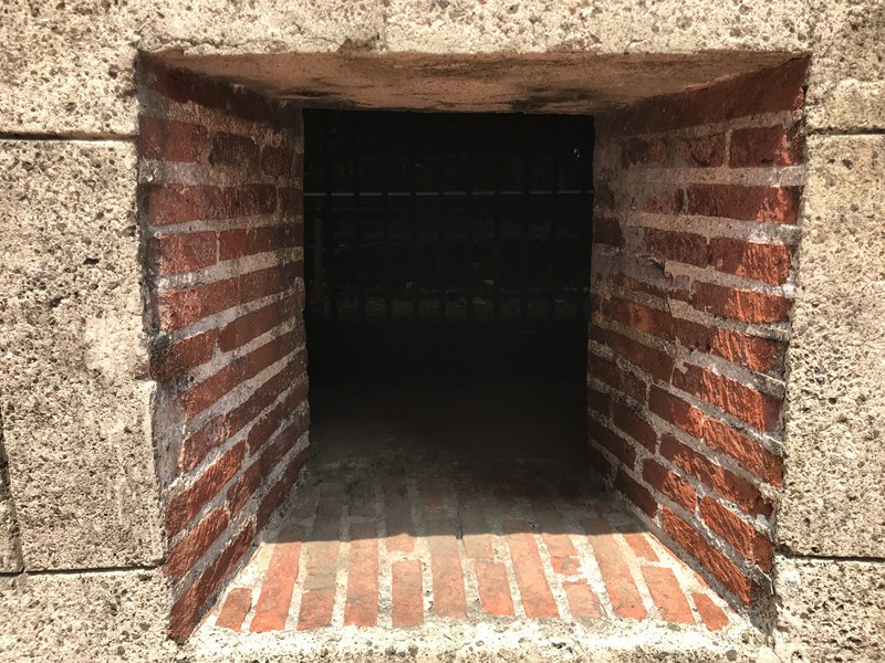
One of the fort’s embrasures
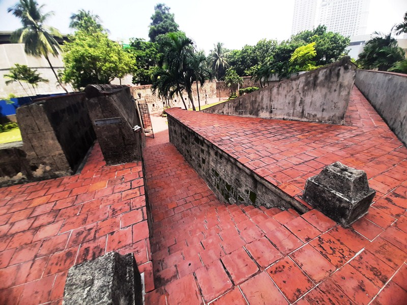
You can walk around the entire wall perimeter via very narrow, 2-foot wide ramparts which can be reached via stone steps. Standing on either side of the fort, on arrowhead-shaped bulwarks (East and West), are two large, sea-facing naval guns which were damaged when the American Air Force bombed the fort during the 1945 Liberation of Manila in World War II.
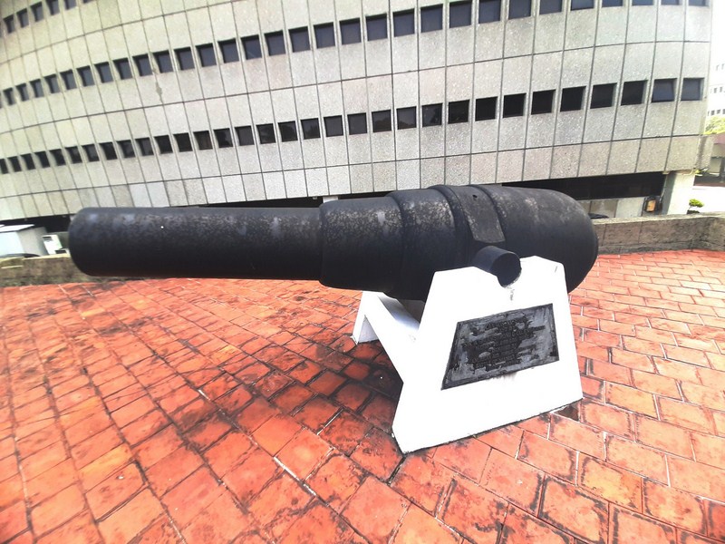
William Armstrong gun at the East Bastion
Cast by Sir William Armstrong & Co. (England), these two 19th century, rifled breech-loading guns, weighing 20,238 and 20,220 pounds respectively, had a bore of 8 inches. The original gun carriages are now gone (probably destroyed during the bombing or have rotted away) and have been replaced by concrete supports.
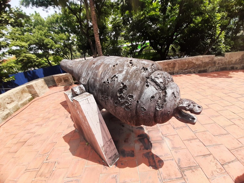
Pockmarked William Armstrong gun at West Bastion
AUTHOR’S COMMENTS:
After our visit to the fort, I can’t help but notice the differences between the plain looking south entrance and the exuberantly decorated north entrance. Plus, I also can’t help but notice the seemingly misplaced bas-re;ief, with its statued niche, to the right of the south entrance. This has got me thinking.
Could the south entrance have been originally located just below this bas-relief? It would make sense as statues of saints in niches or in bas-reliefs are usually placed above the entrances of churches and forts (even Fort Santiago has a bas relief of St. James the Moor Slayer, its patron saint, above its main entrance) to watch over those who enter. Probably the lower and narrower entrance (suitable for wagons), with its pilasters, must have been walled up and a new, simple but higher and wider square opening was created, during the American era, a few meters beside it, possibly to allow tall and wide-bodied vehicles such as trucks to pass through. I wonder ……..
For me, this makes sense…..
Fort San Antonio Abad: Banko Sentral ng Pilipinas Complex, Malate, Manila 1004. E-mail corporateaffairs@bsp.gov.ph (to arrange for a visit).