Halfway Up Mt. Makulot (Cuenca, Batangas)

Mt. Makulot

Jandy and I checked out of Casa Punzalan in Taal early in the morning and proceed to Cuenca, passing by the towns of Sta. Teresita and Alitagtag.   We planned to climb the 1,145 m. high Mt. Makulot, the highest mountain in Batangas.  The weather was perfect.  Mt. Makulot (also called Macolod), located at the northeast boundary with Laguna, is said to have been named after the kinky-haired people who lived on the mountain.  The mountain dominates the southeastern shore of Taal Lake and has a rounded, densely-forested  main summit and an extended shoulder on the west flank which ends abruptly in a 700-m. rocky drop-off.  The mountain  is thought to be the highest part of the caldera rim that was not blown away in Taal’s ancient eruptions.  Others say the mountain is part of another extinct volcano.  It was the last Japanese stronghold in the province during World War II, and 5 Japanese-built tunnels still exist in the area.  To preserve the mountain for future generations, the mountain was adopted by the Philippine Air Force, under then commanding Gen. William Hotchkiss, on February 21, 1998.
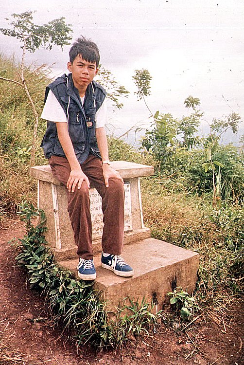
The Philippine Air Force Marker

Upon entering Cuenca town, we stopped at the town hall where we were advised, as a safety measure, to register (PhP5 per person)  at the Barangay 7 hall.  After registration, we were given a quick lecture lecture on how to get to the campsite.   I parked our Nissan Sentra at the Mountaineer’s Stop-over Store.  At the last minute, I decided not to bring my camping equipment and to just go on a day hike up to the mountain’s shoulder.  I wanted to go home early.  We donned jackets, changed into rubber shoes and packed 5 bottles of mineral water, my camera, extra shirts, my cell phone and a first aid kit.
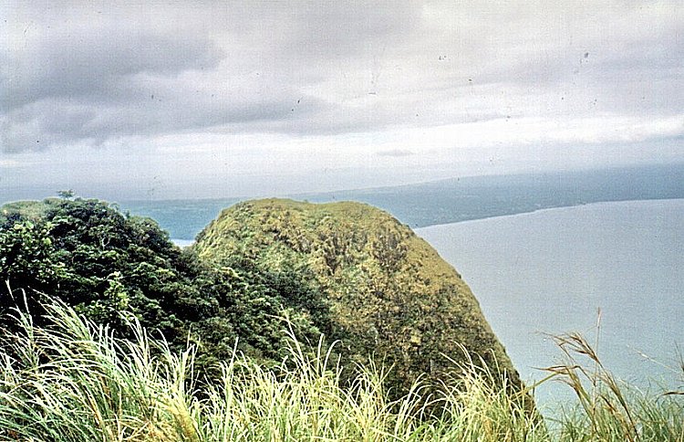
The Rockies

The initial trail is a fairly gentle, moderate grade section through a gravel path.  After passing some residential houses, including an expensive-looking one, and entering a forest, we reached a fork along the trail.  Remembering the lecture, we took the left trail (the one descending), and went past a dried rivulet and another fork. We asked around and were told to take the right trail.  We were also told that the left trail leads to a staircase down a cliff to the lake shore.  Surely for the more adventurous.  The trail became steeper (and more lung-busting) as we entered the forest.   We needed both hands to hold on to roots and branches of trees.  Rest stops became more frequent.  All the while, hikers, as well as local residents, were passing me by.  I was shamed by the sight of a woman carrying a heavy load of long bamboo stems.  As we went along, I befriended a man laden with two backpacks and an icebox full of soft drinks, all slung on a pick.  Named Eduardo Puso, he was a Barangay 7 tanod on his way to bring supplies for his store on top of the mountain.  His two sons, Eduardo Jr. and Ramon, also carrying provisions, passed me by a while earlier.

The knife’s edge leading to the Rockies

The last quarter of the hike was through an even narrower path through tall cogon grass which swayed in rhythmic, wave-like motions when the wind blew. At around 11:30 AM, we reached the campsite at the mountain’s shoulder.  Mang Ed and his sons were already tending to their store, which is beside another store tended by a woman.  Even on this mountain, the spirit of healthy competition lives on.   The campsite, Makulot’s main attraction, is actually a small clearing on the cogon-covered shoulder.  We explored a small trail through the cogon grass leading to a clearing with a marker installed by the PAF. 
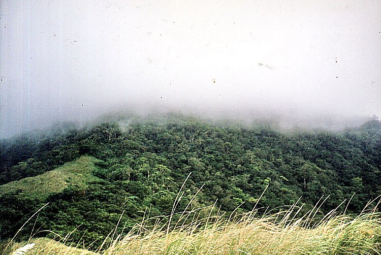
The fog-covered peak

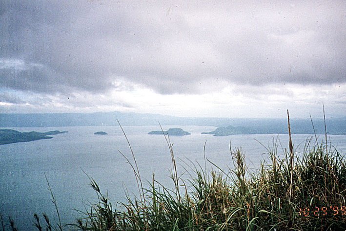
Here, we were presented with an impressive view, the best I’ve seen so far, of Taal Lake, Lipa Point, Volcano Island, the surrounding towns and beyond it, Laguna de Bay and the sea. Over a knife’s edge is the 700-m. drop-off (500 m. of which are almost vertical).  Locals call it the “Rockies” after its American namesake.   We returned to Mang Ed’s store and I interviewed him about the mountain.  He said that Makulot has 14 Stations of the Cross frequented by townsfolk during Holy Week.  Trekkers and campers come here even in adverse weather conditions and peak days are Fridays to Sundays when up to 200 campers converge.  

View of Volcano Island

Mang Ed opens his store only during those peak days.  Set up with money borrowed from a “five-six” loan shark, the store offers cigarettes, bread, candies, soft drinks in cans, real buko juice and, only on request, cooked food.  When provisions run low, he quickly sends his sons down the mountain for supplies.  Prices are high, but understandably so considering the labor involved. Mang Ed, being an elected barangay tanod, sees to it that the campsite remains clean. He frowns on campers who leave their rubbish behind.  Just the same, he and his sons gather the trash and carefully burn it.  They also assist in bringing down badly injured campers on a stretcher and advises climbers not to go beyond the Rockies. In 1994, a woman fell to her death (some say it was a suicide).  In 1997, another man fell but survived.  He was evacuated by helicopter.
Eduardo Jr. guided me 100 m. down the mountain to a bukal (spring) where potable water can be had.  As can seen from discarded shampoo sachets, campers frequently bathe here. Also in the area are four bat-and-bird-inhabited tunnels built by the Japanese close to one another during the war. Birds panicked and flew away as we entered one guano-filled tunnel.  It is said that campers caught by storms seek refuge here.  The fifth and longest tunnel is located a distance away.  A Japanese expedition had tried to enter it but retreated. And it remains unexplored to this day.

Upon our return, Mang Ed invited me to a late lunch, and we feasted, kamayan-style, on tuyo, fried egg and rice, washed down by mountain spring water.  We left the campsite at around 2:30 PM.  The descent was faster and less tiring, but slippery and harder on the joints.  Along the way we passed and conversed with two groups of backpackers on the way up.  Peak season has just began.  We reached the Mountaineer’s store at around 4 PM, snacked on crackers and soft drinks, changed our clothes and left for Manila, passing by Lipa City and the towns of Malvar, Tanauan, Sto. Tomas and Calamba City before entering the South Luzon Expressway.  We were home by 8:30 PM. 

Underground Cemetery (Nagcarlan, Laguna)

Underground Cemetery

Jandy and I left San Pablo City early in the afternoon of Easter Sunday.  It was just a short 14-km. drive from the city to Nagcarlan, passing by the tuba and lambanog-producing town of Rizal (formerly a barrio of Nagcarlan called Pauli).  Along the way, you can’t help but notice bamboo scaffolding linking coconut trees used by tuba gatherers.  Nagcarlan is Laguna’s vegetable garden and is the  biggest supplier of sweet lanzones (harvested  September to November) to Manila.  

Legend has it that the town’s name was a corruption of the name of Ana Kalang, a rich and generous benefactress much love by the townspeople.  Her name was eventually corrupted by speech to the more mellifluous Nanang Clara and Nang Clara before it became Nagcarlan.  In time, the town bore that name.   

Our first stop, before reaching the poblacion, was the Underground Cemetery, the first and only one of its kind in the country.  We parked our car at the service station opposite it. From this vantage point, I couldn’t help but admire its restored scrollwork-decorated octagonal red brick walls and  elaborate wrought iron gates.  Upon entering, we were ushered into an  enclosed circular garden surrounded by 240 above-ground crypts similar to Manila’s Paco Cemetery.  At the opposite end of the red tiled walkway is a dome-like chapel atop a hillock.  Quite spooky.

Entrance to Underground Cemetery

The first thing we saw upon entering the chapel is the Sto. Entierro, the glass bier of the dead Christ, at this time enshrouded.  The planked ceiling was water-damaged and in dire need of repair.  We were welcomed by the caretaker who narrated the history of the place.

An exclusive burial ground for Spanish friars, the cemetery was built in 1845 by Franciscan Fr. Vicente Velloc (or “Belloc” as spelled by some artifacts or documents). The crypt was a secret meeting place of Katipuneros in the 1890s and the historic Pact of Biak-na-Bato was first planned here by Pedro Paterno and Gen. Severino Taino in 1897.

In 1898, Emilio Jacinto, the “Brains of the Katipunan,” was captured here after being wounded in an encounter in Mahabang-Tanaw in Majayjay.  The Underground Cemetery was made into a National Shrine on August 1, 1973 by virtue of Presidential Decree No. 260 and again by Exec. Order No. 1505 on June 11, 1978. 

Still in use until 1981, the chapel was built in a strange arabesque style and has blue and  white tiles.  We went down the  stairs leading down to the underground crypt which contain tombs and burial plaques. I was, however, not allowed to take pictures or videos.   According to the caretaker, Fr. Velloc  also  built an  underground passage leading to 5 underground chapels where he was said to have held solitary masses.  Very spooky indeed.  It is also said to have continued all the way to Mt. Banahaw. The passage was then sealed off and its location now unknown.  Our visit ended, we signed the customary guest book and left.

Nagcarlan Underground Cemetery: open Tuesdays to Sundays. Admission is free.  Donations are needed and welcomed.

A Day Tour of Batad Rice Terraces (Banaue, Ifugao)

Batad Rice Terraces

A stay in Banaue is never complete without visiting the Batad Rice Terraces.  Seeing it is a “must” but getting there is no picnic as I was soon to find out.  The next day, April 12, Easter Sunday, after an early morning breakfast at the inn, Jandy and I were joined by Asia, Min-Min and Tom as we proceeded to the Trade Center.  Here, we hired a jeepney for PhP1,500 and waited awhile for other hikers to join us, our intention being to split the bill even further.  There were no takers.  We decided for the 5 of us to go at it alone.  The Batad Rice Terraces are located 16 kms. from the town and 12 kms. of the distance can be traversed, over the dusty Mayoyao national road, by our jeepney. Luckily for us, there were no sudden occurrences of landslides triggered by too much heat, it being the peak of the El Nino season. We safely made it all the way to the junction at Km. 12.

From hereon it would be hiking for the rest of the 4-km. distance. Jandy and I had on our indispensable media jackets (with its many pockets) and I brought along bottled water and my Canon point and shoot camera and videocam. The 2 to 3-hr. uphill/downhill and winding hike is demanding, but rewarding for hardy and seasoned hikers in good physical condition.  I didn’t exactly fit in that category as I wasn’t in good shape.  Jandy, a specimen of good health, kept egging me on – as I was huffing, puffing and sweating profusedly (even in the cold mountain air) – so I could keep up with the group, being the frequent tailender.   Luckily, for me, there were about 6 waiting sheds offering refreshments (as well as souvenir items) to hikers.  The rugged mountain trail sometimes narrowed to footpaths where only one person at a time could pass.  Below us were treacherous ravines.  Fog sometimes blanketed these trails.

After a few hours we emerged at the Batad “Saddle” in Bohr-Bohr, a landmark station in Cordilleras used to gauge the distance stretching to Batad. After another arduous hike, we finally reached our destination – the Simon Inn Viewpoint and its breathtaking side vistas of the Batad Rice Terraces.    This stupendous amphitheater of stone and earth terraces, sculpted out of twin coalescing spurs of a steep, wooded mountain from riverbed to summit, are considered as the “Eighth Wonder of the World” and, unlike the more famous Pyramids of Egypt built by slave labor, were  built in the true bayanihan spirit (system of helping each other without fees).  However, the rice terraces weren’t as green as I would have wanted them to be, again it being the height of the El Nino phenomenon.

Below the viewpoint and adjacent to the rice terraces is Cambulo Village, a typical, unspoilt Ifugao village with two lodges and pale Hershey Kisses-like roofs in the midst of terraces.  My 3 companions decided to visit this rustic cobblestoned village where the ancient craft of bark cloth weaving thrives. Going down seemed easy but I dreaded the uphill return trip so I opted to stay behind and admire the view instead.  Too bad I didn’t bring any extra clothes with me.  It would have been nice to have stayed overnight.  Maybe next time.  My 3 companions returned after 2 hrs..  After a 3-hr.  stay (including lunch at the inn), we retrace our way back, under a more comfortable late-afternoon sun, to the Km. 12 junction where our jeepney waited for us.  Unlike our previous trip, our jeepney was now filled to capacity with foreign and local hitchhikers all thankful for the free ride back to town.  They then left us to settle our bill with our driver.   The nerve!!!  Jandy and I then proceeded to the Autobus ticket office at the town center to reserve bus seats as there was only one trip back to Manila. Asia, Min-Min and Tom planned to spend an extra day in Banaue.  Afterwards, we returned to People’s Lodge for a well-deserved dinner and rest.

The next day (Monday), after a very early breakfast at the inn, we proceeded to the Trade Center where we boarded our Autobus bus for the 347-km. (10-hr.) long-haul trip back to Manila via the Dalton Pass in Nueva Vizcaya.  Although the bus was branded as “aircon,” it would have been better for us to open the bus windows as the airconditioning wasn’t working.  It was hot all the way.  However, as soon as we reached the lowlands, my mobile phone became useful again.  Thank God.

Arrival in Banaue (Ifugao)

The 47-km. jeepney ride from Bontoc to Banaue, Ifugao province’s main tourism destination, was to take all of 2.5 hrs., the seemingly short distance made while climbing steep mountains via the dusty, narrow and bumpy Halsema Highway.  The discomfort was somehow alleviated by great views of some rice terraces that we passed.  By 4 PM, we arrived at the parking area for buses and jeepneys at the town’s Trade Center.   Banaue is the province’s transportation hub, being traversed by the one major highway leading south to Nueva Vizcaya and Manila and by a less-developed road going to Bontoc (Mountain Province), and from there, to Baguio City (Benguet).

Banaue town

This touristy area is the center of activity in the town and it has handicraft shops selling different kinds of traditional fabric like the woven bark cloth and dyed ikat cloth, wooden objets d’art  such as bowls, trays, oversized spoons and forks, antiques, entirely alien statues of American Indian chiefs and smiling, pot-bellied Chinese gods, and the traditional bul-ols (statues of rice gods).  Curio souvenirs include handwoven wall hangings, crocheted bedroom slippers and pfu-ong (traditional jewelry) representing good luck in hunting or prosperity of children.    At one end of it is the Municipal Hall and Post Office Sub-station.

Stopover at Bontoc (Ifugao)

Bontoc Village Museum

After a 4-day stay in Sagada, Jandy and I left in a jeepney bound for Bontoc, the Ifugao provincial capital, early in the morning of April 11, Black Saturday.  The 18-km. trip took all of an hour and we arrived at the provincial capital’s municipal plaza by 11 AM. From here, we were to take another jeepney bound for Banaue (Ifugao).  The 396.1 sq. km. Bontoc, the biggest town in the Cordillera heartland and the Bontoc Igorot’s cultural center, lies 3,000 ft. above sea level in a trough formed by the eastern and central ranges of the Cordillera mountains in the Chico Valley.

With curator Sister Teresita Nieves Valdes

We still had time to spare before the jeepney leaves for Banaue, so we did some sightseeing. We walked to nearby Catholic ICM Sisters’ convent and the St. Vincent’s Elementary School and visited the Bontoc Village Museum. Also called the Ganduyan Museum, it was established by Mother Basil Gekiere and run by the Belgian ICM missionaries.  The museum presents a good overview of the differences and similarities between the mountain tribes (Bontoc, Kalinga, Kankanai and Tingguian and the Gaddang, Isneg and Ibaloi of the Ifugao).

Jandy at the outdoor museum

Its 4 well-laid out and labeled  rooms features artifacts (woven fish traps, death chair, head basket, ceremonial bowls, ritual backpack, etc.), musical instruments (jew’s harp, zither, flute, etc.), a group of miniature traditional houses, a collection of rocks and fossils from different parts of the Cordilleras and interesting old photos of the Bontocs’ colorful pre-Christian history, including some early 1900s photos of their headhunting days (one shows a beheaded person tied up in a bamboo pole and, another, a burial for such a beheaded person). At the basement is a library with a limited collection of books. There is also a carved wooden chest to put a curse on people and a basket where a chick is placed to awaken the spirits with its constant chirping. Its museum shop sells postcards, carved wood  items and other novelties.  I,  being a postcard collector,  bought a sepia-colored  postcard pack of 6 featuring pictures of the museum artifacts.  I also got to interview Sister Teresita Nieves Valdes, the museum curator.

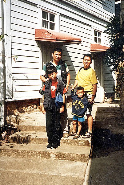
Banny and me with our sons

We also visited the adjacent outdoor museum with its full-scale model of a traditional Bontoc village including the ulog for maidens and a pit shelter for swine.  On my way out I met my former officemate (Manosa-Zialcita Architects) Jose Bayani “Banny” Hermanos who was also travelling with his wife Carol and two sons.  An avid traveler like me, he is also a professional photographer whose colored photos were featured in The Philippines: Action Asia Adventure Travel Guide.  After our museum visit, we proceeded to the nearby Pines Hotel & Kitchenette for a quick lunch. Then, we went back to the municipal plaza where we boarded the last Banaue-bound jeepney. Here, I befriended sisters Asia and Min-Min, one of which was traveling with her German boyfriend named Tom.  We left Bontoc by 1:30 PM.

Good Friday in Sagada (Mountain Province)

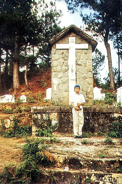
Good Friday, our last whole day in Sagada, was partly spent in prayer.  Together with my Danum Lake companions who were also staying in my inn, we made our way past the school gate and up some steps to the cemetery where Eduardo Masferre, the famous photographer (June 24, 1995), and William Henry Scott (1993), are buried.  It has a view of the northern valley.  Further up is Calvary, the highest point in the town cemetery which is marked with a huge cross.  Here, we visited and prayed at its 14 Stations of the Cross.

Sagada Cemetery

From the cemetery, a steep path took us to Echo Valley.  Halfway down, we viewed hanging coffins on large, gray limestone cliffs at the opposite side and some small burial caves.  There are still a few sangadil (“death chairs”) next to the hanging coffins, placed there for the spirits to rest on.

Hanging coffins

When a Sagadan nears old age, he is given the choice of cave burial or “hanging coffins.”  The deceased is cladded in special burial attire woven by a widow in the village.  This ensures that the spirit (anito) community would recognize them and admit them to the spirit world.

They are bound to a sangadil (death chair) and placed on the house porch for the duration of the long makibaya-o (wake period).  During the makibaya-o, pigs are sacrificed, dirges are sung and eulogies given during the all-night vigils.

The empty coffin is first taken to the burial site (cave or rock ledges).  The funeral procession follows later, preceded by torchbearers who make sure that no animals crosses its path.  When bad omens are encountered, the previously selected burial site could be changed at the last moment in the belief that the new arrival is not welcomed by the present occupants.

The deceased’s body is borne by young lads who vie with one another for the honor of carrying it the furthest distance.  In doing so, it is believed that he would gain much strength and wisdom from the deceased.  Today, these traditional rites are still being practiced, although on a smaller or revised scale, and still requested by some old people.

However, most are now buried on family land or at the Christian cemetery. The makibaya-o, whether traditional, Christian or in combination, is still significant in adult deaths.

The next day, Saturday, after breakfast at the inn, Jandy and I left Sagada on the 10 AM jeepney bound for Bontoc.

Lake Danum (Besao, Mountain Province)

The next day, Holy Thursday (and Araw ng Kagitingan as well), Jandy and I decided to join 8 other guests of the inn I was staying in who were going on a 4-km. uphill hike, along the almost empty, party rough Besao Rd., to Lake Danum (derived from the Kankanai or Ilocano word meaning “water”).   From a vantage point along this road, we had a panoramic view of Sagada town nestled between mountains. After about an hours hike, we turned left on a fork on the road and reached the lake.

Lake Danum

This lake which I actually mistook for a pond is actually referred to by the locals as a lake.  It is peaceful and its grassy and shady ground makes it ideal for picnicking and camping.  Some sort of blackberries were in bloom and some members of the group tried some.   In front of the lake is a hill which, according to the locals, offers a great view of the setting sun behind the mountains.  Unfortunately, we didn’t plan to wait that long.

It was the peak of the El Nino phenomenon when I arrived in Sagada but, even if the lake’s water level was low, its color remained torquiose green instead of orange as was usually the case.  The lake is also a jump-off point for trekking the 1,899-m. high Mt. Ampacao, the highest mountain near Sagada.  Another hour’s walk past the lake would have brought us to the next town of Besao, another pleasant and mostly Anglican town with more rice terraces.  Here, Lake Danum is called Lake Banao.  However, we gave up on the idea and just hitched a ride on a passing vehicle on its way back to Sagada.

Hiking along Bontoc Road (Sagada, Mountain Province)

We spent the whole afternoon hiking along Bontoc Road. On both sides of the road is the 34-hectare Mission Compound.  It includes St. Theodore’s Hospital (established in 1926), the Rectory, the recently restored Doctor’s Residence, the Girl’s Dormitory (established in 1912) and residence  of American historian William Henry Scott. Across St. Theodore’s Hospital  is the DOT accredited and Episcopalian parish-operated St. Joseph’s Resthouse. Further out along Bontoc Road, on the left, is Sagada Weaving & Souvenir Shop.  Established  in 1978, it produces quality products hand-woven on backstrap looms and supervised by Mrs. Andrea Bondad and daughter Rhoda.  Finished products sold at reasonable prices include backpacks, shoulder bags, tapis (Igorot skirts), wallets and blankets.

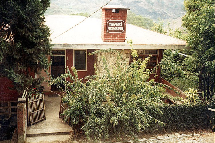
Masferre Photographs

Further out along Bontoc Road, at the Bagaan Road Junction, is the Masferre Gallery.  Here, Mrs. Nena Masferre, wife of the late photographer Eduardo Masferre, welcomed us.  In the 1930s, 40s and 50s, through his pioneering skill and sensitivity as a photographer, Eduardo took photographs of the vanishing life and culture in the villages of Mountain Province. Mrs. Masferre showed us the black and white photographs taken by her husband and a few maps and artifacts.

Eduardo, a Spanish mestizo, was born on April 18, 1909, the second of eight children.  He was the son of Jaime P. Masferre, a retired Spanish soldier from Cataluna, who settled in Sagada at the turn of the century, became a coffee farmer, married an Kankanai woman (Mercedes Cunyap Langkew), joined the Episcopal Church and became a minister.  From 1914 to 1921, Eduardo first lived with his family in Spain where he began his education.  After completing his schooling in the Philippines, he became a missionary teacher like his father and then a missionary administrator.  In addition, he took up farming.

In the 1920s, he learned photography from U.S. missionaries.  Returning to photography in 1934, his artistic focus were the mountain people of the Cordilleras with whom he shares part of his heritage.  After World War II, he opened a photographic studio in Bontoc.  In 1951, he married Nena Ogues, a nurse from Kapangan.  The union produced six children.

His grainy, high contrast monochrome photos are displayed here and around the world.  His first exhibit was held in Manila in 1982.  After a second Manila exhibit the following year, his work traveled to Copenhagen (1984) and Tokyo (1986).  In 1988, his third Manila exhibit was mounted.  A book of his work, “E. Masferre: People of the Philippine Cordillera” was also produced.  Mobil Philippines funded the work, provided 1,500 copies to Philippine schools, museums and libraries, and funded the touring exhibit of his works to the cities of Baguio, Cebu, Cagayan de Oro, Davao and Bacolod.

In 1989, Masferre exhibited his works at Les Recontres International de la Photographie in Arles (France), the only Filipino to be accorded such an honor.  In 1990, again with Mobil support, the Smithsonian Institute of Washington D.C. purchased 120 of his impressive original photos and exhibited them for six months at the main rotunda of the American National Museum of Natural History.  They are now carefully archived in the same museum.  He died on June 24, 1995 at the age of 86.

Jandy with Ms. Nena Masferre

Plodding on, we reached a bend opposite the Rocky Valley Inn.  Here, a path lead down to the small Matangkib Burial Cave. However, it was closed due to the recent death of a hapless Irish tourist who slipped and broke his head.  Coffins here are carefully stacked. At  the lower end of the path, to the left of Matangkib burial cave, is the unmistakable mouth of the Latang Underground River.  We didn’t bring along a good flashlight and weren’t prepared for a 15-min./500-m. spelunking hike through  cold, knee-deep waters and a scramble over rocks.  It was late in the day and we made our way back to the inn.

Latang Underground River

The night was chilly and foggy.  Tourists from Manila were beginning to arrive, all looking for places to stay and most without any success.  Even St. Theodore’s hospital beds were rented out (barring any emergencies) for PhP45 per head.  Others camped out on the Mission grounds while others just slept in their vehicles.  Poor fellows.  Sagada has a reputation as a meeting place for travelers and I also made a number of friends during my stay.  Many were guests staying at the inn while the others I met were straying in the town’s  different coffee shops.

The Caves of Sagada (Mountain Province)

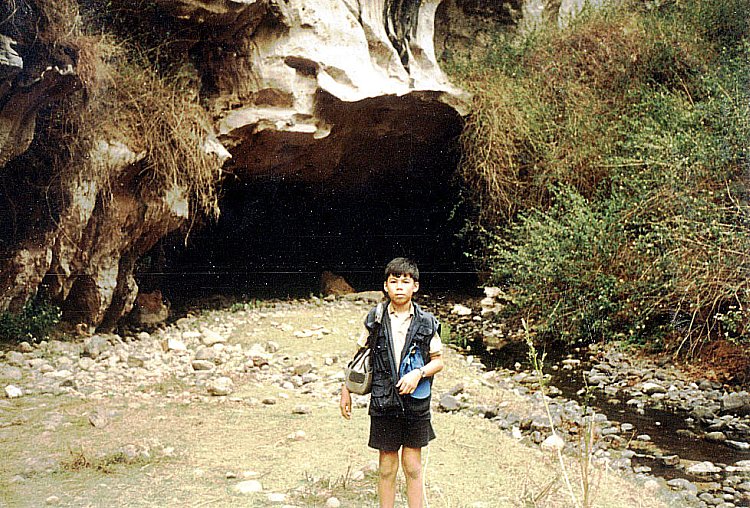
The next day, Wednesday, we decided to go spelunking at Sumaging Cave.   Holy Week was around the corner and we wanted to go there before the onrush of tourists made it a first come-first served affair. Armed with my trusty video camera and point and shoot camera, we proceeded to the municipal hall where the Sagada Environmental Guides Association (SEGA) offers detailed information and guides with ropes and Petromax lamps.  They also keep the caves safe for and from tourists.  We hired a Kankanai lady guide for PhP300. It is always advisable to go spelunking with an accredited guide.  For one thing, they know the way to, from and around  the caves and secondly, if accidents happen inside a cave they now where to go for help.  Sagada sits on a limestone valley riddled with a total of 20 caves, some short, some  interconnected in huge underground mazes.  Eleven are burial caves, 6 of which are  accessible by foot from the highway. The burial caves have hollow-log “hanging coffins” or kuongs and should be treated with respect.

Rice terraces along the road to the caves

With our guide in tow, we made a 40-min. downhill hike, along Soyu Rd., to the cave. Along the way, we passed many of Sagada’s coffee shops (try Shamrock Café beside the municipal hall) and guesthouses: Country Inn (up the stairs opposite the municipal hall), Masferre’s Inn and Café (displays old Masferre prints), Olahbinan Resthouse & Restaurant and the Greenhouse.  Next is the town’s first hotel, the 16-room Sagada Prime Hotel, opened in March 1997.  Here, we found a large, unsightly and quite out of place satellite dish.  Further out along Soyu Road, on the right, is Demang Village. This old village still holds traditional rituals at dap-ays (used by men of the village for meetings and ceremonies).  On the left, we saw some hanging coffins on a rock face.     Also along the way we passed some beautiful rice terraces.  Further down, to the left, we entered a path leading to Sumaging Cave’s (also called Big Cave, Marcos or Latipan Cave) big yawning entrance. Entering the cave doesn’t require special training or equipment but the first 100 m. entailed a steep and slippery descent.  At a certain point, we were required to take off our shoes.  Our guide pointed out the cave’s many unusual and grotesque limestone formations including “Pig Pen,” “Rice Granary,” “Giant’s Foot,” “Dap-ay,” “Pregnant Woman” and the impressive “Dancing Hall” and “King’s Curtain.”   We didn’t go beyond “King’s Curtain” as Jandy had difficulty going down.  The guide said that beyond was a cold, knee-deep underground stream which accumulates into  a large, 15-ft. diameter and 6-ft. deep vaulted pool 250 ft. down.  Its waters swirl through a funnel at the side of the mountain.   After about 2 hrs., we made our way back and out of the cave.

Jandy inside Sumaguing Cave

The tourist route takes about 3 hrs. but a full exploration of the cave entails at least 6 hrs. and some areas at its deepest levels can only be traversed by serious spelunkers with cave climbing equipment.  The cave also has other exits but most are difficult to reach by land. On our uphill trek back along Soyu Road, past the junction, is  a path on the right with a fence.  Here, steps going down the path leads to Lumiang Cave.  We stopped just at the large cave entrance where  many old and a few newer coffins were stacked. A portion of the cave’s mouth had collapsed and broken bones and coffin fragments litter the floor.  We felt no need to go inside.  The guide told us that this cave is connected to Sumaging Cave but reaching it would entail 6 hrs. of spelunking.   There are other caves that could be explored farther out but we were just too tired to explore them.    We returned to our inn for lunch and a much needed bath.  I opted for a noontime bath thinking the water would be warmer.  Boy was I wrong! Brrrr…..!

Arrival in Sagada (Mountain Province)

Sagada

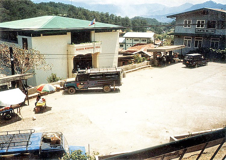
We arrived at Sagada by 4 PM. Upon our arrival at the bus terminal near the municipal hall, Jandy and I checked in at one of the 5 double rooms with common bath at the second floor of nearby Ganduyan Inn, managed by Hanzel and Marina Biag. The inn was strategically located as it was just across the bus terminal and the municipal hall.  Rate was a very cheap PhP75 per person per day. The inn also had a restaurant.  According to Marina, her husband, as well as a significant portion of Sagada’s population, are descendants of Biag, a folk hero of the Igorots  and the most important figure in Sagada’s history.  Biag introduced new rites, prayers and customs.

Ganduyan Inn

As it was late in the afternoon, we decided to just visit the nearby Episcopal Church of St. Mary the Virgin.  Along the winding, pine needle-paved cement lane, to the  right of the basketball court, is this massive, gray stone Anglican church,  originally built under the direction of Reverend John Staunton and consecrated on December 8, 1921.  It was  badly damaged (especially the belfry) by U.S. bombing raids during World War II and later repaired.  The oldest church in the Cordilleras outside of Baguio City, its foreign architectural design is fused with indigenous motifs.  Further down is the 30-hectare St. Mary’s High School.  Founded in 1912, it was destroyed in World War II, rebuilt in 1950, destroyed by fire in 1975 and reopened in 1983.

Episcopal Church of St. Mary the Virgin

After this short tour we returned to the inn for supper at its coffee shop.   Food in Sagada is really cheap and the servings humongous.  Noteworthy is its tasty native red rice (kintuman), mountain tea and its aromatic and strong Arabian coffee, locally-grown, grounded and roasted.

Sagada Municipal Hall