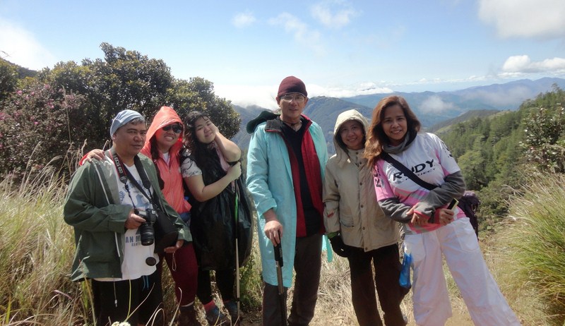
Haunted locations are part of Philippine ghostlore which is a form of folklore. One is located in La Union (Pindangan Church Ruins), four in Baguio City (Hyatt Terraces Hotel, SM City Baguio, Diplomat Hotel and Laperal White House) in Benguet, one in Pampanga (Clark Air Base), one in Mountain Province (Sagada), one off Cavite (Corregidor Island) and the rest in Metro Manila. Though I haven’t really experienced any paranormal activity in these sites, probably because I don’t have a third eye, many others have.
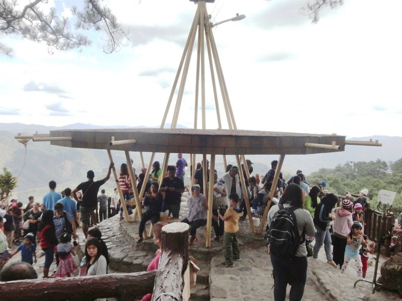
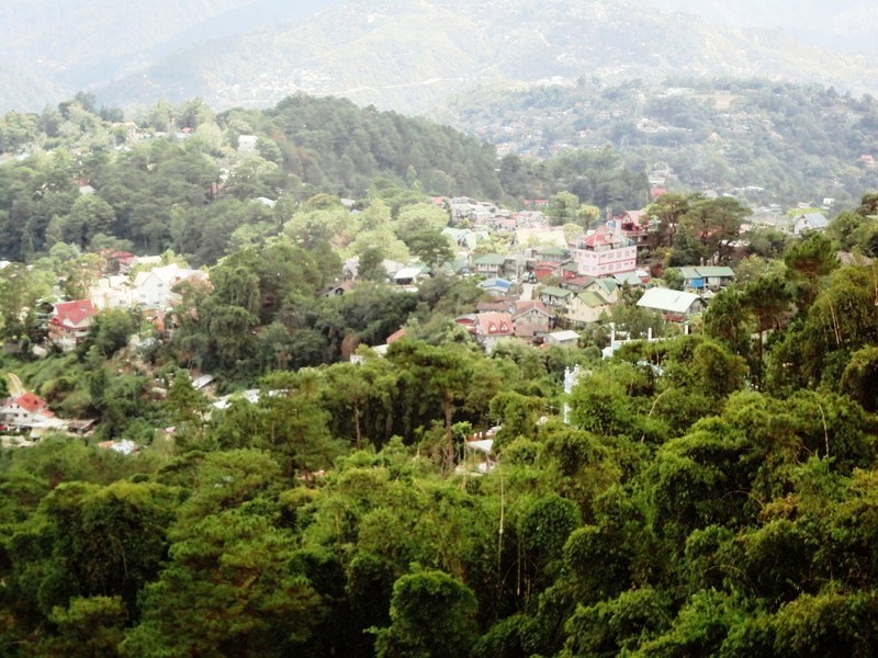
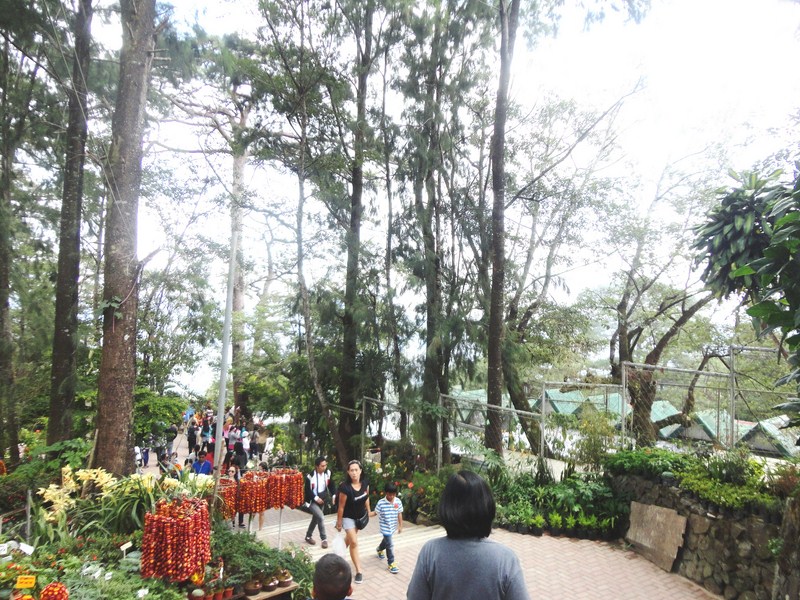
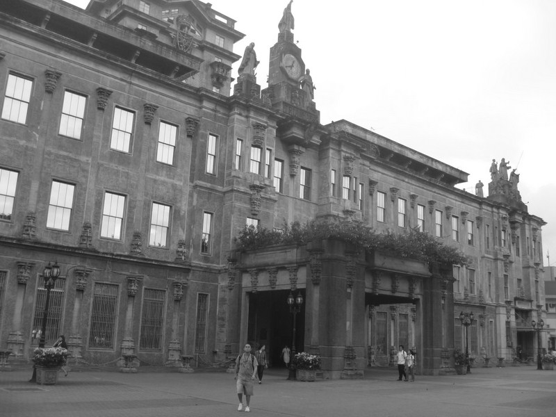
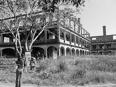
My wife Grace and I stayed in the 12-storey, 303 -room HYATT TERRACES HOTEL for three days in April 1986. Located on a pine tree-clad hill along South Drive, near Camp John Hay, the Hyatt Terraces Hotel was said to be the grandest hotel outside Metro Manila. At 4:26 PM, on July 16, 1990, a little over 4 years after our stay, a magnitude 7.8 earthquake struck Luzon, killing 1,621 people. Again, I happened to be in the city, with my family and some relatives, on the day of the devastating 1990 Luzon Earthquake but were lucky enough to have left the city before lunch. In Baguio City, 28 buildings collapsed during the earthquake. One of the most prominent buildings destroyed was the Hyatt Terraces Hotel when the central wing’s terraced front collapsed, like an accordion, onto the hotel lobby, killing 98 employees and guests. In the aftermath of that tragic earthquake, many of those listed as “missing” were never found and many say that there are still bodies in the debris of the hotel site and the spirits of these victims have never moved on. Its tragic history has surely contributed to its terrifying reputation.
Check out “Hyatt Terraces Hotel“
Hyatt Terraces Hotel circa 1986
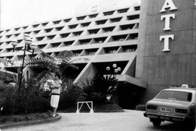
Today, its old fountain and a gated fence are all that remains of the still undeveloped site of the Hyatt Terraces. Now said to be haunted, strange lights and ghostly apparitions are said to have been seen around the empty lot. There was once a bus stop in front of the gate and motorists, driving along South Drive, have told stories of strange apparitions of the spirits of dead employees there. Some passersby in the area at night have also heard cries for help and seen figures against the spotlight that illuminates the area. In fact, for those driving along South Drive, the directed procedure is to honk your horn when passing beside the former Hyatt location, lest they run over a spirit crossing the street. Aromatic smells, coming out of nowhere, are also consistently reported.
SM CITY BAGUIO (a favorite shopping venue of mine while in the city), opened in 2003, was erected on the site where the former 4-storey, wood-framed, 423-room Pines Hotel used to overlook Session Road. On October 23, 1984, at about 11:30 PM, a 6-hour blaze gutted this government-owned hotel. To escape the thick smoke and flames, most of the dead (17 were killed, including 4 Americans) and 46 injured leaped from windows of this American Colonial-style, hillside hotel while others were seen slipping from rescue ropes.
Check out “SM City Baguio“
SM City Baguio
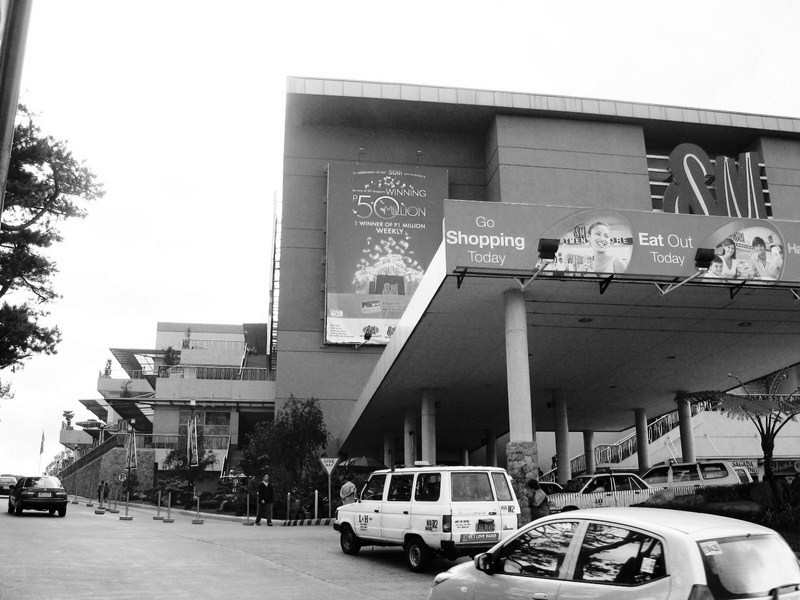
Today, mall visitors have reportedly seen faces in bathroom mirrors that would not be there a second later. One patron, in the ladies’ room, gave a photographic description of a bloodied fireman (The Baguio City Fire Department lost four firefighters in the blaze).
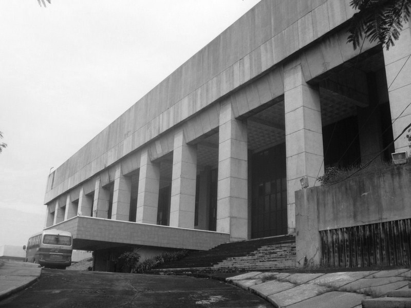
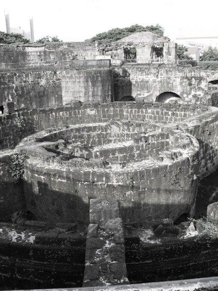
The MANILA FILM CENTER had its beginnings in 1981 when then First Lady Imelda R. Marcos started the Manila International Film Festival (MIFF). Slated to start on January 18, 1982, 4,000 laborers working, round the clock, in 3 shifts in the rush to complete the project in time for the MIFF. Tragedy struck, on November 17, 1981, shortly before 3 AM, when scaffolding and wooden support for part of the second basement collapsed, causing at least 169 graveyard shift workers to fall to the orchestra below and be buried or trapped under wet, quick-drying cement.
Check out “The Urban Legend That is the Manila Film Center“
Manila Film Center
Rather than halt construction to rescue survivors and retrieve the bodies of dead workmen, cement ordered to be poured into the orchestra, entombing the fallen workmen, some of them still alive. The MIFF was to last another year but, instead of quality films, pornographic films were shown in an effort to gain a larger audience and, perhaps, to make up for the first festival’s financial losses. Later, in 1984, I would watch the premiere of Tikoy Aguiluz’ startling, controversial but highly-acclaimed first full-length film “Boatman” (Ang Bangkero), in its uncut version, at this very venue. Today, it is the venue of the Amazing Show, a Las Vegas-like song and dance extravaganza where all the performers are transgenders.
 The place, said to be haunted as well as cursed, is incredibly spooky. Various ghostly manifestations were reported within the building on the site, including poltergeist activity, apparitions; mysterious hearing of cries and moans; bleeding walls; and hands sticking out from under doors. The ghosts of those who died are said to roam the area, looking for live bodies to possess and take over as their own.
The UNIVERSITY OF THE PHILIPPINES Diliman Campus , where my wife and I graduated (with a degree of B.S. Architecture) has had a long history of alleged haunting, with a lot of paranormal hot spots. The Wilfrido Ma. Guerrero Theater, at the second floor of Palma Hall, is the residence of a ghost named “Marisa,” said to be a famous star of the university’s theater productions back in the 1970s who was eventually overshadowed by younger, more talented newcomers. Overwhelmed by grief and jealousy, she killed herself, in the most dramatic way possible, by hanging herself onstage, in costume. She’s known for making her presence felt by haunting the stage, the rest room and her old dressing room, joining the chorus during performances and, sometimes, showing up onstage.
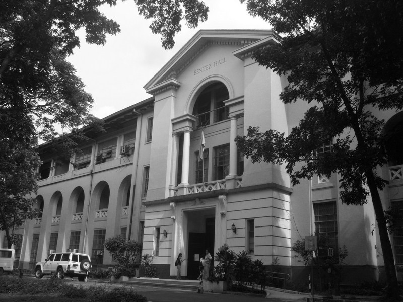
Benitez Hall
Benitez Hall, home to the College of Education and one of the oldest buildings on campus and, naturally, has gained the reputation as one of the most haunted. A ghost, with blood red eyes, is said to wanders the halls. Kalayaan Hall, a residence hall exclusively for freshmen, has a ghost of a woman who supposedly shows up in the mirror facing the stairs to the second floor of the girls’ wing. Abelardo Hall, home of the College of Music, is said to be haunted by the ghost of a girl vocalizing, or playing the piano or the gamelan in the middle of the night.
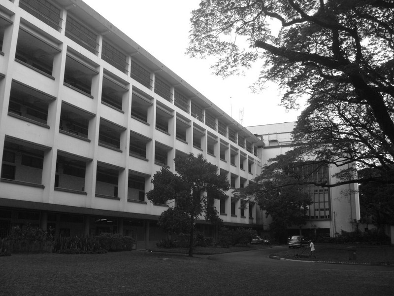
Melchor Hall
The lights on the top floor of Melchor Hall, the College of Engineering Building, where our college was then housed (the college now has its own building), was, for some reason, never turned off, the reason being that, sometimes, the lights there inexplicably turn to red. Many of my classmates have also seen a “Lady in White” come in and out of the corridor walls
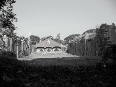
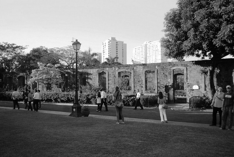
The PINDANGAN CHURCH RUINS, the picturesque, roofless remains of a small vine-covered brick and coral church (the first in City of San Fernando, La Union) which I visited way back in 2004, is located 500 m. off the National Highway, near Camp Oscar Florendo. The nuns of the Carmelite Monastery of the Holy Family are the caretakers of these church ruins.
Check out “Pindangan Church Ruins“
Pindangan Church Ruins
It is said to be the home of the sole ghost of a headless stabbed priest who prowls the night, either carrying his severed head or searching for his head. Some have also reported hearing his head calling out for his body to find it. The wind here is known to whisper strange malediction to those that disrespect the location. My picture of the site was featured in an episode of “Ang Pinaka: Scary Places in the Philippines,” aired during the 6:30 PM GMA News TV last October 22, Sunday.
The University of Santo Tomas, where my daughter Cheska graduated (with a degree of B.S. Medical Technology), served as an internment camp during the World War II. Many prisoners died here of starvation and illness, and is reported by believers to be haunted. An alleged mass grave is located near the UST Museum. One of the restroom cubicles in the Main Building is also haunted by a female student who hung herself.
Main Building of the University of Sto. Tomas
Other paranormal hot spots are the UST Hospital (haunted by a ghost wearing a red tag, which only corpses in the morgue section wear), St. Raymund’s Building (the comfort rooms on the first floor are haunted by the ghost of a girl was said to have committed suicide because she was bullied for her physical appearance), the Albertus Magnus Building (the Conservatory of Music where the piano is heard playing by itself) and Benavides Park (a.k.a. Lover’s Lane) where, at past midnight, students are greeted by a man wearing a Dominican habit who would later disappear (Sometimes, unfortunate couples hanging out in the park’s benches at night, have also heard a disembodied voice singing mass songs).
- CLARK AIR BASE, being an American military installation, experienced major bombing from the Japanese during World War II. There are a number of reminders of that bloody past that still exist today and these locations are some of the most haunted in the Philippines.
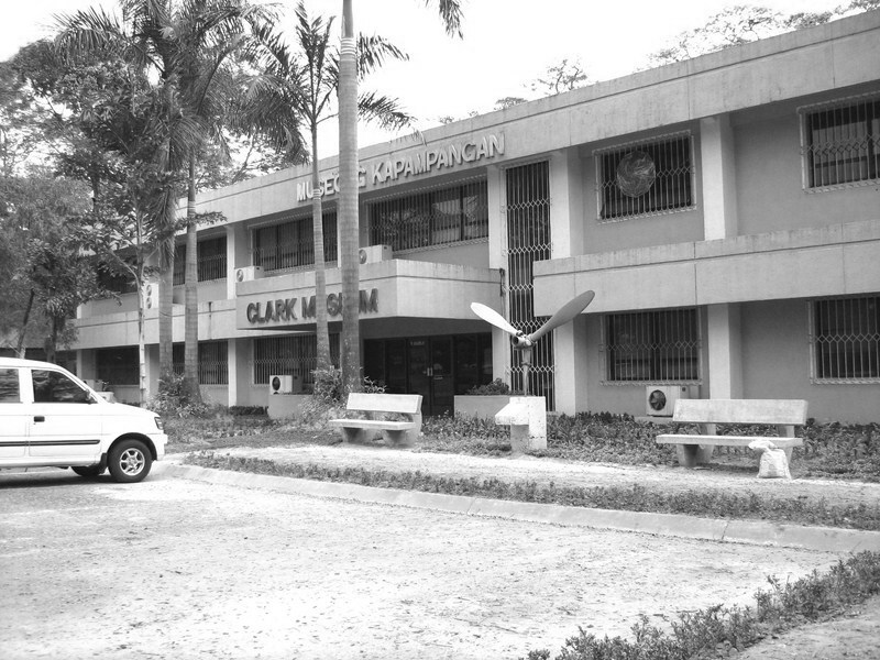
Clark Museum
The area around the abandoned Clark Air Base Hospital has been rendered off limits to everyone as inhabitants have witnessed apparitions of violent spirits and heard mysterious voices.
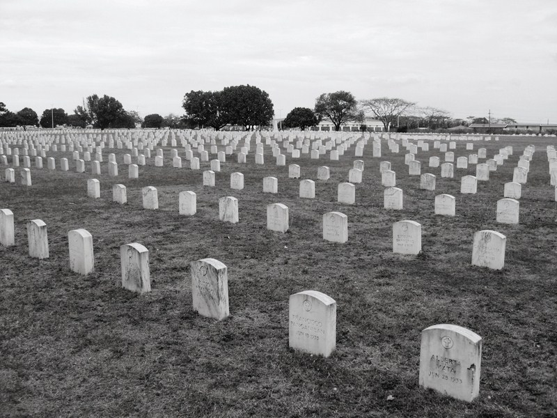
Clark Cemetery
Early morning joggers have also reported hearing party music and excited talk coming from inside the obviously empty Home Plate canteen. At the Clark Museum, the ghost of a serviceman who committed suicide by hanging himself still haunts the place.
Check out “Clark Museum“
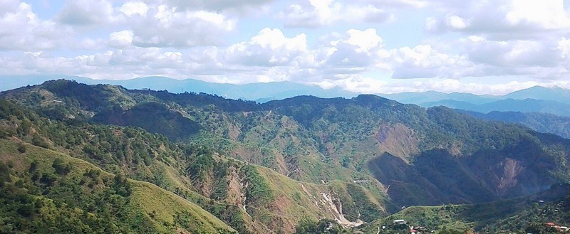
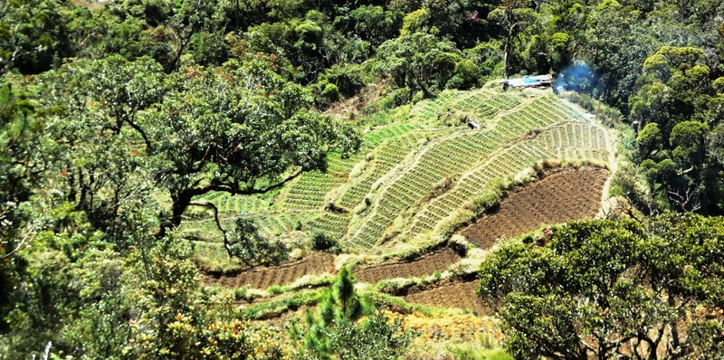
- SAGADA, in Mountain Province, has an authentic culture dealing with death, free of Western influence. The caves of the town, in particular, are rumored to be site of ghostly mischief. According to the locals, whispery voices are heard and wayward shadows or apparitions are seen among the Hanging Coffins as well as graves up in the Echo Valley.
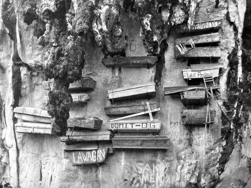
Hanging Coffins
The Igorots, however, generally say that if you show some respect and leave the coffins alone, you’ll make it out of the valley unscathed. At Sumaguing Cave, locals believe that the cave is haunted by the spirits of their ancestors. I have explored this cave twice and, each time, I always felt an otherworldly feeling as I entered.
Check out “Back to Sumaging Cave“
Historic CORREGIOR ISLAND, an island of history and heroism at the entrance of Manila Bay, has played a major role during World War II. Many Filipino and American soldiers died in its defense. During the liberation, the Japanese defenders here committed suicide via harakiri, jumping into the sea or blowing themselves up instead of capture or surrender. The ghosts of Corregidor’s World War II dead were also joined by Muslim soldiers who, in 1968, were training in Corregidor for a planned invasion of Sabah in Malaysia but were exterminated during the infamous March 18, 1968 Jabidah Massacre.
Hospital Ruins
At the Hospital Ruins. tourists who passed by have heard footsteps, rumblings of normal hospital activities, and wails of people.
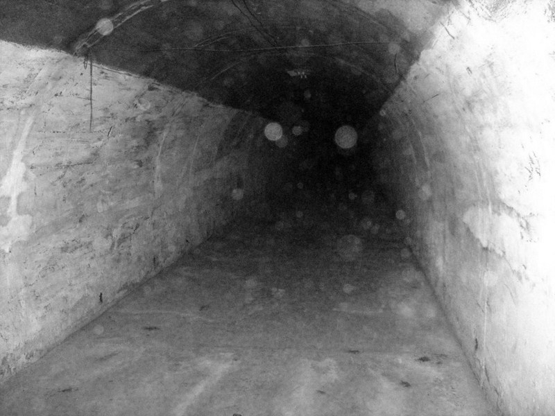
One of the laterals of Malinta Tunnel. Notice the orbs?
Around the bunker area inside the Malinta Tunnel, shouts of people grimacing in pain can also be heard. Witnesses have also reported hearing eerie sounds and seeing a spirit near by. Manifestations would also appear in photos and videos.
Check out “Ghost Hunting in Corregidor“
In INTRAMUROS, where the historical and the supernatural intersect, the possibility of ghost sightings in the oldest part of Manila is real. It attracts ghosts and ghost hunters in search of kapres, white ladies, demonic spirits, and other entities. In the dying days of World War II, Japanese soldiers reportedly massacred men, women and children in Baluarte de Dilao.
Baluarte de San Diego
Baluarte de San Diego, known as the break-up park for being the site where many a relationship met their demise, is where a crying White Lady often makes appearances.
Manila Cathedral
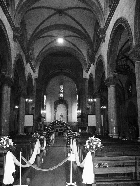
The Aduana (Customs House) Building, which housed several government offices, is the most haunted building in Intramuros. Many people believe its demonic entities takes lives. At Plaza Mexico, there have been sightings of reapers, or hooded figures who chase after wandering spirits. Many of the retail and commercial spaces along the wall of Puerta de Sta. Isabel have now been abandoned, supposedly because of numerous reports of hauntings. An ordinary-looking tree, along Arzobispo Street, has earned the gruesome nickname the Suicide Tree after a student, supposedly from Mapua Institute of Technology, killed herself by hanging. Headless priests supposedly make regular appearances at the Manila Cathedral.
Fort Santiago
Fort Santiago, where National Hero Jose Rizal was jailed, was used by the Japanese as a prison and torture chamber during World War II. It is imprinted with the agony and sufferings of its many prisoners and is now also extremely haunted with ghosts of prisoners who drowned in its underground dungeons.
Check out “Revisiting Fort Santiago“
According to believers, the LAPERAL WHITE HOUSE, in Baguio City, in Beguet, is haunted, with stories of sightings of a little girl (said to be the three-and-a-half year old child of the owner who was killed while running, across the street, towards her nanny) standing motionless on the third step of the staircase fronting the house; a woman (said to be the nanny who killed herself in one of the bedrooms) looking out the third floor glass windows; and a white figure coming down, from the attic, down to the front entrance.
During World War II, the basement of the house was used by the Japanese as a garrison where, if stories are to believed, many were brutally tortured and executed, including members of the Laperal family. Don Roberto survived the war but accidentally slipped, and fell to his death, from the stairs in front of the house. He, as well as ghosts of family members, the torture and execution victims, as well as Japanese soldiers (seen in the upper bedrooms), still haunt the house. These spirits are believed to violently push and scratch visitors to the place.
If ghosts, spirits and the paranormal tickle your fancy, then the so famously haunted, eerie, bleak and abandoned DIPLOMAT HOTEL, considered as one of the most haunted places in Baguio City and the Philippines, is definitely for you. Even since this hotel was open, employees and guests would report hearing strange and eerie noises coming from the building and seeing headless ghosts, with their heads on a platter, constantly roaming the hallways.
Check out “Laperal White House“
However, even after the hotel shut down, those sightings would continue. The people living nearby were often disturbed at night by sounds coming from the Dominican Hill. They would hear banging of doors and windows, clattering of dishes, voices of screaming people who seem to be agonizing, as well as rattling and clanging sounds alternating with total silence. Adding to the eerie atmosphere is the derelict condition of the hotel.