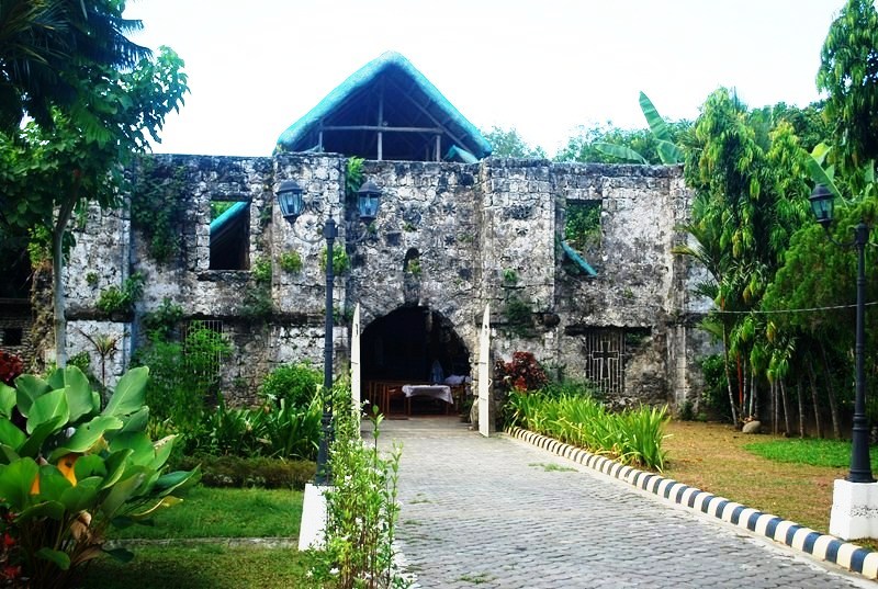
Angkor Wat (Siem Reap, Cambodia)

Angkor Wat

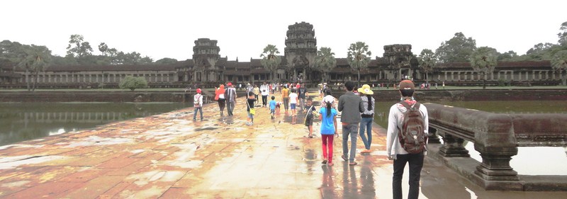
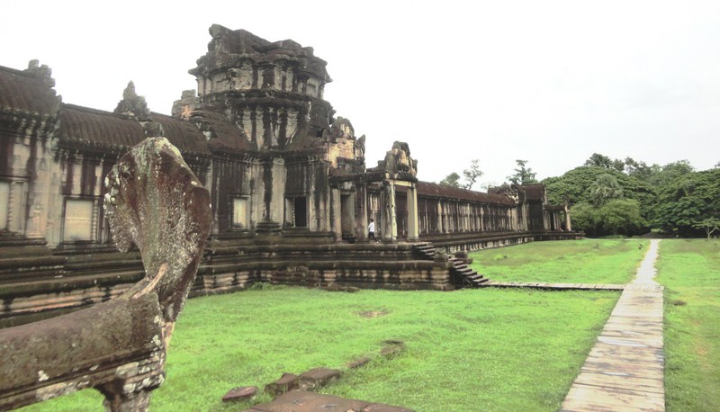
After paying admission fees at the ticket office, we approached Angkor Wat via its main entrance –  a 350 m. (1,150 ft.) long sandstone causeway (a later addition which possibly replacing a wooden bridge) to the west which connects the western gopura to the temple proper.

Angkor Wat ticket office

Along the way are three ruined towers, naga balustrades and six sets of steps leading down to the city on either side. The western entrance is, by far, the largest.  To the east, access to the temple is via an earth bank.

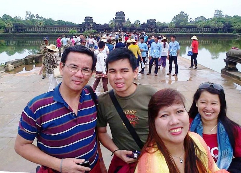
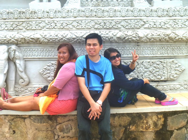
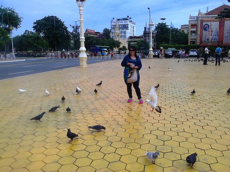
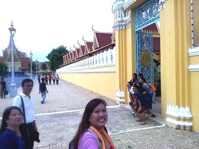
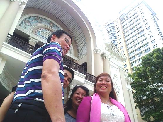
The author, Jandy, Violet and Osang at the causeway

Each side of the causeway also features a library with gopuras (entrances) at each of the cardinal points, in front of the third set of stairs from the entrance, and a pond (later additions to the design) between the library and the temple itself. The cruciform terrace (also a later addition), guarded by lions, connects the causeway to the central structure.
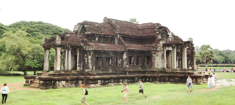
Northern Library

The Southern Library

Angkor Wat, lying 5.5 kms. (3.4 mi) north of the modern town of Siem Reap and a short distance south and slightly east of the previous capital (which was centered at Baphuon), was built by the Khmer King Suryavarman II in the early 12th century in Yaśodharapura (present-day Angkor), the capital of the Khmer Empire, as his state temple and eventual mausoleum.

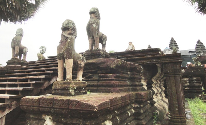
Guardian lion statues

The temple is admired for the grandeur and harmony of the architecture, its decoration and for the numerous  devatas (there are more than 1,796 depictions of devata in the present research inventory) adorning its walls. Above all, the temple has drawn praise for the harmony of its design.

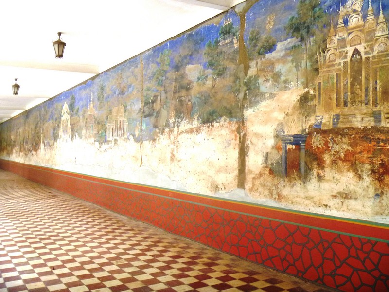
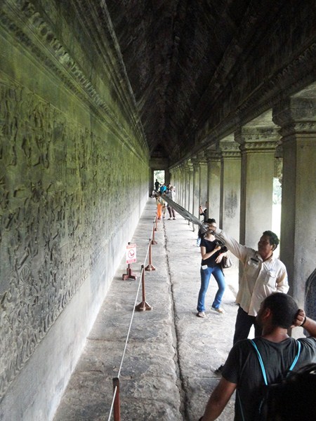
Gallery with bas-reliefs

Larger devata images, all full-body portraits measuring approximately 95 cms. (37 in.) to 110 cms. (43 in.), are incorporated more prominently at every level of the temple from the entry pavilion to the tops of the high towers. Small, 30 cm. (12 in.) to 40 cm. (16 in.) apsara images were used as decorative motifs on pillars and walls.
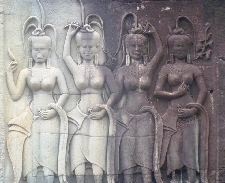
Devatas

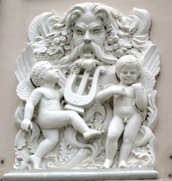
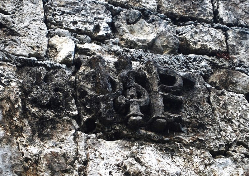
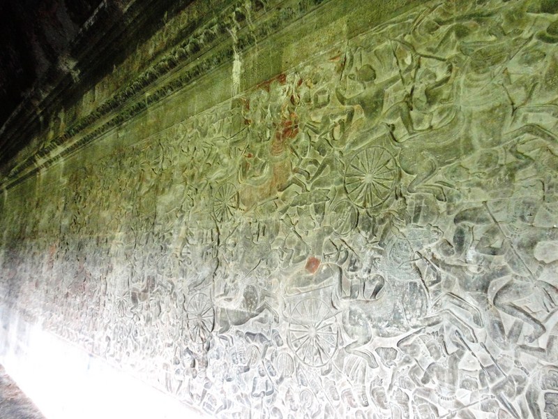
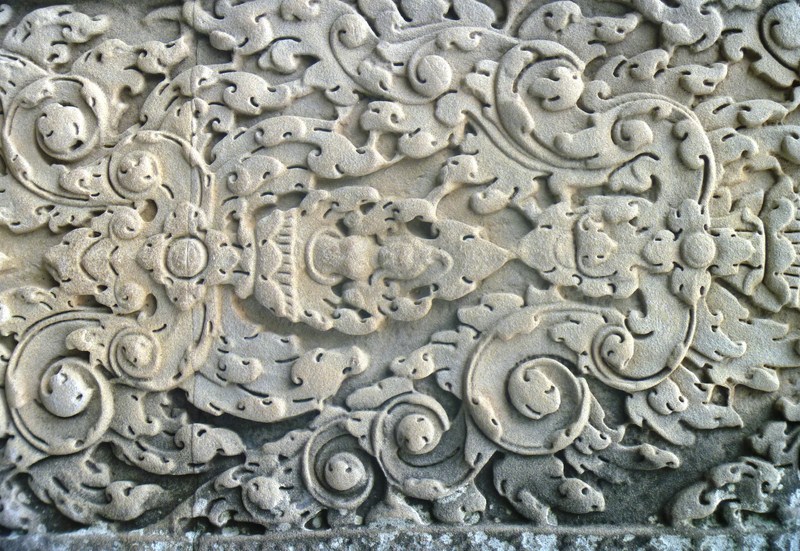
Angkor Wat’s extensive decoration, one of the causes for its fame, is integrated with the architecture of the building and predominantly takes the form of bas-relief friezes. Virtually all of its surfaces, columns, lintels and even roofs are carved, with miles of reliefs illustrating scenes from Indian literature including unicorns, griffins, winged dragons pulling chariots as well as warriors following an elephant-mounted leader and celestial dancing girls with elaborate hair styles.

Bas relief

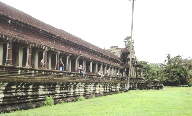
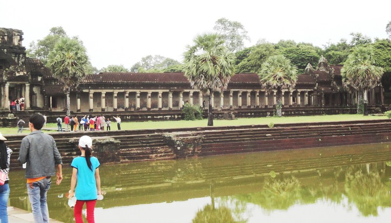
One gallery wall alone is decorated with almost 1,000 sq. m. of bas reliefs.  Besides the temple proper, its outer wall also enclosed three rectangular galleries (each raised above the next), the city and, to the north of the temple, the royal palace. Inside the temple, ropes and wooden steps have been introduced to protect the bas-reliefs and floors.
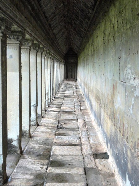
Corridor

Here are some interesting trivia regarding this temple complex:

  • It is the largest religious monument in the world
  • Angkor Wat is the prime example of the high classical style of Khmer architecture—the Angkor Wat style to which it has given its name. Architecturally, the elements characteristic of the style include: the ogival, redented towers shaped like lotus buds; half-galleries to broaden passageways; axial galleries connecting enclosures; and the cruciform terraces which appear along the main axis of the temple. Typical decorative elements are devatas (or apsaras)bas-reliefs, and on pediments extensive garlands and narrative scenes.
  • A powerful symbol of Cambodia and a source of great national pride, a depiction of Angkor Wat has been a part of Cambodian national flags since the introduction of the first version circa 1863.
  • It is the country’s prime attraction for visitors. Since the 1990s, Angkor Wat has become a major tourist destination. In 1993, there were only 7,650 visitors to the site but, by 2004, (according to government figures) 561,000 (approximately 50% of all foreign tourists in Cambodia) foreign visitors had arrived in Siem Reap province, most of whom visited Angkor Wat, increasing to over a million in 2007 and over two million by 2012. In 2013, Angkor Wat received over two million foreign tourists.
  • The temple’s original name is unknown as neither the foundation stela nor any contemporary inscriptions referring to the temple have been found.  It may have been known as “Varah Vishnu-lok” (Barom Visnulōk, which means the sacred dwelling of Vishnu) or Parama Vishnuloka (Sanskrit), after the presiding deity. The modern name, Angkor Wat (alternate name: Nokor Wat) means “Temple City” or “City of Temples.”  In KhmerAngkor meaning “city” or “capital city.” It is a vernacular form of the word nokor (which comes from the Sanskrit word nagara). Wat is the Khmer word for “temple grounds,” also derived from Sanskrit a, meaning “enclosure.”
  • Constructed by Khmer King Suryavarman II for the Khmer Empire, it was originally, in a break from the Shaiva tradition of previous kings, a Hindu temple dedicated to the god Vishnu but was gradually transformed, towards the end of the 12th century, into a Buddhist
  • As the best-preserved temple at the site, Angkor Wat is the only one to have remained a significant religious center since its foundation.
  • The entire city of Angkor used up far greater amounts of stone than all of the Egyptian pyramids combined.
  • Angkor occupied an area significantly greater than modern-day Paris.
  • Sandstone, rather than brick or laterite, was used as the main building material. Sandstone blocks were used for most of the visible areas while laterite was used for the outer wall and for hidden structural parts. Sandstones, as smooth as polished marble, were laid without mortar, with very tight joints that were sometimes hard to find. In some cases, the blocks were held together by mortise and tenon joints while, in others, they used dovetails and gravity. Presumably, the blocks were put in place by a combination of elephants, coir ropes, pulleys and bamboo scaffolding.
  • Unlike the Egyptian pyramids which use limestone quarried barely 0.5 km. (0.31 mi.) away all the time, the entire city of Angkor was built with sandstone quarried 40 kms. (25 mi.) or more away. This sandstone had to be transported from Mt. Kulen, a quarry approximately 40 kms. (25 mi.) to the northeast.
  • It was designed to represent Mount Meru, home of the devas(gods) in Hindu mythology. The central quincunx of towers symbolizes the five peaks of the mountain while the walls and moat symbolize the surrounding mountain ranges and ocean.
  • Angkor Wat is a unique combination of two basic plans of Khmer temple architecture – the temple mountain (the standard design for the empire’s state temples) and the later concentric  galleried temple.
  • Compared to earlier work, the statuary of Angkor Wat is considered conservative, being more static and less graceful.
  • Unlike most Angkorian temples, Angkor Wat is oriented to the west and scholars are divided as to the significance of this. Angkor Wat may relate to the Greek and Roman architecture record in terms of the west rather than east orientation of the temple.
  • It is the southernmost of Angkor’s main sites.
  • The temple’s bas-reliefs proceeds in a counter-clockwise direction (prasavya in Hindu terminology), the reverse of the normal order.
  • Among the Angkor temples, Angkor Wat is unusual in that, although it was largely neglected after the 16th century, it was never completely abandoned.
  • According to legend, the construction of Angkor Wat was ordered by Indra to serve as a palace for his son Precha Ket Mealea. According to Zhou Daguan, a 13th-century Chinese traveler, some believed that the temple was built by a divine architect in a single night.
  • Japanese Buddhist pilgrims who established small settlements, alongside Khmer locals, thought that Angkor Wat was the famed Jetavana garden of the Buddha, which originally located in the kingdom of Magadha, India. Fourteen inscriptions (the best-known tells of Ukondafu Kazufusa, who celebrated the Khmer New Year at Angkor Wat in 1632) discovered in Angkor area, dated from the 17th century, testifies to this.
  • As with most other ancient temples in Cambodia, a combination of plant overgrowth, fungi, ground movements, war damage and theft have extensively destroyed many elements of the temple’s design including gilded stucco on the towers, gilding on some figures on the bas-reliefs, and wooden ceiling panels and doors. Around 20% of the devatas are in very poor condition, mainly because of natural erosion and deterioration of the stone but, also in part, due to earlier restoration efforts.  However, compared to the rest of Cambodia’s temple ruins, it has also received the most attentive restoration. So far, other than some graffiti, the influx of tourists has caused relatively little damage.
  • Some additional funds for the temple’s maintenance has been provided by tourism. As of 2000, approximately 28% of ticket revenues across the whole Angkor site was spent on the temples (although most work is carried out by teams sponsored by foreign governments rather than by the Cambodian authorities).
  • A number of countries such as France, Japan, Germany and China are currently involved in various Angkor Wat conservation projects. The German Apsara Conservation Project (GACP) is working to protect the devatas, and other bas-reliefs which decorate the temple, from damage.
  • Angkor Wat the location for some key scenes from the 2001 film Lara Croft: Tomb Raider (the first major motion picture to be shot in Cambodia since Lord Jim in 1964), when Angelina Jolie arrives in a floating village in front of the temple. She exits the village and then enters the temple to meet a holy monk who heals her injured arm and lends her a phone.
  • Angkor Wat was also the setting for the final scenes of the 2000 In the Mood for Love, a classic Hong Kong romantic drama from Wong Kar-wai,.

Here is the historical timeline of the temple:

  • In the first half of the 12th century, the initial design and construction of the temple took place during the reign of Suryavarman II (ruled 1113 – c. 1150).
  • Shortly after the king’s death, work seems to have ended, leaving some of the bas-relief decoration unfinished.
  • In 1177, approximately 27 years after the death of Suryavarman II, Angkor was sacked by the Chams, the traditional enemies of the Khmer.
  • Thereafter, King Jayavarman VII restored the empire and established a new capital and state temple (Angkor Thom and the Bayon respectively) a few kms. to the north.
  • Towards the end of the 12th century, Angkor Wat was gradually transformed, from a Hindu centre of worship, to Buddhism, which continues to the present day.
  • In 1586, António da Madalena, a Portuguese friar visited the temple, one of the first Western visitors to do so.
  • In the mid-19th century, French naturalist and explorer Henri Mouhot effectively rediscovered the temple and popularized the site in the West through the publication of travel notes.
  • On August 11, 1863, the splendid artistic legacy of Angkor Wat and other Khmer monuments in the Angkor region led directly to France adopting Cambodia as a protectorate, invading Siam to take control of the ruins. This quickly led to Cambodia reclaiming lands in the northwestern corner of the country that had been under Siamese (Thai) control since AD 1351 (Manich Jumsai 2001), or by some accounts, AD 1431.
  • Between 1889 and 1937, the original temple site was presented in French colonial and universal exhibitions in Paris and Marseille.
  • From c. 1880 to the mid-1920s, Angkor Wat’s aesthetics were on display in the musée Indo-chinois, a plaster cast museum of Louis Delaporte which existed in the Parisian Trocadero Palace.
  • By 1885, a French exploration commission (who drew up a list of principal monuments) had worked up a chronology of the rulers and developed the outlines of a description of the civilization that had produced the temple complex. The true history of Angkor Wat was pieced together from stylistic and epigraphicevidence accumulated during subsequent clearing and restoration work. Subsequent missions copied inscriptions written on Angkor buildings so that scholars might translate them and learn something of Angkor’s history.
  • In 1898 the French decided to commit substantial funds to Angkor’s preservation.
  • The 20th century saw considerable restoration of Angkor Wat. Centuries of neglect had permitted the jungle to recapture many of the more significant structures and, gradually, teams of laborers and archaeologists pushed back the jungle, freed buildings from the embrace of huge banyan and silk-cotton trees (which might have crushed them to destruction) and exposed the expanses of stone, permitting the sun once again to illuminate the dark corners of the temple.
  • In 1934, the conservator George Trouvé, excavating the pit beneath the central shrine, finds a sacred foundation deposit of gold leaf, 2 m. above ground level.
  • On November 9, 1953, Cambodia gained independence from France and, since that time, has controlled Angkor Wat.
  • In the 1960s, a major restoration of Angkor was undertaken
  • During the 1970s and 1980s, work was interrupted by the Cambodian Civil War and Khmer Rouge control of the country but, during this period, relatively little damage was done. However, camping Khmer Rouge forces did use, for firewood, whatever wood remained in the building structures plus a shoot-out, between Khmer Rouge and Vietnamese forces, put a few bullet holes in a bas relief.
  • In the late 1980s and early 1990s, art thieves, working out of Thailand, claimed almost every head that could be lopped off the structures, including reconstructions.
  • Between 1986 and 1992, as France did not recognize the Cambodian government at the time, the Archaeological Survey of India carried out restoration work on the temple .
  • In 1992, following an appeal for help by Norodom Sihanouk, Angkor Wat was listed in UNESCO’s World Heritage in Danger (later removed in 2004) and World Heritage Site
  • Between 1990 and 2016, the site was managed by the private SOKIMEX group which rented it from the Cambodian government.
  • In 1994, zoning of the area was set up to protect the Angkor site.
  • In 1995, APSARA was established to protect and manage the area.
  • In 1996, a law to protect Cambodian heritage was passed.
  • In 2005, a Japanese team completed restoration of the north library of the outer enclosure.
  • In 2008, World Monuments Fund began conservation work on the Churning of the Sea of Milk Gallery after several years of studies on its condition.
  • In 2012, the main phase of restoration work ended.
  • In 2012, at the ASEAN Tourism Forum, it was agreed that Borobudur and Angkor Wat would become sister sites and the provinces sister provinces.
  • In 2013, the installation of finials on the roof of the gallery was finished.
  • In December 2015, a research team from University of Sydney announced that they had found a previously unseen ensemble of buried towers built and demolished during the construction of Angkor Wat, as well as massive structure of unknown purpose on its south side and wooden fortifications.
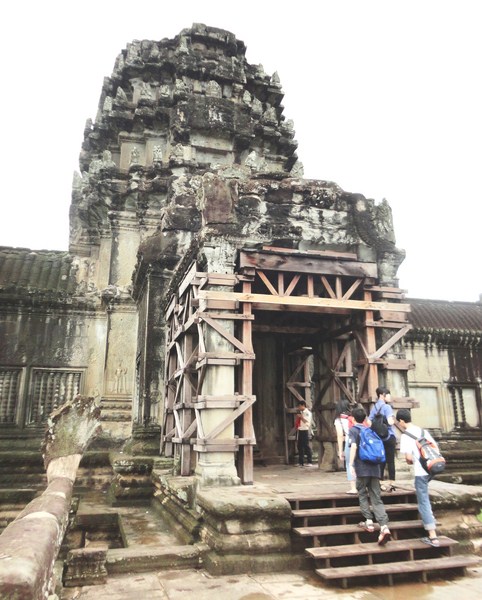
Western gopura

Here are some interesting trivia regarding the temple’s design and construction:

  • The monument was made out of 5 million to 10 million sandstone blocks with a maximum weight of 1.5 tons each.
  • The temple sits on a site measuring 162.6 hectares (1,626,000 m2; 402 acres).
  • The 3.6 km. (2.2 mi.) long outer wall, measuring 1,024 m. (3,360 ft.) by 802 m. (2,631 ft.) and is 4.5 m. (15 ft.) high, is surrounded by a 30 m. (98 ft.) apron of open ground and a moat 190 m. (620 ft.) wide and over 5 kms. (3 mi.) in perimeter. It enclosed a space of 820,000 sq. m. (203 acres) and was built with perishable materials rather than of stone, so nothing remains of them except the outlines of some of the streets. Most of the area is now covered by forest.
  • The outer gallery measures 187 m. (614 ft.) by 215 m. (705 ft.)

Outer Gallery

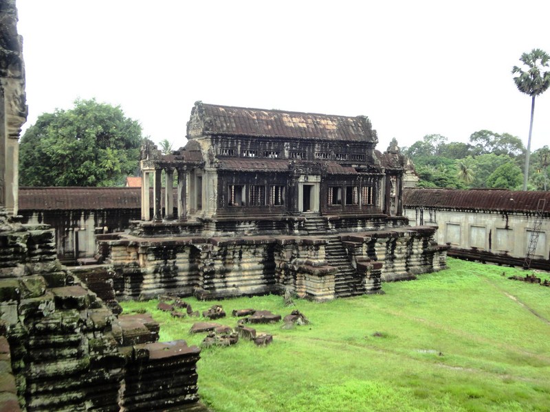
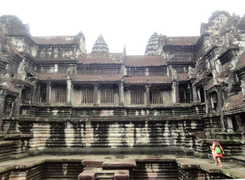
The temple itself, standing on a terrace raised higher than the city, is made of three rectangular galleries (each with a gopura at each of the points) rising to a central tower (aligned to the morning sun of the Spring Equinox), each level higher than the last. The two inner galleries each have towers at their corners, forming a quincunx with the central tower.

Multi-armed Ta Reach statue

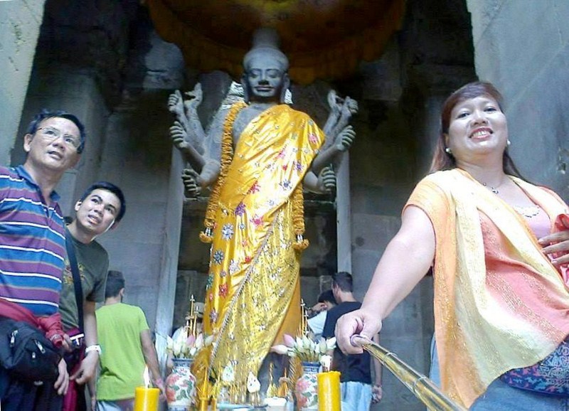
A multi-armed statue of Vishnu (known as Ta Reach), under the southern tower, originally have occupied the temple’s central shrine. Galleries, with square pillars on the outer (west) side and a closed wall on the inner (east) side, run between the towers as far as the two “elephant gates,” entrances on either side of the gopura that are large enough to admit these animals.

Northeast Tower

Lotus rosettes decorated the ceiling between the pillars; dancing figures on the west face of the wall; and balustered windows, dancing male figures on prancing animals, and devatas  (including the only one, at the south of the entrance of the temple, showing her teeth) at the east face of the wall.

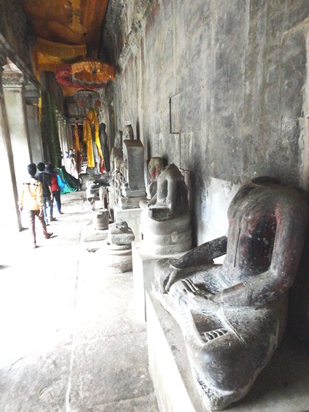
Headless Buddha statues

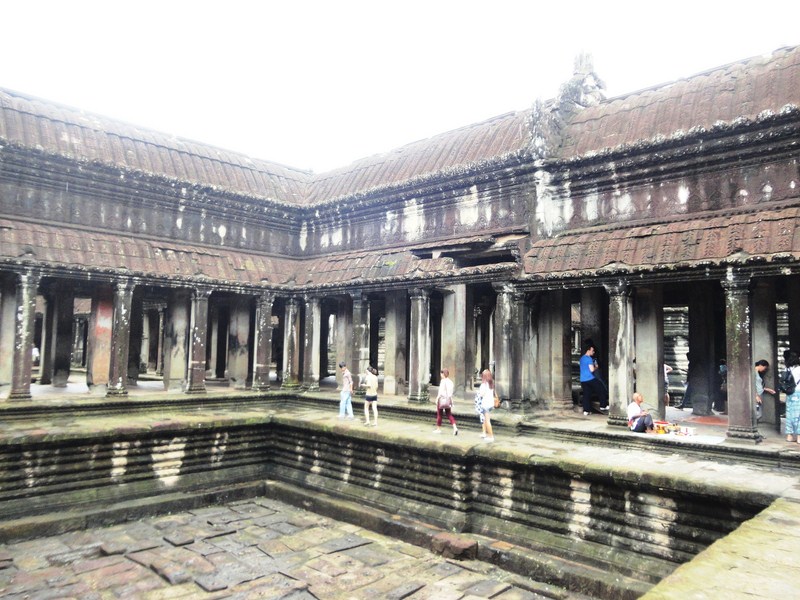
Another cruciform terrace, again a later addition, connects the second and inner galleries to each other and to two flanking libraries. Devatas, singly or in groups of up to four, abound on the walls from the second level upwards.
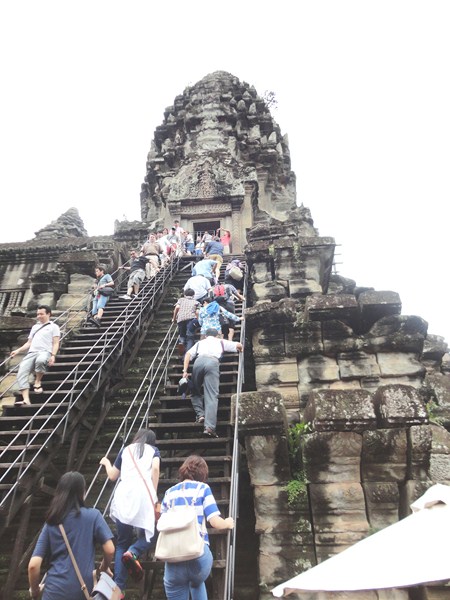
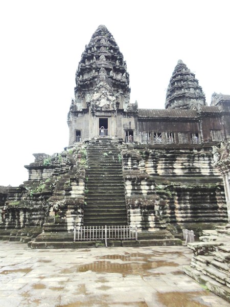
The Bakan

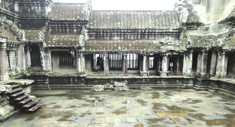
The 100 m. (330 ft.) by 115 m. (377 ft.) second-level enclosure, probably originally flooded to represent the ocean around Mount Meru, has three very steep sets of steps (representing the difficulty of ascending to the kingdom of the gods) on each side leading up to the corner towers and gopuras of the Bakan, the 60 m. (200 ft.) square inner gallery with axial galleries connecting each gopura with the central shrine, and subsidiary shrines located below the corner towers.

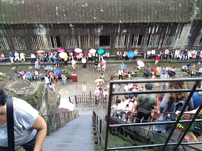
View of courtyard from Bakan

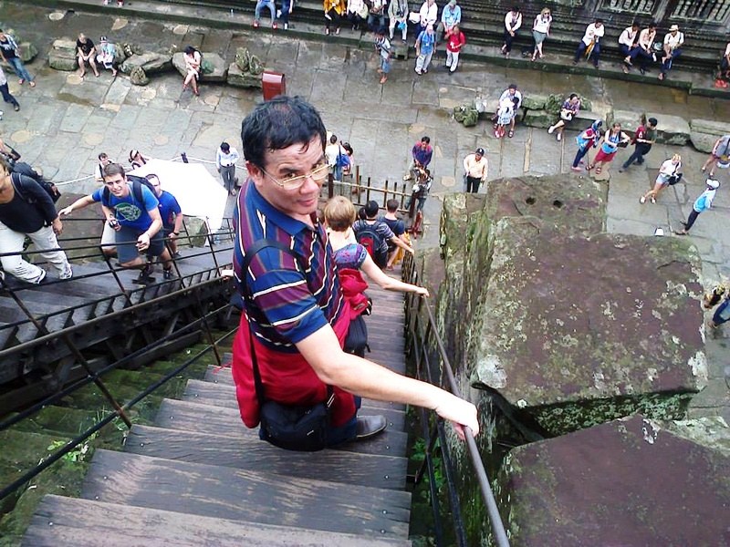
The author descending the stairs from the Bakan

The motif of the body of a snake, ending in garudas (heads of lions), decorate the roofings of the galleries while carved lintels and pediments decorate the entrances to the galleries and to the shrines.
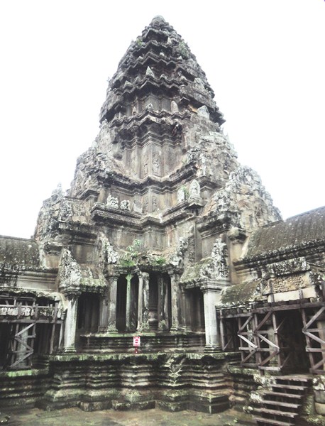
The central tower

The tower above the central shrine, rising 43 m. (141 ft.) to a height of 65 m. (213 ft.) above the ground, is unlike those of previous temple mountains as this central tower is raised above the surrounding four. The shrine, originally open on each side and occupied by a statue of Vishnu, was walled in when the temple was converted to Theravada Buddhism (the new walls featuring standing Buddhas).
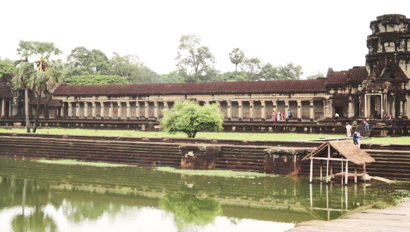
Outer Gallery

The outer gallery, with pavilions rather than towers at the corners, is open to the outside of the temple, with columned half-galleries extending and buttressing the structure.

Preah Poan (the Hall of a Thousand Gods) (3)

The outer gallery is connected to the second enclosure on the west side via the Preah Poan (the “Hall of a Thousand Gods”), a cruciform cloister.  The cloister, whose north and south have libraries, marks out four small courtyards which may originally have been filled with water.

Preah Poan

A series of large-scale scenes, mainly depicting episodes from the Hindu epics the Ramayana and the Mahabharata, are found at the inner walls of the outer gallery.

Inner courtyard

The western gallery, from the north-west corner anti-clockwise, shows the Battle of Lanka (from the Ramayana), in which Rama defeats Ravana;  and the Battle of Kurukshetra (from the Mahabharata), showing the mutual annihilation of the Kaurava and Pandava clans. The only historical scene at the southern gallery is a procession of Suryavarman II, then the 32 hells and 37 heavens of Hinduism.

Bas-relief gallery

The Churning of the Sea of Milk, one of the most celebrated scenes on the eastern gallery, shows 92 asuras and 88 devas using the serpent Vasuki to churn the sea under Vishnu’s direction, followed by Vishnu defeating asuras (a 16th-century addition). The northern gallery shows Krishna’s victory over Bana.

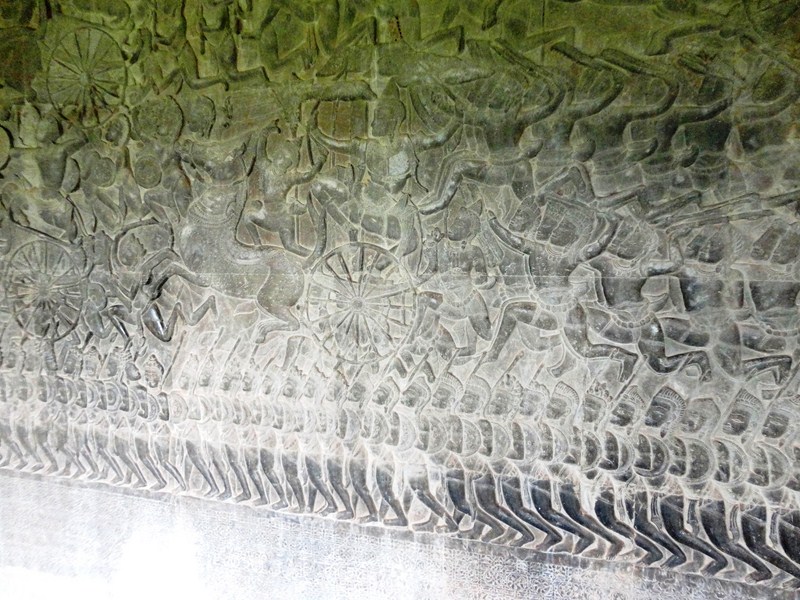
Bas-relief of Battle of Kurukshetra

Over the centuries, Buddha images have been left in the cloister by pilgrims.  Although most have now been removed, we noticed that some still remain and many inscriptions, mostly written in Khmer but others in Burmese and Japanese, relate the good deeds of these pilgrims.
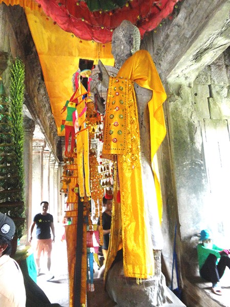
A Buddha statue

Angkor Wat: AngkorSiem Reap ProvinceCambodia. Coordinates: 13°24′45″N 103°52′0″E.

Angkor Archaeological Park (Siem Reap, Cambodia)

Our second day in Siem Reap was to be spent exploring Angkor Archaeological Park, particularly its star attraction – Angkor Wat.  After breakfast at Bopha Angkor Hotel, Violet, Osang, Jandy and I were met at the lobby by our previous tuktuk driver who brought us, from the bus station, to the hotel the previous day. A lot of tourists tour Angkor this way.

Check out “Hotel and Inn Review: Bopha Angkor Hotel & Restaurant

He agreed to bring us, on board his tuktuk, to the park and back for US$5 each (they prefer this payment rather than their local currency – the rial).

Touring Angkor Archaeological Park via tuktuk

Aside from Angkor Wat, we were to also visited Bayon Temple, Preah Pithu, Terrace of the Elephants, Terrace of the Leper King, Royal Palace and Phimeanakas Temple, Baphuon Temple, Chao Say Tevoda, Ta Prohm Temple, Banteay Kdei and Thommanon Temple.

A rainy arrival……

The tuktuk drive took around 20 mins. and we arrived at the park by 10:30 AM.  It was drizzling when we arrived.

Check out “Bayon Temple,” “Preah Pithu,” “Terrace of the Elephants,” “Terrace of the Leper King,” “Royal Palace and Phimeanakas Temple,” “Baphuon Temple,” “Chau Say Tevoda,” “Ta Prohm Temple,” “Banteay Kdei” and “Thommanon Temple

Royal Palace – Silver Pagoda (Phnom Penh, Cambodia)

Silver Pagoda (Temple of the Emerald Buddha)

Silver Pagoda (Temple of the Emerald Buddha)

From the Throne Hall, Osang, Violet, Jandy and I proceeded to south side of the Royal Palace complex.  The beautiful Silver Pagoda, built in honor of the Lord Buddha, is the official temple of the king of Cambodia.  Formerly known as Wat Ubosoth Ratanaram, its official name is Preah Vihear Preah Keo Morakot (“Temple of the Emerald Buddha”), after the green baccarat crystal Buddha it houses.  Its name is commonly shortened to Wat Preah Keo.

Mandapa of Satra and Tripitaka

Mandapa of Satra and Tripitaka

Constructed in 1962, at Queen Kossamak’s command, by King Norodom Sihanouk, it replaced the wooden pagoda built by his grandfather in 1902,  the original aging structure being too weak to stand. During the Khmer Rouge years, more than half its contents were stolen but the pagoda itself was pretty much unscathed.

King Norodom's Statue

King Norodom’s Statue

The Silver Pagoda, is so named because of its 5,329 silver floor tiles, each around  20 cm. (8 inches) square and each weighing 1.125 kg (2.48 lbs), and having a total weight of more than 6 tons. Some of its outer facade was remodeled with Italian marble. The pagoda’s construction shows the clear influence of Bangkok’s Wat Phra Kaeo, also home to a precious crystal Buddha to which the one in Phnom Penh bears an uncanny resemblance.

King Ang Duong's Stupa

King Ang Duong’s Stupa

After removing our hats and leaving our footwear outside, we were allowed to enter the vihara which houses a rich collection of 1,650 royal gifts received by the Royal family over the years, including artifacts and Buddha images, many of them national treasures.  The pagoda is more a museum than place of homage and no monks stay in permanent residence here. However, on entering the pagoda, we only saw a small area of the temple’s signature  silver tiles as much of the floor was covered by carpets. Photography is also not allowed inside.

Kantha Bopha's Stupa

Kantha Bopha’s Stupa

On display are gold and jeweled Buddha statues, notably a a small 17th century baccarat crystal Buddha (the “Emerald Buddha” of Cambodia) and an impressive, life-sized gold Maitreya Buddha. The latter, housed in the sanctum sanctorum of the temple, was created in the palace workshops between 1906 and 1907.  It weighs in at 90 kgs., is dressed in royal regalia commissioned by King Sisowath, and is decorated with 9,584 diamonds (the largest of which weighs 25 carats).

Reamker Frescoes

Reamker Frescoes

The main building (vihear) is bounded, to the east, by the statue of King Norodom (sitting on a white horse) and to the north by the Mondapa of Satra and Tripitaka, a library housing Buddhist texts.  At the eastern corner is the bell tower, south of which, near the exit, is a model of Angkor Wat. South of the vihear stands 4 structures, from west to east – the chedi (stupa) of King Suramarit and Queen Kossamak, the Dharmasala, the Chedi of Princess Kantha Bopha and the Phnom Mondop (Mount Mondop, where the statue of Preah Ko is situated). The last mentioned is an artificial hill with a pavilion housing a bronze footprint of the Buddha from Sri Lanka.

Osang, Jandy and Osang at Kantha Bopha's Stupa

Osang, Jandy and Osang at Kantha Bopha’s Stupa

These structures are surrounded by a wall – the oldest part of the palace – covered with 80 m. long, colorful series of frescos depicting episodes from Reamker, the Khmer version of the Indian Ramayana, , one of the great Hindu epics.ainted from 1903 to 1904, its bottom half has faded, throughout the Khmer Rouge years, due to neglect. Some restoration has been done but much of the damage is still clearly visible.

Royal Palace: Samdach Sothearos Blvd., Phnom Penh.  Open daily, 8 to 11 AM and 2 to 5 PM.

Royal Palace – The Throne Hall (Phnom Penh, Cambodia)

Throne Hall (Preah Tineang Tevea Vinichhay)

Throne Hall (Preah Tineang Tevea Vinichhay)

Upon paying the admission fee of US$6.25, Jandy, Osang, Violet and I started our guide-less tour of the Royal Palace grounds.The first major building we passed was the open-sided Preah Tineang Phhochani, the banqueting and dance hall, inaugurated in 1912. The pristine gardens of the palace grounds are dotted with topiaried trees and are planted with tropical flowers and plants such as Allamanda catharticaCouroupita guianensis and Jatropha integerrima.

Osang, Violet and Jandy at top of grand stairway

Osang, Violet and Jandy at top of grand stairway

We started with the cross-shaped Throne Hall (Preah Thineang Dheva Vinnichay Mohai Moha Prasat, or “Sacred Seat of Judgement”), the most impressive building in the royal compound.  The Throne Hall , crowned with 3 spires, is the second building to be built on this site.  The King’s confidants, generals and royal officials once carried out their duties here and it is still in use today as a place for religious and royal ceremonies (such as coronations and royal weddings) as well as a meeting place for the King’s guests.

A 7-headed naga

A 7-headed naga

The first building was constructed of wood in 1869-1870, under King Norodom, then demolished in 1915 and the present 30 x 60 m. building, a  faithful reproduction of Norodom’s wooden palace, was built in 1917 and inaugurated by King Bat Sisowath in 1919. This building, as well as all buildings and structures at the Royal Palace, faces the east (best photographed in the morning). The building’s central, 59 m. high spire is topped with the white, 4-faced head of Brahma.

A garuda appearing to support the roof

A garuda appearing to support the roof

Inside are 3 royal thrones (2 traditional and 1 Western-style) and golden busts of Cambodians kings and queens, starting from the reign King Ang Doung onwards. However, we, as well as all other visitors, weren’t allowed to go inside, much less take pictures of the interiors, even from the outside.  We could only take photographs of its exterior.

Spire topped with the white, 4-faced head of Brahma

Spire topped with the white, 4-faced head of Brahma

The hall’s broad and grand entrance stairway has banisters formed by 7-headed nagas.  Each column of the colonnaded veranda is topped by a garuda with outstretched wings, all seemingly supporting the eaves of the roof.

Hor Samranphirum

Hor Samranphirum

To the right of the Throne Hall is the Hor Samran Phirum, the Royal Rest House, built between 1915 and 1917.  It is not open for public viewing. On coronation day, this small pavilion is used as a royal rest house and waiting area.  Here, the incoming King and Queen wait for their elephants to be bought around. On one side of the building is a door and some posts which are used to harness the elephants while the royals board.  The king no longer keeps elephants and, today, this building is used to house gifts from foreign dignitaries as well as the royal musical instruments and utensils used in royal coronation processions.

Hor Samritvimean

Hor Samrit Vimean

Exhibits at Hor Samritvimean

Exhibits at Hor Samrit Vimean

One small but elaborate pavilion we could photograph, both inside and out, was the Hor Samrit Vimean, also known as the Bronze Palace. The Royal treasury, this tall but narrow building houses regalia vital to the coronation ceremony including the Great Crown of Victory; The Great White umbrella of state; The Sacred Sword; The Victory Spear; The Fan; various procession group figures bearing the national, religious and monarchy flags; and clothing worn during King Sihamoni’s coronation on October 2004. We joined other tourists at the small display room at the lower floor where we observed, and photographed, display cases exhibiting some of the more minor royal regalia and utensils. At the rear, we note the 7 mannequins wearing seven days’ worth of colors.

Preah Tineang Phhochani

Preah Tineang Phhochani

Just north of the Preah Tineang Phhochani, the palace grounds are closed to visitors so we could only observe the other buildings beyond from afar. Getting a much-needed facelift and shielded by a huge tarpaulin (with the actual likeness of the building inside) during our visit was the cast-iron, French-style Pavilion of Napoleon lll, the oldest surviving structure on the palace grounds.  It was presented by French Emperor Napoleon III to King Norodom in 1876 and re-erected here. The pavilion was used by the Empress Eugenie (Napoleon’s wife) during her inauguration of the Suez Canal in in Ismailia, Egypt in 1869. It now serves as a museum of royal memorabilia and a photo exhibit of former Cambodian kings.

The Pavilion of Napoleon III and the Preah Reach Damnak Chan

The Pavilion of Napoleon III and the Preah Reach Damnak Chan

West of the pavilion is the Preah Reach Damnak Chan.  Built in 1953, it’s partly a museum housing a collection of gifts to the royal family while another part is an office for the Ministry of the Royal Palace.  Just past the Pavilion of Napoleon III, a gateway provided us access to the Silver Pagoda.

Royal Palace: Samdach Sothearos Blvd., Phnom Penh.  Open daily, 8 to 11 AM and 2 to 5 PM.

Preah Sothearos Boulevard (Phnom Penh, Cambodia)

Preah Sothearos Boulevard

Preah Sothearos Boulevard

After our short visit to the National Museum, Osang, Violet, Jandy and I proceeded on our way to the nearby Royal Palace. The Royal Palace, a good example of Khmer architecture, covers an area of 174,870 sq. m. (402 m. x 435 m.). Its layout features a defensive wall (kampaeng), throne hall (preah tineang), Temple of the Emerald Buddha (Wat Preah Keo Morakot), stupas (chedei), towering spires (prang prasat) and mural paintings.

Osang feeding the doves

Osang feeding the doves

The complex is divided by walls into four main compounds.  On the south side is the Silver Pagoda, on the north is the Khemarin Palace, on the west is the private sector (or the Inner Court) while the central compound contains the Throne Hall . The buildings of the palace were gradually built over time, some were dismantled and rebuilt as late as the 1960s, but some old buildings date back to the 19th century.

Gamely posing with a sentry at his ost

Gamely posing with a sentry at his post

From Street 184, we turned right to the surprisingly car-free (save for one tourist bus) Preah Sothearos Blvd. On its left is a wide promenade with yellow hexagonal floor tiles.  Here, flocks of black, white and gray doves congregate.  Children enjoy chasing them while adults feed them with corn kernels and peanuts bought from vendors nearby. Beyond the promenade is a small park, Sisowath Quay and the mighty Mekong River.

The open-air  Preah Thineang Chan Chhaya ("Moonlight Pavilion")

The open-air Preah Thineang Chan Chhaya (“Moonlight Pavilion”)

On the boulevard’s right are the high, yellow crenelated walls of the Royal Palace. We passed two guardhouses, one of them manned, gamely posing with the guard on duty. The  open-air  Preah Thineang Chan Chhaya (“Moonlight Pavilion”), built alongside a section of the palace walls, dominates the facade.

The Victory Gate

The Victory Gate

One of the most notable buildings of the Royal Palace, it serves as a venue for the Royal Dancers, as a tribune for the King to address the crowds and as a place to hold state and royal banquets. During the 2004 coronation of King Norodom Sihamoni, it was used for a banquet and a tribune for the new king.  It also has a balcony that is used for viewing parades marching along Sothearos Boulevard.

Finally ... the visitor's entrance gate

Finally … the visitor’s entrance gate

Past the pavilion is the Victory Gate which faces the entrance steps leading to the palace’s Throne Hall. Traditionally, this gate was only used by the king and queen though it is now used to admit visiting dignitaries.  As such, this gate was locked.  However, the entrance for tourists wanting to tour the palace was nearby.  Upon entering, we walked along a short corridor to the ticket booth.


Saigon Central Post Office (Ho Chi Minh City, Vietnam)

The largest and busiest central post office in Vietnam, this Neo-Classical-style building, one of the most recognizable landmarks in the city and a fine example of French colonial architecture, is a mixture of Gothic, Renaissance and French influences.  This big, airy and spacious building  was designed and constructed, between 1886 and 1891, by the famous French civil engineer and architect Gustave Eiffel (of Eiffel Tower fame).

Saigon Central Post Office

Saigon Central Post Office

Its vaulted roof, massively high arched ceiling (carried by the two rows of steel pillars), numerous wickets, wooden counters (that seem like ticket counters), ornate furnishings, green window shutters and creatively designed arched windows (with engaged piers) are reminiscent of old European railway stations.

Clock above the main entrance

Clock above the main entrance

Above the main entrance, with its intricate ironwork, is its original and still working giant clock. The gorgeous, patterned floor tiles inside represent antique maps.

The post office's massive interior

The post office’s massive interior

Though still a completely functional post office housing a useful office center with phones and fax lines, the building administration have also added souvenir shops (ref magnets, post cards, T-shirts, wallets, coin and stamp collector sets, etc.), currency exchange offices (though their rates was pretty high they are better than rates at the airport), wooden benches for tired tourists, and the still original phone booths (above which are clocks with times of select Asian cities) to make international calls (others are now ATM booths).

Phone and ATM booths

Phone and ATM booths

Inside this never too crowded but never really empty post office, on the upper part of both walls flanking the main entrance, are two large, eighteenth century maps that were painted on the walls just after the post office was built.

Map of Southern Vietnam and Cambodia

Map of Southern Vietnam and Cambodia

Map of Greater Saigon

Map of Greater Saigon

On the left side is a map of Southern Vietnam and Cambodia entitled Lignes telegraphiques du Sud Vietnam et Cambodge 1892 (“Telegraphic lines of Southern Vietnam and Cambodia 1892”) while on the right side is a map of Greater Saigon entitled Saigon et ses environs 1892 (“Saigon and its environment 1892’). At the end of the expansive hall is a huge portrait of Ho Chi Minh. 

Osang, Jandy, Violet, the author and Australian friend Gerald Hosiah

Osang, Jandy, Violet, the author and Australian friend Gerald Hosiah

Saigon Central Post Office: 2 Công xã Paris, Bến Nghé, tp. (opposite Notre Dame Cathedral), Ho Chi Minh City.  Open 8 AM – 5 PM. Tel: +84 8 3822 1677.   

Saigon Opera House (Ho Chi Minh City, Vietnam)

The iconic, stately and elegant Saigon Opera House, also known as the Ho Chi Minh Municipal Theater, is hard to miss as it is located at the intersection of Ð Dong Khoi and ÐL Le Loi.  The front of the building is a good place to take photos or maybe just sit round and spend some time people-watching. A Highland Coffee Shop outlet is located behind the building. During our visit, a pre-nuptial photo shoot was ongoing at the bottom of the steps in front of the theater.

Saigon Opera House

Saigon Opera House

Unfortunately, we weren’t allowed to see the inside unless we watched an actual performance (plays, concerts, ballet, opera, and Vietnamese traditional dance) or the 60-min. AO Show (6 PM and 8 PM), a show fusing dance, circus and musical forms in a vibrant and light-hearted series of sketches.  However, prices for these performances don’t come cheap. For the AO Show, admission ranges from 630,000 VND to 1,470,000 VND (US$29.7 to US$69.3).

A venue for pre-nuptial photo shoots

A venue for pre-nuptial photo shoots

This grand, 1,800-seat colonial building, an example of French Colonial architecture in Vietnam, was designed, as the Opėra de Saigon, by architect Felix Olivier and its construction, started in 1898, was supervised by architects Ernest Guichard and Eugène Ferret. The theater was completed on January 1, 1900. Its applied ornaments, balustrades, cartouches and roof are particularly French while the large central arch, Ionic columns, coffered ceiling and the caryatids (though less modestly clothed than Greek examples) are Greco-Roman motifs.

The veranda and richly-engraved arch

The veranda and richly-engraved central arch

In 1944, the theater was damaged by the Allied air attacks and, in 1954, was used as a temporary shelter for French civilians arriving from North Vietnam. After 1956, the building was restored and used as the home of the Lower House assembly of South Vietnam and it was not until 1975, after the fall of Saigon, that it was again used as a theater. In 1995, the theater was again restored.

A scantilly clad carytid

A scantily clad caryatid

Shaped like the Opéra Garnier in Paris, the Municipal Theater is a smaller counterpart of the Hanoi Opera House (built between 1901 and 1911).  Influenced by the flamboyant style of the French Third Republic, its ornate façade, decorated with inscriptions and bas reliefs, is shaped like France’s Petit Palais (“little palace”) which was also built in 1900. In 1943, some of its decorations, engravings and statues were removed from the theater façade (to make the the theater look more youthful) but, in 1998, during the 300th anniversary celebration of Saigon, a portion was restored by the city government.

Bas reliefs and paired Ionic colums

Bas reliefs and paired Ionic colums

This opera house has an 800-seat main seating floor plus two levels of seating above; a sweeping staircase; and all the inscriptions, décor, and furnishings were designed and drawn by a French artist and sent from France. It now hosts the Ho Chi Minh City Ballet Symphony Orchestra and Opera (formerly the Ho Chi Minh City Symphony and Chamber Orchestra), one of the city’s premiere entertainment companies.

Deatil of bas relief

Deatil of bas relief

The theater is equipped with state-of-the-art lighting and sound systems, and safety equipment. Many of its original architectural and decorative features, including a stone veranda, white stone statues at the entrance, colorful granite tiled floors, chandeliers, bronze statues in front of the stairs, richly-engraved auditorium arch and wall statues, have been incorporated. In 2009, an outdoor lighting system was installed on the roof of the Opera House.

The author, Jandy, Osang and Violet

The author, Jandy, Osang and Violet

Saigon Opera House: 7 Lam Son Square, Ben Nghe Ward, District 1, Ho Chi Minh City. Tel: 08 3829 9976.

Sangyaw Pasasalamat Parade (Tacloban City, Leyte)

Jandy and I arrived at typhoon-ravaged Tacloban, via a Cebu Pacific flight, on the morning of June 29.  Grace, Cheska, Marve and Kyle were already in the city, having left the day before.  We arrived at my brother-in-law Manny’s house just in time for lunch.

The Sangyaw Pasasalamat Parade

The Sangyaw Pasasalamat Parade

His house was conveniently located along Avenida Veteranos, one of the major city streets that the Sangyaw Pasasalamat Festival (which honors Señor Santo Niño de Leyte, Tacloban City’s patron saint) parade would pass through (Real to Imelda then Rizal towards Romualdez and will end at the Kanhuraw Hill).

The Sto. Nino de Leyte is a favorite theme

The Sto. Nino de Leyte is a favorite theme

The parade, held nearly 8 months after Typhoon Yolanda (international name: Haiyan) devastated the city and other parts of the Visayas, was a simple affair, tame and devoid of much extravagance and glamour as with previous festival parades.

Thank you in many languages

Thank you in many languages

Foreign aid workers also join in

Foreign aid workers also join in

The parade was participated in by more than a thousand merrymakers from 8 schools, 5 barangays, private companies (LBC, Talk and Text, Monterey, ABS-CBN, etc.), government agencies (PhilHealth, Department of Health, Department of Education, etc.), delegates from the various branches of the country’s armed services, and the humanitarian international non-government organizations (iNGOs) such as Oxfam, Save the Children, Volunteers for the Visayans, World Vision, Plan Philippines, Care Philippines, and the United Nations High Commissioner for Refugees (UNHCR), etc.. Eleven non-competing and six competing groups will join in the merrymaking. There were only 5 participating floats.

One of the participating floats

One of the participating floats

With its theme “Pasasalamat,” the parade now focuses on thanksgiving for those who survived the wrath of the super typhoon as well as for Taclobanons and Leyteños to express their gratitude to the different iNGOs whose heartwarming assistance and support helped Tacloban and the Taclobanons get back on their feet.

Lion dancers from the Fil-Chinese community

Lion dancers from the Filipino-Chinese community

The iNGOs also made this parade possible by taking care of the logistics, giving a subsidy of not less than PhP30,000 to each participating barangay and contingent.  During, the parade, thanks was expressed in the languages of the iNGOs –  Australia (Thoinks Moite), Belgium (Dank U), China (Xie Xie), France (Merci),  Germany (Dankeschön),  Greece (Efharisto), Hungary (Koszonom), India (Nandri), Indonesia (Terima Kasih), Italy (Grazie), Japan (Arigato), Korea (Kamsahamnida), New Zealand (Kiaora Koe), Russia (Blagodarya), Spain (Gracias), U.S.A. (Thank You), etc.

A drum and lyre band

A drum and lyre band

Though it was a gloomy Sunday, with scattered rain showers (but no excruciating heat from the sun), it was nice to see the people enjoying again and the city colorful, with many Taclobanons, in colorful costumes, joining the parade, exhibiting their unique innovations and creativity.

Sangyaw Parade (27)

Sangyaw Parade (37)

Sangyaw Parade (147)

It was still a parade with a rainbow of colors

It was still a parade with a rainbow of colors

The parade somehow relieved the stress and trauma that the Taclobanons have experienced after Typhoon Yolanda.  At the same time, it also helped people in the area to feel that life is returning back to normal in the city.

Kyle, Marve, Grace, Cheska and Jandy enjoying the parade

Kyle, Marve, Grace, Cheska and Jandy enjoying the parade

City Tourism Operations Office: City Hall, Kanhuraw Hiil, Tacloban City, Leyte. Tel: (053) 325-8955, (053) 325-2491, (053) 523-9671 & (053) 325-6248.

The Mangyan Village of Talipanan (Puerto Galera, Mindoro Oriental)

From the Puerto Galera Municipal Hall, we returned to our respective vans, with Ms. Aileen N. Bareng (Senior Tourism Operations Officer of Puerto Galera) plus Ms Susan E. Cruz (Tourism Operations Assistant) and Sienna May R. Manongsong, both of the Oriental Mindoro Provincial Tourism Office joining us, and were driven to the Iraya Mangyan Village at Sitio Talipanan.

Weaving hut

Weaving hut

The Mangyans, the indigenous people of Mindoro Island,  consists of 8 ethnic sub-groups, the Iraya being one of them.  This tribe used to prospered along the coastal areas until they were forced to move from their land and were treated as second class citizens, neglected and discriminated.

Iraya-Mangyan weavers at work

Iraya-Mangyan weavers at work

They never wore slippers, wore old and torn clothes, and could rarely afford to eat rice in a week, surviving by gathering lami (sweet potato). After a major battle between government forces and communist rebels in 1986, the indigenous families were forced to leave the mountain and squat in the lowlands. The foot of Mt. Malasimbo in Puerto Galera alone is home to as many as 200 Iraya-Mangyan families.

Nito handicrafts on display at showroom

Nito handicrafts on display at the showroom

Nito jars

Nito jars

Since 1989, the Ayala Foundation, with the help of Ms. Beatriz “Bea” Zobel (wife of businessman and philanthropist Don Jaime Zobel de Ayala), has been implementing numerous projects covering education, livelihood development, housing management and health for these Iraya-Mangyans so that they may become more active participants in and productive members of their community yet be capable of managing its own affairs and activities without compromising its own culture.

Neat row of Mangyan houses

A neat row of Mangyan houses

In 1990, the Jaime and Bea bought a piece of the property for them and, in 2007, the couple acquired the rest of land and started developing the Mangyan Village, complete with power and water supplies.  Through their effort to bring the Mangyans to the mainstream of Philippine society through education, the village has produced a number of successful graduates (licensed teachers, community workers, ec.) who are now doing their part in helping their fellow Iraya-Mangyans.

Oriental Mindoro Cruise Drive Caravan ladies exploring village

Oriental Mindoro Cruise Drive Caravan ladies exploring the village

At the village, Oriental Mindoro Cruise Drive Caravan participants were welcomed by Mr. Fabian “Pabling” de Jesus, the 53 year old Batangueño right hand man of the Ayalas in Mindoro, who is at the helm of this project.  We met him at a large pavilion, at the center of the village, were about 52 Iraya-Mangyan, mostly women and wearing their uniform yellow shirts, were busy weaving strands of nito (Lygodium circinatum), a richly colored tropical vine of the fern family, into beautiful but functional baskets, plates with intricate designs, beer bottle holders, place mats, laundry baskets, jars and storage boxes. Mangyans are  expert basket weavers. At the very least, each Mangyan earns around PhP60-P70 in a day. In 2013, the Mangyan Village received 1,879 visitors who availed of these locally produced handicrafts.

An Iraya=Mangyan family in their new home

An Iraya-Mangyan family in their new home (photo: Ms. Sheena Ferrer)

The finished nito products are displayed at the adjoining showroom. The products are also brought to Makati City where the Ayalas opened two stores. The Mangyan workers receive shares from the sales and 4 kilos of rice every week. The Foundation also provides livelihood training in dressmaking, beading, masonry, electrical wiring and agriculture, among others.

Author crossing bamboo bridge (photo: Sheena Ferrer)

Author crossing bamboo bridge (photo: Ms. Sheena Ferrer)

When we visited this 4.2-hectare community located 9 kms. from the town proper, they already had a 4-classroom public elementary school (which accommodates grades 1 to 6 students), a medical facility managed by Indian nuns, common comfort rooms and 69 nice 36 sq. m. 2-bedroom houses complete with electricity, beds, furniture and kitchen and eating utensils.  Priority was given to the community elders.  Each house was estimated to have cost PhP150,000 which includes labor and materials. According to Mr. de Jesus, they are looking at building about 300 of these houses.

Iraya-Mangyan children

Iraya-Mangyan children (photo: Ms. Sheena Ferrer)

Mangyan Village: Sitio Talipanan, Brgy. Aninuan, Puerto Galera, Mindoro Oriental.

Automobile Association Philippines (AAP): 28 EDSA, Greenhills, San Juan City.  Tel: (632) 655-5889.  Fax: (632) 655-1878.  E-mail: info@aap.org.ph. Website: www.aap.org.ph.

AAP Travel: G/F, Sea Tower Bldg., 2332 Roxas Blvd. cor. Arnaiz Ave., Pasay City. Tel: (632) 551-0025.  Fax: (632) 551-0014. E-mail: info@aaptravel.com.  Website: www.aaptravel.com.ph.

Bancuro Church Ruins (Naujan, Mindoro Oriental)

After lunch at Benilda ng Bancuro Resort & Restaurant, next on our Oriental Mindoro Cruise Drive Caravan tour was the Bancuro Church Ruins, more popularly known as Simbahan Bato (Stone Church), just a short drive from the resort.

Bancuro Church Ruins (Simbahan Bato)

Bancuro Church Ruins (Simbahan Bato)

This old, roofless ruin is what remains of an Augustinian Recollect church and priory that was built in the 1690s, on swampy ground, with adobe and coral rock.  The church also served as a fort and a place of refuge against Moro invaders.

The native-style church within a church

The native-style “church within a church”

After several tries by marauding Moro pirates, the place was finally overran by them.  The pirate were said to be looking for the church’s bell, said to be made of gold but, not being able to find it, they instead burned the church to the ground in 1824.

The Augustinian symbol of a pierced heart

The Augustinian symbol of a pierced heart

The 2-level church has never been reconstructed and its coralstone and adobe walls were crumbling and creeping with vines until the 1960s, when a small chapel (literally “a church within a church”) was built within its massive walls.  It was renovated in 2011.

Masonic symbol of a square over compass?

Masonic symbol of a square over compass? 

Still trying to decipher it.

Still trying to decipher this. I recognize the pierced heart on the left. The symbol beside it looks like the Greek symbol for “pi.”

Above the main entrance arch, on the second level, is a small statue niche, above which is the Augustinian symbol of the pierced heart. Flanking it are rectangular openings. Pockets along the walls display several Christian icons. Outside the native-style church is a small plaza with 2 shrines (one for Jesus and the other for the Virgin Mary).

Oriental Mindoro Cruise Drive Caravan participants at church entrance

Oriental Mindoro Cruise Drive Caravan participants at church entrance

Simbahan Bato: Brgy. Bancuro, Naujan, Mindoro Oriental.  It is a 45-min. jeepney ride from the town proper.

Automobile Association Philippines (AAP): 28 EDSA, Greenhills, San Juan City.  Tel: (632) 655-5889.  Fax: (632) 655-1878.  E-mail: info@aap.org.ph. Website: www.aap.org.ph.

AAP Travel: G/F, Sea Tower Bldg., 2332 Roxas Blvd. cor. Arnaiz Ave., Pasay City. Tel: (632) 551-0025.  Fax: (632) 551-0014. E-mail: info@aaptravel.com.  Website:www.aaptravel.com.ph.